Mountains & hills · Yorkshire & the Humber
Simon's Seat
In or near Burnsall.
Simon's Seat — Named summit at 485 m.

Wikimedia Commons contributors — see linked file page for photographer and licence licence
Plan your visit
- Typical visit
- 3 h–8 h
- Best time of year
- Late spring – early autumn (May–Oct)
- Nearest railway station
- Bolton Abbey · 6.7 km
- Free entry
- Dog-friendly
Getting there & planning your visit
To visit Simon's Seat, the nearest railway station is Bolton Abbey, located 6.7 km away. The postcode for navigation is BD23 6DE, and entry is free.
About
Simon's Seat is a named summit in the United Kingdom. Wikidata describes it as: "Named summit at 485 m.". Coordinates: 54.0342°, -1.8811°.
Photo gallery
Protected designations
- Site of Special Scientific Interest: West Nidderdale, Barden and Blubberhouses Moors SSSI
- Area of Outstanding Natural Beauty: Nidderdale
Designations sourced from Natural England open data under OGL v3.
From the Wikipedia article
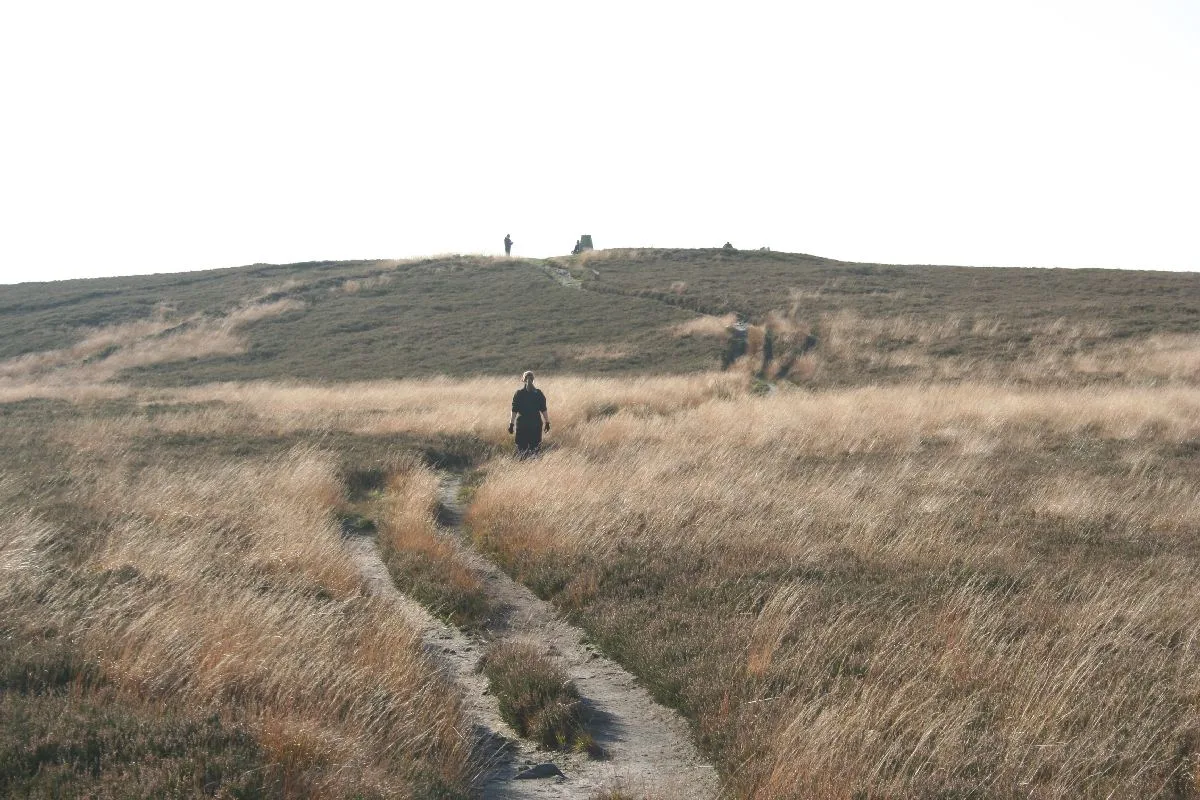
Simon's Seat is a peak in the Yorkshire Dales in northern England. It is a prominent outcrop of millstone grit on the eastern side of Wharfedale. Although only 485 metres (1,591 ft) high, the extensive views from the summit make it a popular destination for walkers. Simon's Seat is on private land of the Bolton Abbey Estate. There are no public footpaths to the summit, but the summit is on access land. It is usually reached by a permissive route which leads north from Bolton Abbey across the River Wharfe up the Valley of Desolation. The route leads across Barden Fell, which is a grouse moor, sometimes closed to the public during the shooting season. The summit can also be reached by shorter but steeper paths from Howgill or Skyreholme, one mile north of the summit.
Excerpt from Wikipedia under CC BY-SA 4.0. See the source article linked in Sources below.
- Coordinates
- 54.0342, -1.8811
- District
- North Yorkshire
- Parish
- Appletreewick
- Postcode
- BD23 6DE
- Parliamentary constituency
- Skipton and Ripon
- Nearest railway station
- Bolton Abbey — 6.7 km
Sources
- osm: n410132605 (ODbL)
- wikipedia: Simon's Seat (CC BY-SA 4.0)
- commons: View towards Dalehead Farm - geograph.org.uk - 1004377.jpg (CC BY-SA 4.0)
Other places nearby

Simon's Seat
Climbing & bouldering crags · 0.0 km

Dale Head Lathe
Archaeological sites · 0.9 km

Malham Peat Pits
Archaeological sites · 1.4 km

Skyreholme Mill
Archaeological sites · 1.4 km

Long Lane Peat Pits
Archaeological sites · 1.5 km

Howgill Lodge
Campsites · 1.5 km
Howgill Lodge
Caravan parks · 1.6 km

Earl Seat
Mountains & hills · 1.6 km
Sep2005.jpg?width=1200)
Parcevall Hall
Gardens · 1.8 km

Parceval Hall
Historic houses · 1.8 km

Methodist Chapel With Cottage
Chapels · 1.9 km

Whithill
Mountains & hills · 2.3 km
Nearby
📷 5Climbing & bouldering crags · Yorkshire & the Humber
Simon's Seat
Simon's Seat — a climbing crag in england yorkshire.
📷 2Archaeological sites · Yorkshire & the Humber
Dale Head Lathe
Dale Head Lathe — a archaeological in england-yorkshire, United Kingdom.
📷 3Archaeological sites · Yorkshire & the Humber
Malham Peat Pits
Malham Peat Pits — a archaeological in england-yorkshire, United Kingdom.
📷 3Archaeological sites · Yorkshire & the Humber
Skyreholme Mill
Skyreholme Mill — a archaeological in england-yorkshire, United Kingdom.
📷 3Archaeological sites · Yorkshire & the Humber
Long Lane Peat Pits
Long Lane Peat Pits — a archaeological in england-yorkshire, United Kingdom.
📷 5Campsites · Yorkshire & the Humber
Howgill Lodge
Howgill Lodge — a campsite in england yorkshire.
Where to eat & stay near Simon's Seat
Places to stay
📷 5Campsites · Yorkshire & the Humber
Howgill Lodge
Howgill Lodge — a campsite in england yorkshire.
📷 5Caravan parks · Yorkshire & the Humber
Howgill Lodge
Howgill Lodge — a caravan park in england yorkshire.
 📷 5
📷 5Campsites · Yorkshire & the Humber
Mason's Campsite
Mason's Campsite — a campsite in england yorkshire.
📷 5 📷 5
📷 5Caravan parks · Yorkshire & the Humber
Bolton Abbey Estate Caravan Club Site
Bolton Abbey Estate Caravan Club Site — a caravan park in england yorkshire.
 📷 5
📷 5Hostels · Yorkshire & the Humber
Back O' Th' Hill
Back O' Th' Hill — a hostel in england yorkshire.
Places to eat & drink
 📷 5
📷 5Historic pubs · Yorkshire & the Humber
Grassington House Hotel
Grassington House Hotel in England Yorkshire, United Kingdom.
 📷 5
📷 5Historic pubs · Yorkshire & the Humber
Elm Tree Inn
Elm Tree Inn in England Yorkshire, United Kingdom.
 📷 5
📷 5Restaurants · Yorkshire & the Humber
The Angel Inn
The Angel Inn — a restaurant in england north west.
 📷 5
📷 5Historic pubs · Yorkshire & the Humber
The Rustic Shop And Former Stable Buildings To Rear Of The Red Lion Public House
The Rustic Shop And Former Stable Buildings To Rear Of The Red Lion Public House in England North West, United Kingdom.
 📷 5
📷 5Historic pubs · Yorkshire & the Humber
The Devonshire
The Devonshire in England North West, United Kingdom.
 📷 6
📷 6Historic pubs · Yorkshire & the Humber
Royal Shepherd Public House
Royal Shepherd Public House in England North West, United Kingdom.
More mountains in this region
 📷 3
📷 3 📷 5
📷 5Mountains & hills · Yorkshire & the Humber
Whaley Moor
Whaley Moor — a hill or mountain in england west midlands.
 📷 5
📷 5Mountains & hills · Yorkshire & the Humber
Idle Hill
Idle Hill — a hill or mountain in england west midlands.
 📷 5
📷 5Mountains & hills · Yorkshire & the Humber
Hollingworthhall Moor
Hollingworthhall Moor — a hill or mountain in england west midlands.
Frequently asked questions
- Where is Simon's Seat?
- Simon's Seat is in Yorkshire, United Kingdom (postcode BD23 6DE), in the parish of Appletreewick.
- What is Simon's Seat?
- Simon's Seat — Named summit at 485 m.
- How do I get to Simon's Seat?
- The nearest railway station is Bolton Abbey, about 6.7 km away. Drivers can use postcode BD23 6DE.
- Is Simon's Seat a protected site?
- Yes — Simon's Seat is part of the West Nidderdale, Barden and Blubberhouses Moors SSSI Site of Special Scientific Interest and the Nidderdale National Landscape (AONB).
- Is Simon's Seat free to visit?
- Yes, Simon's Seat is free to enter.
- How do I get to Simon's Seat?
- The nearest railway station is Bolton Abbey, about 6.7 km away. Drivers can navigate to postcode BD23 6DE.