
Public art & sculpture · East Midlands
Shrine of Nemi
In or near Edwinstowe.
Shrine of Nemi — a public art in england-east-midlands, United Kingdom.

Humphrey Bolton — CC BY-SA 2.0 via Wikimedia Commons licence

Plan your visit
- Typical visit
- 1 h–2 h
- Free entry
- Dog-friendly
About
Shrine of Nemi is a public art located in england-east-midlands, United Kingdom. Sourced from OpenStreetMap (ODbL licence); see local listings for visitor information, opening hours and admission details.
Photo gallery
Official information
Rufford Abbey features the best-preserved remains of a Cistercian abbey in England, primarily dating from around 1170. Visitors can explore the external ruins and enjoy the surrounding 150-acre Rufford Country Park, which includes nature trails, gardens, and various facilities.
From the Wikipedia article
The Shrine of Remembrance (commonly referred to as The Shrine) is a war memorial in Melbourne, Victoria, Australia, located in Kings Domain on St Kilda Road. It was built to honour the men and women of Victoria who served in World War I, but now functions as a memorial to all Australians who have served in any war. It is a site of annual observances for Anzac Day (25 April) and Remembrance Day (11 November), and is one of the largest war memorials in Australia. Designed by architects Phillip Hudson and James Wardrop, both World War I veterans, the Shrine is in classical style, based on the Tomb of Mausolus at Halicarnassus and the Parthenon in Athens, Greece. The crowning element at the top of the ziggurat roof references the Choragic Monument of Lysicrates. Built from Tynong granite, the Shrine originally consisted only of the central sanctuary surrounded by the ambulatory. The sanctuary contains the marble Stone of Remembrance, upon which is engraved the words "Greater love hath no man" (John 15:13); once per year, on 11 November at 11 a.m. (Remembrance Day), a ray of sunlight shines through an aperture in the roof to light up the word "Love" in the inscription. Beneath the sanctuary lies the crypt, which contains a bronze statue of a soldier father and son, and panels listing every unit of the Australian Imperial Force. The Shrine went through a prolonged process of development, which began in 1918 with an initial proposal to build a Victorian memorial. Two committees were formed, the second of which ran a competition for the memorial's design. The winner was announced in 1922. However, opposition to the proposal, led by Keith Murdoch and the Herald Sun, forced the governments of the day to rethink the design. A number of alternatives were proposed, the most significant of which was the Anzac Square and cenotaph proposal of 1926. In response, General Sir John Monash used the 1927 Anzac Day march to garner support for the Shrine, and finally won the support of the Victorian government later that year. The foundation stone was laid on 11 November 1927, and the Shrine was officially dedicated on 11 November 1934.
Excerpt from Wikipedia under CC BY-SA 4.0. See the source article linked in Sources below.
Background
Architecture
Materials for building the Shrine were sourced from within Australia: the chosen building stone was granodiorite quarried from Tynong; the internal walls use sandstone from Redesdale; and the black marble columns used stone from Buchan.
Visiting
Restoration work on the terraces surrounding the Shrine during the 1990s raised once again the possibility of taking advantage of the space under the Shrine: as the Shrine had been built on a hollow artificial hill, the undercroft (although at the time filled with rubble from the construction) provided a large space for development. In redeveloping the site, special consideration was given to the positioning of the new entrance. The original plan was to use a tunnel from the east, but this was discarded as it had "no sense of ceremony". Instead it was decided to develop two new courtyards, and place the new gallery under the northern steps. Construction commenced in 2002, with the design by…
Sourced from Wikipedia under CC BY-SA 4.0.
- Coordinates
- 53.1761, -1.0338
- County
- Nottinghamshire
- District
- Newark and Sherwood
- Parish
- Rufford
- Postcode
- NG22 9DF
- Parliamentary constituency
- Sherwood Forest
- Phone
- 0370 333 1181
- Established
- 1918
- Opening
- Open daily.
- Official site
- www.english-heritage.org.uk
Sources
- osm: node/3627625859 (ODbL)
- wikipedia: Shrine of Remembrance (CC BY-SA 4.0)
Other places nearby
The Oil Patch Warrior
Public art & sculpture · 0.1 km
Girlguiding Nottinghamshire's Centenary Seat
Public art & sculpture · 0.1 km

Water Tower And Boundary Wall At Rufford Abbey
Memorials & monuments · 0.1 km
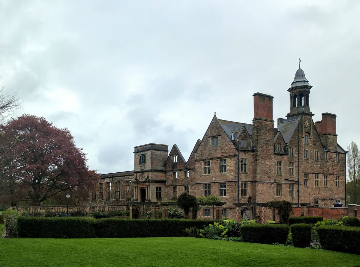
Rufford Abbey
Abbeys & priories · 0.1 km

Rufford Abbey
Cathedrals · 0.1 km

Sherwood Castle Holiday Forest
Castles · 1.3 km

Aqua Sana Spa
Lidos & outdoor pools · 1.3 km

The Beach
Beaches · 2.0 km

Cratley
Vineyards · 2.0 km

Wellow
Villages · 2.7 km

Wellow Maypole
Natural landmarks · 2.7 km
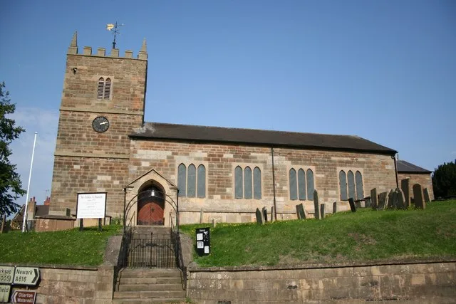
St Giles' Church, Ollerton
Historic churches · 2.7 km
Nearby
📷 3Public art & sculpture · East Midlands
The Oil Patch Warrior
The Oil Patch Warrior — a public art in england-east-midlands, United Kingdom.
📷 3Public art & sculpture · East Midlands
Girlguiding Nottinghamshire's Centenary Seat
Girlguiding Nottinghamshire's Centenary Seat — a public art in england-east-midlands, United Kingdom.
📷 5Memorials & monuments · East Midlands
Water Tower And Boundary Wall At Rufford Abbey
Water Tower And Boundary Wall At Rufford Abbey — a water tower in england-east-midlands, United Kingdom.
★ Iconic📷 5Abbeys & priories · East Midlands
Rufford Abbey
Rufford Abbey — abbey in Rufford, Nottinghamshire, England, UK.
Flagship📷 5Cathedrals · East Midlands
Rufford Abbey
Rufford Abbey is a cathedral in the United Kingdom.
📷 3Castles · East Midlands
Sherwood Castle Holiday Forest
Sherwood Castle Holiday Forest — a castle in england-east-midlands, United Kingdom.
Where to eat & stay near Shrine of Nemi
Places to stay
 📷 5
📷 5Hostels · East Midlands
Sherwood Forest Youth Hostel
Sherwood Forest Youth Hostel — a hostel in england east midlands.
 📷 5
📷 5 📷 5
📷 5Campsites · East Midlands
Sherwood Forest Holiday Park
Sherwood Forest Holiday Park — a campsite in england east midlands.
 📷 3
📷 3Campsites · East Midlands
Robin Hood's Retreat
Robin Hood's Retreat — a campsite in england east midlands.
 📷 5
📷 5Campsites · East Midlands
Walesby Forest
Walesby Forest — a campsite in england east midlands.
 📷 5
📷 5Campsites · East Midlands
Blakeley Lane Campsite
Blakeley Lane Campsite — a campsite in england east midlands.
Places to eat & drink
 📷 5
📷 5Historic pubs · East Midlands
Hop Pole Hotel And Adjoining Stable Block And Outbuilding
Hop Pole Hotel And Adjoining Stable Block And Outbuilding in England East Midlands, United Kingdom.
 📷 5
📷 5Historic pubs · East Midlands
The Greendale Oak Inn
The Greendale Oak Inn in England East Midlands, United Kingdom.
 📷 5
📷 5Historic pubs · East Midlands
The Newcastle Arms
The Newcastle Arms in England East Midlands, United Kingdom.
 📷 5
📷 5Historic pubs · East Midlands
The Bridge Tavern Public House
The Bridge Tavern Public House in England East Midlands, United Kingdom.
 📷 5
📷 5Historic pubs · East Midlands
The Old Ram Public House
The Old Ram Public House in England East Midlands, United Kingdom.
 📷 5
📷 5More places in this region
 📷 5
📷 5Public art & sculpture · East Midlands
West Walton Village Sign
West Walton Village Sign — a public art in england-london, United Kingdom.
 📷 5
📷 5Public art & sculpture · East Midlands
Tilney St Lawrence Village Sign
Tilney St Lawrence Village Sign — a public art in england-london, United Kingdom.
 📷 5
📷 5Public art & sculpture · East Midlands
Emneth Village Sign
Emneth Village Sign — a public art in england-london, United Kingdom.
 📷 5
📷 5Public art & sculpture · East Midlands
Marshland St James Village Sign
Marshland St James Village Sign — a public art in england-london, United Kingdom.
Frequently asked questions
- Where is Shrine of Nemi?
- Shrine of Nemi is in Nottinghamshire, the East Midlands, United Kingdom (postcode NG22 9DF), in the parish of Rufford.
- What is Shrine of Nemi?
- Shrine of Nemi — a public art in england-east-midlands, United Kingdom.
- How do I get to Shrine of Nemi?
- Drivers can use postcode NG22 9DF.
- When was Shrine of Nemi built?
- Built or established in 1918.
- Is Shrine of Nemi free to visit?
- Yes, Shrine of Nemi is free to enter.
- How do I get to Shrine of Nemi?
- Drivers can navigate to postcode NG22 9DF. It sits within the Sherwood Forest parliamentary constituency.