Other places · North East England
Shieldfield
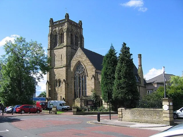
In or near Newcastle upon Tyne.
Shieldfield in England North East, United Kingdom.

Adrian Dust — CC BY-SA 2.0 via Wikimedia Commons licence
Plan your visit
- Typical visit
- 1 h–2 h
- Nearest railway station
- Jesmond · 0.5 km
About
Shieldfield is a place of interest in England North East, United Kingdom — drawn from open-data sources for visitor reference. See the linked Wikipedia article for the full description.
Photo gallery
From the Wikipedia article
Shieldfield is an area in the east of Newcastle upon Tyne, England. It borders the City Centre, Heaton, Byker, and Sandyford.
Excerpt from Wikipedia under CC BY-SA 4.0. See the source article linked in Sources below.
Background
History
The name of the district is considered to be a reference to a shelter in the forest clearing, derived from Anglo-Saxon sources. During the English Civil War, King Charles I was permitted to play golf at Shieldfield whilst he was held prisoner at Newcastle by Parliamentarian forces. The building where he would rest, King Charles House, was demolished in 1960 to make way for the new council estate. This is commemorated by a plaque within Shieldfield Green, and reflected in the naming of King Charles Tower adjacent to the site. The area was increasingly urbanised during the 19th century, and by 1881, contained many houses for the employees of nearby factories. The population at this time was…
Sourced from Wikipedia under CC BY-SA 4.0.
- Coordinates
- 54.9810, -1.5990
- District
- Newcastle upon Tyne
- Parish
- Newcastle upon Tyne, unparished area
- Postcode
- NE2 1QX
- Parliamentary constituency
- Newcastle upon Tyne North
- Nearest railway station
- Jesmond — 0.5 km
Sources
- wikidata: Q7496168 (CC0)
- wikipedia: Shieldfield (CC BY-SA 4.0)
Other places nearby

Hutton Terrace drill hall
Historic houses · 0.2 km
.jpg?width=1200)
Jesmond Old Cemetery
Cemeteries · 0.3 km

Jesmond
Historic houses · 0.4 km
Fernwood House
Historic houses · 0.4 km

Star and Shadow Cinema
Theatres · 0.4 km

Jesmond railway station
Historic houses · 0.4 km

Sandyford House
Historic houses · 0.4 km

Garden Front
Gardens · 0.5 km

The Biscuit Factory
Museums · 0.5 km
Jesmond Parish Church
Historic churches · 0.5 km

Mansion House, Newcastle upon Tyne
Historic houses · 0.5 km

Sandyford
Other places · 0.6 km
Nearby
📷 4Historic houses · North East England
Hutton Terrace drill hall
Hutton Terrace drill hall in England North East, United Kingdom.
📷 3Cemeteries · North East England
Jesmond Old Cemetery
Jesmond Old Cemetery is a cemetery in the United Kingdom.
📷 4Historic houses · North East England
Jesmond
Jesmond in England North East, United Kingdom.
📷 4Historic houses · North East England
Fernwood House
Fernwood House in England North East, United Kingdom.
📷 3Theatres · North East England
Star and Shadow Cinema
Star and Shadow Cinema in England North East, United Kingdom.
📷 4Historic houses · North East England
Jesmond railway station
Jesmond railway station in England North East, United Kingdom.
Where to eat & stay near Shieldfield
Places to stay
 📷 5
📷 5Hostels · North East England
North Eastern YWCA Hostel
North Eastern YWCA Hostel — a hostel in scotland lowlands.

Hostels · North East England
Kabannas Newcastle
Kabannas Newcastle — a hostel in scotland lowlands.
 📷 5
📷 5 📷 5
📷 5Hotels · North East England
Hotel du Vin
Hotel du Vin — a hotel in scotland lowlands.
 📷 5
📷 5Hotels · North East England
Grey Street Hotel
Grey Street Hotel — a hotel in scotland lowlands.
 📷 5
📷 5Hotels · North East England
Exchange Buildings
Exchange Buildings — a hotel in scotland lowlands.
Places to eat & drink
 📷 5
📷 5Historic pubs · North East England
The Cluny
The Cluny in England North East, United Kingdom.
 📷 5
📷 5Historic pubs · North East England
Theatre Royal Lounge And Restaurant; The Royal Public House
Theatre Royal Lounge And Restaurant; The Royal Public House in Scotland Lowlands, United Kingdom.
 📷 5
📷 5Historic pubs · North East England
The Cordwainers' Public House
The Cordwainers' Public House in Scotland Lowlands, United Kingdom.
 📷 3
📷 3Historic pubs · North East England
The Crown Posada
Newcastle's Quayside Victorian pub, with William Morris stained glass.
 📷 5
📷 5Restaurants · North East England
Cilantro
Cilantro — a restaurant in scotland lowlands.
 📷 5
📷 5Restaurants · North East England
Sambuca
Sambuca — a restaurant in scotland lowlands.
More places in this region
 📷 5
📷 5Other places · North East England
Appleby Horse Fair
The Appleby Horse Fair, previously known as Appleby New Fair, is an annual gathering of Romani people (Gypsies) and Travellers in Appleby-in-Westmorland in Cumbria, England. The horse fair is held eac
 📷 5
📷 5Other places · North East England
Crosby Garrett
Crosby Garrett in England North East, United Kingdom.
 📷 5
📷 5Other places · North East England
Ravenstonedale
Ravenstonedale in England North East, United Kingdom.
 📷 5
📷 5Frequently asked questions
- Where is Shieldfield?
- Shieldfield is in North-East England, United Kingdom (postcode NE2 1QX), in the parish of Newcastle upon Tyne, unparished area.
- What is Shieldfield?
- Shieldfield in England North East, United Kingdom.
- How do I get to Shieldfield?
- The nearest railway station is Jesmond, about 0.5 km away. Drivers can use postcode NE2 1QX.
- How do I get to Shieldfield?
- The nearest railway station is Jesmond, about 0.5 km away. Drivers can navigate to postcode NE2 1QX.