
Historic churches · South West England
Shaugh Prior village cross: a wayside cross at the road junction 150m east of the parish church
In or near Yelverton.
Shaugh Prior village cross: a wayside cross at the road junction 150m east of the parish church — a Grade II-listed church in england-south-west, United Kingdom.

don cload — CC BY-SA 2.0 via Wikimedia Commons licence

Plan your visit
- Typical visit
- 30 min–1 h
- Nearest railway station
- Plym Bridge · 4.9 km
- Free entry
About
Shaugh Prior village cross: a wayside cross at the road junction 150m east of the parish church is a Grade II-listed building in england-south-west, United Kingdom. Grade II status is conferred by Historic England (or Cadw, Historic Environment Scotland or NIEA equivalents) on buildings of exceptional national interest. See the linked Wikipedia article for full historical and architectural details.
Photo gallery
Place summary
Shaugh Prior village cross is a wayside cross located at the road junction 150 metres east of the parish church in Devon, South-West England. This Grade II* listed structure is notable for its historical significance within the parish of Shaugh Prior.
AI-generated from the structured facts on this page (operator, designation, listing, era). Not a substitute for visiting.
- Coordinates
- 50.4495, -4.0517
- County
- Devon
- District
- South Hams
- Parish
- Shaugh Prior
- Postcode
- PL7 5EQ
- Parliamentary constituency
- South West Devon
- Nearest railway station
- Plym Bridge — 4.9 km
Sources
- wikidata: Q17648493 (CC0)
Other places nearby

Church of St Edward
Historic churches · 0.2 km

Shaugh Prior
Villages · 0.3 km

Cross S of Shaden Plantation
Historic houses · 0.9 km

Dewerstone Rock
Mountains & hills · 1.0 km

Mine (dis)
Archaeological sites · 1.2 km

Shaugh Bridge
Historic bridges · 1.3 km
River Meavy
Museums · 1.3 km

Inclined Plane (dis)
Archaeological sites · 1.4 km

Cadover Cross
Historic houses · 1.9 km

Goodameavy Bridge
Historic bridges · 2.2 km
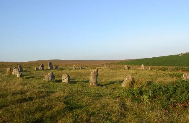
Brisworthy stone circle
Hill forts · 3.1 km
.jpg?width=1200)
Partially enclosed stone hut circle settlement and post-medieval warren structures on the western slope of Little and Great Trow
Archaeological sites · 3.3 km
Nearby
📷 5Historic churches · South West England
Church of St Edward
Church of St Edward — church in Shaugh Prior, Devon, England, UK.
📷 5📷 3Historic houses · South West England
Cross S of Shaden Plantation
Cross S of Shaden Plantation — a Grade II-listed historic house in england-south-west, United Kingdom.
📷 5Mountains & hills · South West England
Dewerstone Rock
Dewerstone Rock — mountain in england south west. Elevation: 227 m.
📷 3Archaeological sites · South West England
Mine (dis)
Mine (dis) — a archaeological in england-south-west, United Kingdom.
📷 3Historic bridges · South West England
Shaugh Bridge
Shaugh Bridge — Grade II listed building-listed bridge in england-south-west, United Kingdom.
Where to eat & stay near Shaugh Prior village cross: a wayside cross at the road junction 150m east of the parish church
Places to stay
 📷 5
📷 5Caravan parks · South West England
Riverside Caravan Park
Riverside Caravan Park — a caravan park in england south west.
 📷 5
📷 5Campsites · South West England
Riverside
Riverside — a campsite in england south west.
 📷 4
📷 4Caravan parks · South West England
Dartmoor Caravan Park
Dartmoor Caravan Park — a caravan park in england south west.
 📷 5
📷 5B&Bs · South West England
The Cider House
The Cider House — a bed-and-breakfast in england south west.
 📷 5
📷 5 📷 5
📷 5Campsites · South West England
Smithaleigh Caravan And Camping Park
Smithaleigh Caravan And Camping Park — a campsite in england south west.
Places to eat & drink
 📷 5
📷 5Restaurants · South West England
Toby Carvery
Toby Carvery — a restaurant in england south west. Cuisine: british. Brand: Toby Carvery.
 📷 7
📷 7Historic pubs · South West England
St Elizabeth's House
St Elizabeth's House in England South West, United Kingdom.
 📷 5
📷 5Restaurants · South West England
Miller & Carter
Miller & Carter — a restaurant in england south west. Cuisine: steak. Brand: Miller & Carter.
 📷 5
📷 5 📷 5
📷 5Historic pubs · South West England
Minerva Inn (Number 31)
Minerva Inn (Number 31) in England South West, United Kingdom.
 📷 7
📷 7More places in this region
 📷 5
📷 5Historic churches · South West England
Abbey Church of St Gregory the Great, Downside Abbey
Abbey Church of St Gregory the Great, Downside Abbey — church in Stratton-on-the-Fosse, Somerset, England, UK.
 📷 5
📷 5Historic churches · South West England
All Saints Church
All Saints Church — Grade I listed church in Woolley, Somerset, England, UK.
 📷 5
📷 5Historic churches · South West England
All Saints Church, Hampreston
All Saints Church, Hampreston — church in Hampreston, Dorset, England, UK.
 📷 5
📷 5Historic churches · South West England
All Saints Church, Nether Cerne
All Saints Church, Nether Cerne — church in Nether Cerne, Dorset, England, UK.
Frequently asked questions
- Where is Shaugh Prior village cross: a wayside cross at the road junction 150m east of the parish church?
- Shaugh Prior village cross: a wayside cross at the road junction 150m east of the parish church is in Devon, South-West England, United Kingdom (postcode PL7 5EQ), in the parish of Shaugh Prior.
- What is Shaugh Prior village cross: a wayside cross at the road junction 150m east of the parish church?
- Shaugh Prior village cross: a wayside cross at the road junction 150m east of the parish church — a Grade II-listed church in england-south-west, United Kingdom.
- How do I get to Shaugh Prior village cross: a wayside cross at the road junction 150m east of the parish church?
- The nearest railway station is Plym Bridge, about 4.9 km away. The nearest town is Yelverton. Drivers can use postcode PL7 5EQ.
- Is Shaugh Prior village cross: a wayside cross at the road junction 150m east of the parish church a listed building?
- Shaugh Prior village cross: a wayside cross at the road junction 150m east of the parish church is officially recognised as Grade II listed.
- Is Shaugh Prior village cross: a wayside cross at the road junction 150m east of the parish church free to visit?
- Yes, Shaugh Prior village cross: a wayside cross at the road junction 150m east of the parish church is free to enter.
- How do I get to Shaugh Prior village cross: a wayside cross at the road junction 150m east of the parish church?
- The nearest railway station is Plym Bridge, about 4.9 km away. Drivers can navigate to postcode PL7 5EQ.