
Historic houses · South East England
Shardeloes
In or near Chesham Bois.
Shardeloes — a Grade I-listed historic house in england-west-midlands, United Kingdom.

Balraj Gill — CC BY-SA 2.0 via Wikimedia Commons licence

Plan your visit
- Typical visit
- 1 h–2 h
- Nearest railway station
- Amersham · 2.6 km
- Family-friendly
- Limited wheelchair access
Getting there & planning your visit
To visit Shardeloes, the nearest railway station is Amersham, located 2.6 km away. The postcode for sat-nav is HP7 0RL. Please note that accessibility is limited for wheelchair users.
About
Shardeloes is a Grade I-listed building in england-west-midlands, United Kingdom. Grade I status is conferred by Historic England (or Cadw, Historic Environment Scotland or NIEA equivalents) on buildings of exceptional national interest. See the linked Wikipedia article for full historical and architectural details.
Photo gallery
Protected designations
- Area of Outstanding Natural Beauty: Chilterns
Designations sourced from Natural England open data under OGL v3.
From the Wikipedia article
Shardeloes is a large 18th-century country house located one mile west of Amersham in Buckinghamshire, England (grid reference SU937978). A previous manor house on the site was demolished and the present building constructed between 1758 and 1766 for William Drake, the Member of Parliament for Amersham. Shardeloes is a Grade I listed building.
Excerpt from Wikipedia under CC BY-SA 4.0. See the source article linked in Sources below.
Background
Architecture
The architect and builder was Stiff Leadbetter; designs for interior decorations were provided by Robert Adam from 1761. Built in the Palladian style, of stuccoed brick, the mansion is nine bays long by seven bays deep. It was constructed with the piano nobile on the ground floor and a mezzanine above. The north facade has a large portico of Corinthian columns. The terminating windows of the piano nobile are pedimented and recessed into shallow niches, as are the end bays of the east front. The roof, typically for the palladian style, is hidden by a balustrade. The original plans of the house by Leadbetter show a design closer in appearance to Holkham Hall, with square end towers. Adam…
Sourced from Wikipedia under CC BY-SA 4.0.
- Coordinates
- 51.6713, -0.6444
- District
- Buckinghamshire
- Parish
- Amersham
- Postcode
- HP7 0RL
- Parliamentary constituency
- Chesham and Amersham
- Established
- 1766
- Nearest railway station
- Amersham — 2.6 km
Sources
- wikidata: Q7489466 (CC0)
- wikipedia: Shardeloes (CC BY-SA 4.0)
Other places nearby

Woodrow High House
Manor houses · 1.3 km

Elmodesham House
Historic houses · 1.9 km

Amersham Hall
Historic houses · 1.9 km

Amersham Museum
Museums · 1.9 km

Kings Arms Hotel
Hotels · 1.9 km

Crown Hotel
Hotels · 2.0 km

Artichoke
Restaurants · 2.0 km
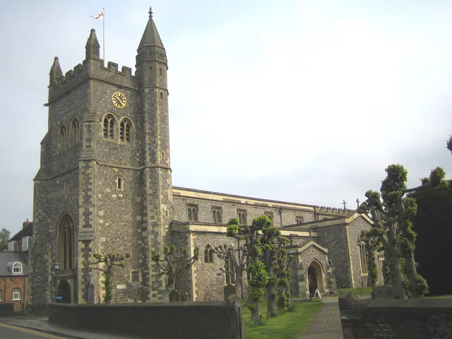
St Mary's Church, Amersham
Historic churches · 2.0 km

Little Missenden
Castles · 2.0 km

Amersham Martyrs
Memorials & monuments · 2.0 km

Lone Soldier
Public art & sculpture · 2.1 km
Willow hares
Public art & sculpture · 2.1 km
Nearby
📷 3Manor houses · South East England
Woodrow High House
Woodrow High House — a manor in england-west-midlands, United Kingdom.
📷 3Historic houses · South East England
Elmodesham House
Elmodesham House — house in Chiltern, Buckinghamshire, England, UK.
📷 5Historic houses · South East England
Amersham Hall
Amersham Hall — a school heritage in england-west-midlands, United Kingdom.
📷 3Museums · South East England
Amersham Museum
Amersham Museum — a museum in england-west-midlands, United Kingdom.
📷 7Hotels · South East England
Kings Arms Hotel
Kings Arms Hotel — a hotel in england west midlands.
📷 7Where to eat & stay near Shardeloes
Places to stay
📷 7Hotels · South East England
Kings Arms Hotel
Kings Arms Hotel — a hotel in england west midlands.
📷 7 📷 5
📷 5Campsites · East of England
Highclere Farm Campsite
Highclere Farm Campsite — a campsite in england west midlands.
 📷 5
📷 5Campsites · South East England
Braid Wood Scout & Guide Activity Centre
Braid Wood Scout & Guide Activity Centre — a campsite in england west midlands.
 📷 5
📷 5Hostels · East of England
YHA Jordans Hostel
YHA Jordans Hostel — a hostel in england west midlands.
 📷 5
📷 5Caravan parks · London
North Hill Farm RV Park
North Hill Farm RV Park — a caravan park in england west midlands.
Places to eat & drink
📷 7 📷 7
📷 7Restaurants · South East England
The Griffin
The Griffin — a restaurant in england west midlands.
 📷 7
📷 7Historic pubs · South East England
The Nag's Head Public House
The Nag's Head Public House in England East, United Kingdom.
 📷 7
📷 7Historic pubs · South East England
The George Public House
The George Public House in England South East, United Kingdom.
 📷 5
📷 5Historic pubs · East of England
The Swan Public House
The Swan Public House in England East, United Kingdom.
 📷 7
📷 7Historic pubs · East of England
Saddlers House The Feathers Public House
Saddlers House The Feathers Public House in England East, United Kingdom.
More historic houses in this region
 📷 5
📷 5Historic houses · South East England
12 and 14 High Street, Rochester
12 and 14 High Street, Rochester — building in Rochester, Kent, England, UK.
 📷 5
📷 5Historic houses · South East England
Berkeley House
Berkeley House — house in Rochester, Kent, England, UK.
.jpg?width=1200) 📷 5
📷 5Historic houses · South East England
Betchworth House
Betchworth House — house in Betchworth, Mole Valley, England, UK.
 📷 5
📷 5Historic houses · South East England
Bookham Grove
Bookham Grove — building in Mole Valley, Surrey, England, UK.
Frequently asked questions
- Where is Shardeloes?
- Shardeloes is in the West Midlands, United Kingdom (postcode HP7 0RL), in the parish of Amersham.
- What is Shardeloes?
- Shardeloes — a Grade I-listed historic house in england-west-midlands, United Kingdom.
- How do I get to Shardeloes?
- The nearest railway station is Amersham, about 2.6 km away. Drivers can use postcode HP7 0RL.
- When was Shardeloes built?
- Built or established in 1766. Designed by Stiff Leadbetter.
- Who owns Shardeloes?
- Shardeloes is owned by | current_tenants =.
- Is Shardeloes a listed building?
- Shardeloes is officially recognised as Grade I listed.
- Is Shardeloes a protected site?
- Yes — Shardeloes is part of the Chilterns National Landscape (AONB).
- How do I get to Shardeloes?
- The nearest railway station is Amersham, about 2.6 km away. Drivers can navigate to postcode HP7 0RL.