Mountains & hills · Scottish Highlands
Sgurr an Iubhair
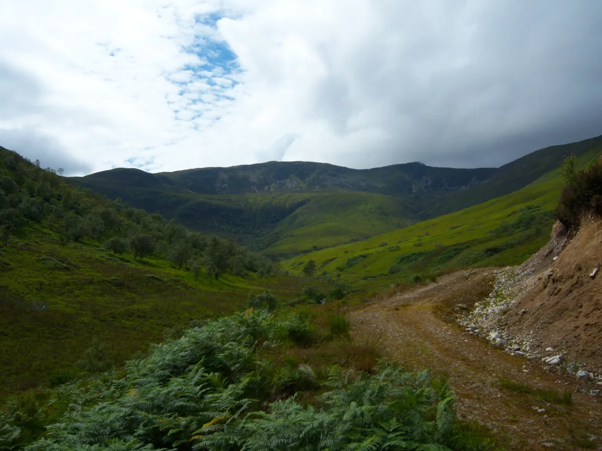
Sgurr an Iubhair — mountain in scotland highlands. Elevation: 722 m.

Steven Brown — CC BY-SA 2.0 via Wikimedia Commons licence
Plan your visit
- Typical visit
- 3 h–8 h
- Best time of year
- Late spring – early autumn (May–Oct)
About
Sgurr an Iubhair is a mountain located in scotland highlands. Elevation: 722 m. A named British peak recorded in OpenStreetMap. Peaks are typically named on Ordnance Survey 1:50k mapping.
Photo gallery
Place summary
Sgurr an Iubhair is a mountain located in the Scottish Highlands. It forms part of the rugged landscape characteristic of the region, attracting walkers and climbers. The mountain offers various routes for ascent, providing panoramic views of the surrounding highlands. Its prominent position and distinctive profile make it a notable feature within the area's natural scenery.
AI-generated from the structured facts on this page (operator, designation, listing, era). Not a substitute for visiting.
- Coordinates
- 56.7966, -5.2746
Sources
- osm: n2700225210 (ODbL)
Other places nearby
Loading nearby places…
Nearby
📷 5Mountains & hills · Scottish Highlands
Sgurr an Iubhair
Sgurr an Iubhair — a hill or mountain in scotland highlands.
 📷 3
📷 3Mountains & hills · Scottish Highlands
Stob Coire a' Chearcaill
Stob Coire a' Chearcaill — Named summit at 771 m.
 📷 5
📷 5Mountains & hills · Scottish Highlands
Gearr Leachdann
Gearr Leachdann — mountain in scotland highlands. Elevation: 409 m.
 📷 5
📷 5Mountains & hills · Scottish Highlands
Druim Leathad nam Fias East Top
Druim Leathad nam Fias East Top — a hill or mountain in scotland highlands.
 📷 3
📷 3Natural landmarks · Scottish Highlands
Eas an Inbhire
Eas an Inbhire in Scotland Islands, United Kingdom.
 📷 5
📷 5Mountains & hills · Scottish Highlands
Meall an Doire Dhuinn
Meall an Doire Dhuinn — a hill or mountain in scotland highlands.
Where to eat & stay near Sgurr an Iubhair
Places to stay
 📷 5
📷 5Hotels · Scottish Highlands
Clan MacDuff Hotel
Clan MacDuff Hotel — a hotel in scotland highlands.
 📷 5
📷 5Hostels · Scottish Highlands
Corran Bunkhouse
Corran Bunkhouse — a hostel in scotland highlands.
 📷 5
📷 5Campsites · Scottish Highlands
Linnhe Lochside Holiday Park
Linnhe Lochside Holiday Park — a campsite in scotland highlands.
 📷 5
📷 5Caravan parks · Scottish Highlands
Bunree Caravan Club Site
Bunree Caravan Club Site — a caravan park in scotland highlands.
 📷 5
📷 5Hotels · Scottish Highlands
Ossians
Ossians — a hotel in scotland highlands.
 📷 5
📷 5Hotels · Scottish Highlands
Best Western Imperial Hotel
Best Western Imperial Hotel — a hotel in scotland highlands. 3-star. Brand: Best Western.

More mountains in this region
 📷 3
📷 3Mountains & hills · Scottish Highlands
A' Bhuidheanach Bheag
A' Bhuidheanach Bheag — Named summit at 936 m.
 📷 3
📷 3Mountains & hills · Scottish Highlands
A' Chailleach
A' Chailleach — Named summit at 997 m.
 📷 3
📷 3Mountains & hills · Scottish Highlands
A' Chailleach
A' Chailleach — Named summit at 930 m.
 📷 3
📷 3Mountains & hills · Scottish Highlands
A' Chaoirnich
A' Chaoirnich — Named summit at 875 m.
Frequently asked questions
- Where is Sgurr an Iubhair?
- Sgurr an Iubhair is in the Scottish Highlands, United Kingdom.
- What is Sgurr an Iubhair?
- Sgurr an Iubhair — mountain in scotland highlands. Elevation: 722 m.
- How do I get to Sgurr an Iubhair?
- Its coordinates are 56.7966°, -5.2746°.