Mountains & hills · Scottish Highlands
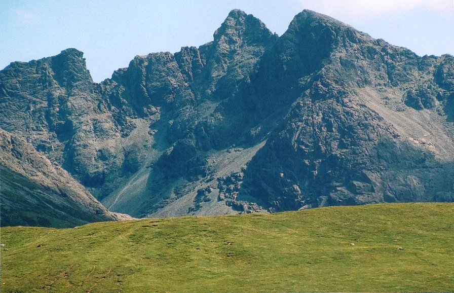
Sgurr Alasdair
Sgurr Alasdair — a hill or mountain in scotland highlands.

Jim Barton — CC BY-SA 2.0 via Wikimedia Commons licence
Plan your visit
- Typical visit
- 3 h–8 h
- Best time of year
- Late spring – early autumn (May–Oct)
About
A British hill or mountain, named on Ordnance Survey maps and walked by hill-baggers. Sgurr Alasdair is a named hill or mountain in scotland highlands, recorded in the GeoNames UK gazetteer. British landmarks of this type are typically marked on Ordnance Survey maps and recorded in the national gazetteer for cartographic and navigational reference. Coordinates and feature classification are sourced from the GeoNames open dataset.
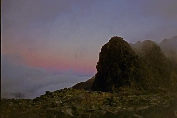
Photo gallery
Place summary
Sgurr Alasdair is a mountain located in the Scottish Highlands. It is known as the highest peak on the Isle of Skye, part of the Cuillin range. This mountain features rugged terrain and dramatic cliffs, attracting climbers and hikers seeking challenging routes and stunning views. The area is characterised by its remote wilderness and natural beauty, making it a significant landmark in the region.
AI-generated from the structured facts on this page (operator, designation, listing, era). Not a substitute for visiting.
- Coordinates
- 57.2066, -6.2241
Sources
- manual: geonames-2657573 (CC BY 4.0)
Other places nearby
Loading nearby places…
Nearby
 📷 3
📷 3Natural landmarks · Scottish Highlands
Sgùrr Alasdair
Sgùrr Alasdair — 992m high mountain in Highland, Scotland, UK.
 📷 3
📷 3Mountains & hills · Scottish Highlands
Sgùrr Alasdair
Sgùrr Alasdair — Named summit at 992 m.
 📷 3
📷 3Mountains & hills · Scottish Highlands
Sgùrr Theàrlaich
Sgùrr Theàrlaich — a mountain in scotland-highlands, United Kingdom.
📷 5Mountains & hills · Scottish Highlands
Sgùrr Sgumain
Sgùrr Sgumain — mountain in scotland highlands. Elevation: 946 m.
 📷 5
📷 5Natural landmarks · Scottish Highlands
Sgùrr Mhic Choinnich
Sgùrr Mhic Choinnich — 948m high mountain in Highland, Scotland, UK.
 📷 5
📷 5Mountains & hills · Scottish Highlands
Sgurr Mhic Choinnich
Sgurr Mhic Choinnich — a hill or mountain in scotland highlands.
Where to eat & stay near Sgurr Alasdair
Places to stay
 📷 5
📷 5Campsites · Scottish Highlands
Glenbrittle Campsite
Glenbrittle Campsite — a campsite in scotland highlands.
 📷 5
📷 5Hostels · Scottish Highlands
Glenbrittle Youth Hostel
Glenbrittle Youth Hostel — a hostel in scotland highlands. Brand: Hostelling Scotland.
 📷 5
📷 5Hostels · Scottish Highlands
Sligachan Bunkhouse
Sligachan Bunkhouse — a hostel in scotland highlands.
 📷 5
📷 5Campsites · Scottish Highlands
Sligachan Campsite
Sligachan Campsite — a campsite in scotland highlands.
 📷 5
📷 5Hostels · Scottish Highlands
Skyewalker Hostel
Skyewalker Hostel — a hostel in scotland highlands.
 📷 5
📷 5Hostels · Scottish Highlands
Croft Bunkhouse
Croft Bunkhouse — a hostel in scotland highlands.
More mountains in this region
 📷 3
📷 3Mountains & hills · Scottish Highlands
A' Bhuidheanach Bheag
A' Bhuidheanach Bheag — Named summit at 936 m.
 📷 3
📷 3Mountains & hills · Scottish Highlands
A' Chailleach
A' Chailleach — Named summit at 997 m.
 📷 3
📷 3Mountains & hills · Scottish Highlands
A' Chailleach
A' Chailleach — Named summit at 930 m.
 📷 3
📷 3Mountains & hills · Scottish Highlands
A' Chaoirnich
A' Chaoirnich — Named summit at 875 m.
Frequently asked questions
- Where is Sgurr Alasdair?
- Sgurr Alasdair is in the Scottish Highlands, United Kingdom.
- What is Sgurr Alasdair?
- Sgurr Alasdair — a hill or mountain in scotland highlands.
- How do I get to Sgurr Alasdair?
- Its coordinates are 57.2066°, -6.2241°.