
Heritage railways · North East England
Settle to Carlisle Line
In or near Sandford.
Settle to Carlisle Line in England North East, United Kingdom.

JThomas — CC BY-SA 2.0 via Wikimedia Commons licence

Plan your visit
- Typical visit
- 1.5 h–3 h
- Best time of year
- Spring – autumn
- Nearest railway station
- Warcop · 5.2 km
Getting there & planning your visit
To visit the Settle to Carlisle Line, the nearest railway station is Warcop, located 5.2 km away. The postcode for the area is CA16 6EW. Entry details are not provided, so please check in advance for accessibility information.
About
Settle to Carlisle Line is a place of interest in England North East, United Kingdom — drawn from open-data sources for visitor reference. See the linked Wikipedia article for the full description.
Photo gallery
Protected designations
- Site of Special Scientific Interest: River Eden and Tributaries SSSI
- Area of Outstanding Natural Beauty: North Pennines
Designations sourced from Natural England open data under OGL v3.
From the Wikipedia article
The Settle–Carlisle line (also known as the Settle and Carlisle (S&C)) is a 73-mile-long (117 km) main railway line in northern England. The route, which crosses the remote, scenic regions of the Yorkshire Dales and the North Pennines, runs between Settle Junction, on the Leeds–Morecambe line, and Carlisle, near the English-Scottish borders. The historic line was constructed in the 1870s and has several notable tunnels and viaducts such as the imposing Ribblehead. The line is managed by Network Rail. All passenger services are operated by Northern apart from temporary diverted services (due to closures of the West Coast Main Line) and are part of the National Rail network. Stations serve towns such as Settle in North Yorkshire, Appleby-in-Westmorland in Cumbria and small rural communities along its route. In the 1980s, British Rail planned to close the Settle–Carlisle line. This prompted a campaign to save the line by rail groups, enthusiasts, local authorities and residents along the route. In 1989, the UK government announced the line would be saved from closure. Since then, passenger numbers have grown steadily to 1.2 million in 2012. Eight formerly closed stations have been reopened and several quarries have been reconnected to the line. It remains one of the most popular railway routes in the UK for charter trains and specials. After damage by a landslip, part of the line was closed from February 2016 to March 2017. To celebrate the reopening, the first regular mainline scheduled service in England for nearly half a century ran with a steam engine.
Excerpt from Wikipedia under CC BY-SA 4.0. See the source article linked in Sources below.
Background
History
The Settle–Carlisle line (S&C) had its origins in railway politics; the expansion-minded Midland Railway company was locked in dispute with the rival London and North Western Railway (LNWR) over access rights to the latter's tracks to Scotland. The Midland's access to Scotland was via the "Little North Western" route to Ingleton. The Ingleton branch line from Ingleton to Low Gill, where it joined the Lancaster and Carlisle Railway, was under the control of the rival LNWR. Initially the routes, although physically connected at Ingleton, were not logically connected, as the LNWR and Midland could not agree on sharing the use of Ingleton station. Instead the LNWR terminated its trains at its…
Architecture
The line was built by over 6,000 navvies, most of them Irish, who worked in remote locations, enduring harsh weather conditions. Large camps were established to house them, with many becoming complete townships with post offices and schools. They were named Inkerman, Sebastapol and Jericho. The remains of one camp – Batty Green – where over 2,000 navvies lived and worked, can be seen near Ribblehead. Scripture readers helped to counteract the effect of drunken violence in these isolated communities. A plaque in St Leonard's Church, Chapel-le-Dale, records the workers who died, both from disease and from accidents, while building the railway. The death toll is unknown, but 80 people died at…
Visiting
approaching Long Marton heading south along the Settle and Carlisle Line in 2019.]] From April 2016, Arriva Rail North Ltd took over all passenger services on the line from the previous operator which was run by Serco & Abellio. As part of the new franchise agreement with the DfT, service improvements were implemented from the May 2018 timetable change with one extra weekday service each way and two extra trains each way on Sundays. Arriva also began work to install digital information screens and ticket machines at each station in early 2019. As from 1 March 2020, passenger services are now operated by the publicly run company Northern Trains, who have maintained this level of service. In…
Sourced from Wikipedia under CC BY-SA 4.0.
- Coordinates
- 54.5170, -2.4560
- District
- Westmorland and Furness
- Parish
- Ormside
- Postcode
- CA16 6EW
- Parliamentary constituency
- Westmorland and Lonsdale
- Nearest railway station
- Warcop — 5.2 km
- Opening
- 1875 (goods) and 1876 (passengers)
Sources
- wikidata: Q803210 (CC0)
- wikipedia: Settle–Carlisle line (CC BY-SA 4.0)
Other places nearby

Whitley Crag, Asby
Vineyards · 0.9 km

Turkeytarn Hill
Mountains & hills · 1.8 km

Asby
Other places · 1.9 km

Tewfill Hill
Mountains & hills · 2.0 km

Warcop
Other places · 2.1 km

Grassgill
Caravan parks · 2.1 km

Great Asby
Villages · 2.3 km

Great Asby
Historic churches · 2.3 km

Trickle Banks
Mountains & hills · 2.7 km

Water Houses clapper bridge
Historic bridges · 2.8 km

Codgy Bank
Mountains & hills · 3.0 km

Bleatarn
Other places · 3.1 km
Nearby
Vineyards · North East England
Whitley Crag, Asby
Whitley Crag, Asby — a UK vineyard in england north east, producing English or Welsh wine from cool-climate grape varieties.
📷 5Mountains & hills · North East England
Turkeytarn Hill
Turkeytarn Hill — mountain in england north east. Elevation: 245.3 m.
📷 4📷 5Mountains & hills · North East England
Tewfill Hill
Tewfill Hill — mountain in england north east. Elevation: 219.8 m.
📷 4📷 5Where to eat & stay near Settle to Carlisle Line
Places to stay
📷 5 📷 5
📷 5Caravan parks · North East England
Wild Rose Caravan Site
Wild Rose Caravan Site — a caravan park in england north east.
 📷 5
📷 5Caravan parks · North West England
Chapel Farm Caravan Park
Chapel Farm Caravan Park — a caravan park in england north west.
 📷 5
📷 5B&Bs · North East England
Bongate House
Bongate House — a bed-and-breakfast in england north east.
 📷 5
📷 5 📷 5
📷 5Caravan parks · North East England
Park House Caravan Park
Park House Caravan Park — a caravan park in england north east.
Places to eat & drink
 📷 5
📷 5Historic pubs · North East England
1, Scattergate
1, Scattergate in England North East, United Kingdom.
 📷 7
📷 7Cafés · North West England
The White Hare Cafe
The White Hare Cafe — a café in england north west.
 📷 5
📷 5Cafés · North West England
The Cross Keys Temperance Inn
The Cross Keys Temperance Inn — a café in england north west.
 📷 5
📷 5 📷 5
📷 5Cafés · North West England
Gun Dog Coffee Shop
Gun Dog Coffee Shop — a café in england north west.
 📷 3
📷 3More heritage railways in this region
 📷 5
📷 5Heritage railways · North East England
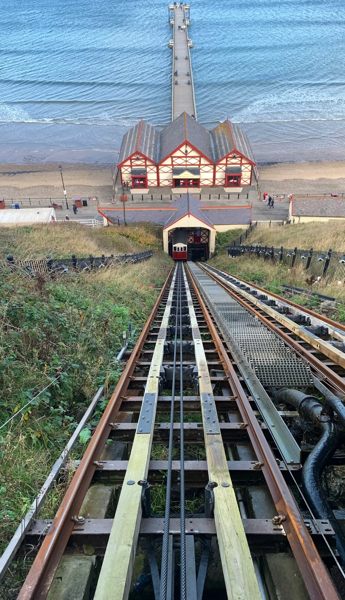
Cliff Tramway
Cliff Tramway is a heritage railway in the United Kingdom.
 📷 5
📷 5Heritage railways · North East England
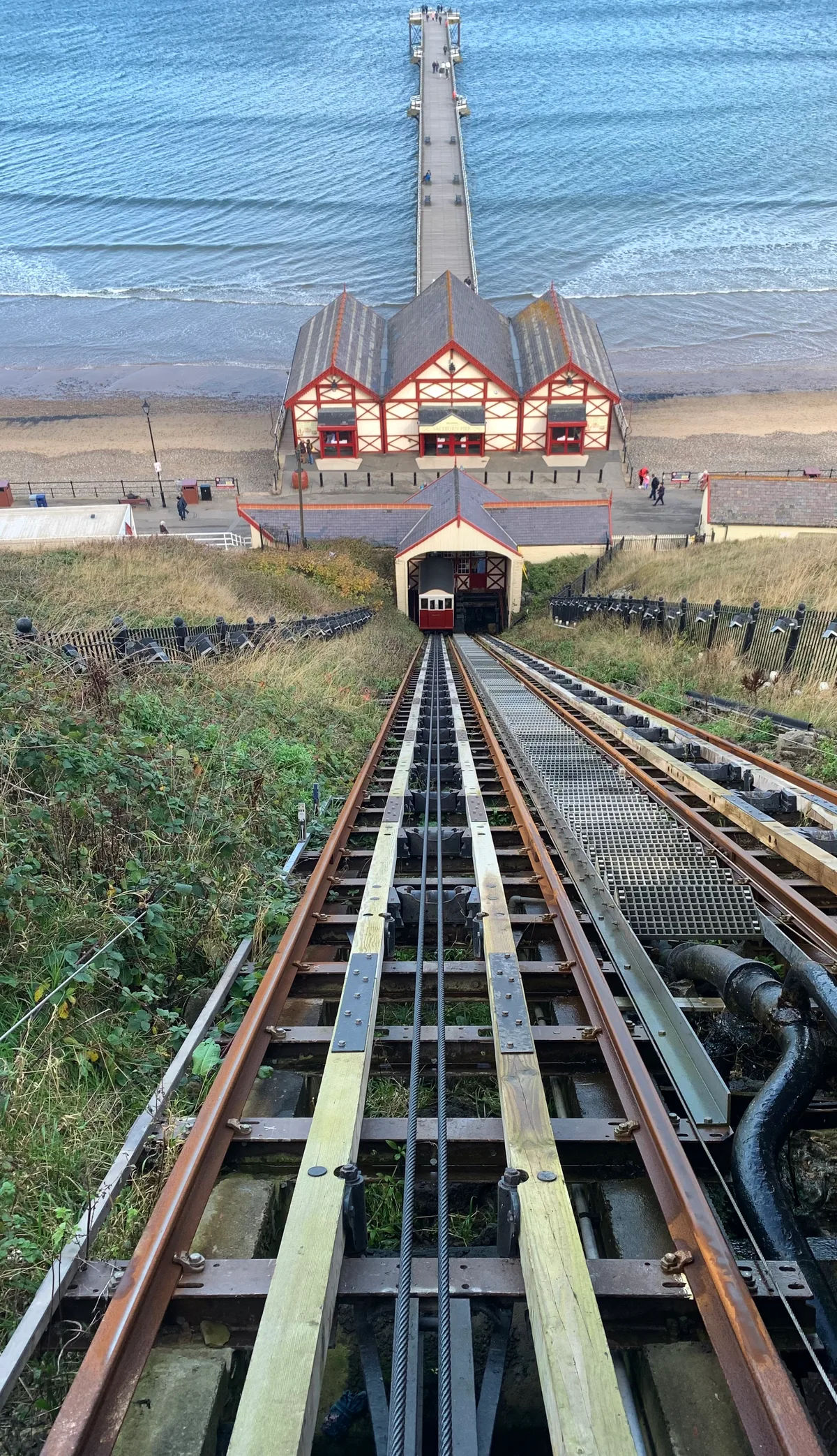
Cliff Tramway
Cliff Tramway is a heritage railway in the United Kingdom.
 📷 5
📷 5Heritage railways · North East England
Esk Valley line
The Esk Valley Line is a railway line located in the north of England, covering a total distance of approximately 35 miles (56 km), running from Middlesbrough to Whitby. The line follows the course of
 📷 4
📷 4Heritage railways · North East England
Alston railway station
Alston railway station in England North East, United Kingdom.
Frequently asked questions
- Where is Settle to Carlisle Line?
- Settle to Carlisle Line is in North-East England, United Kingdom (postcode CA16 6EW), in the parish of Ormside.
- What is Settle to Carlisle Line?
- Settle to Carlisle Line in England North East, United Kingdom.
- How do I get to Settle to Carlisle Line?
- The nearest railway station is Warcop, about 5.2 km away. Drivers can use postcode CA16 6EW.
- Who owns Settle to Carlisle Line?
- Settle to Carlisle Line is owned by Network Rail.
- Is Settle to Carlisle Line a protected site?
- Yes — Settle to Carlisle Line is part of the River Eden and Tributaries SSSI Site of Special Scientific Interest and the North Pennines National Landscape (AONB).
- How do I get to Settle to Carlisle Line?
- The nearest railway station is Warcop, about 5.2 km away. Drivers can navigate to postcode CA16 6EW.