
Forts · South East England
Second Battle of Newbury
In or near Donnington.
Second Battle of Newbury is a fort in the United Kingdom.

Wikimedia Commons contributors — see linked file page for photographer and licence licence

Plan your visit
- Typical visit
- 45 min–1.5 h
- Nearest railway station
- Newbury · 2.0 km
- Free entry
Getting there & planning your visit
The Second Battle of Newbury is located in West Berkshire, with the nearest railway station being Newbury, approximately 2 km away. The postcode for the site is RG14 1UJ. Entry details are not specified, so please check locally for accessibility information.
About
Second Battle of Newbury is a historic fort or fortified site in the United Kingdom. Coordinates: 51.4135°, -1.3349°. This entry is part of The Great Britain Guide, a free, ad-free, open-data tourist directory.
Photo gallery
Official information
Lockett's Bridge is a Grade II listed road bridge located in Newbury, West Berkshire. Built in the 19th century, it features a brick structure with a single arch and is noted for its architectural significance.
Protected designations
- Site of Special Scientific Interest: River Lambourn SSSI
- Site of Special Scientific Interest: River Kennet SSSI
- Area of Outstanding Natural Beauty: North Wessex Downs
Designations sourced from Natural England open data under OGL v3.
From the Wikipedia article
The Second Battle of Newbury was a battle of the First English Civil War fought on 27 October 1644, in Speen, adjoining Newbury in Berkshire. The battle was fought close to the site of the First Battle of Newbury, which took place in late September the previous year. The battle ended indecisively, the Parliamentarian army, commanded by Sir William Waller and the Earl of Manchester, attempted to trap the royalist forces in a pincer by attacking both sides of Charles' army simultaneously. The Parliamentarian attacks were repulsed by the Royal army. Charles however realised following the battle, his position had been rendered untenable and withdrew towards Oxford during the night. The exhausted Parliamentarian army was unable to block the royalist retreat and Charles was able to leave unmolested, despite being heavily outnumbered. The tactical failures in the command and control of the Parliamentarian army during this battle led to several major military reforms that resulted in the creation of the New Model Army for Parliament the following year.
Excerpt from Wikipedia under CC BY-SA 4.0. See the source article linked in Sources below.
Background
History
In the early months of 1644, the Parliamentarians had won victories at Cheriton in the south of England and Nantwich in the northwest. Also, they had secured the allegiance of the Scottish Covenanters, who sent an army into the north east. These developments both distracted the Royalists and weakened their forces around Oxford, King Charles's wartime capital. Early in June, the Parliamentarian armies of the Earl of Essex and Sir William Waller threatened to surround Oxford. King Charles made a night march to escape to Worcester. He was still in danger but on 6 June, Essex and Waller (who disliked each other) conferred at Stow-on-the-Wold and fatally decided to divide their armies. While…
Sourced from Wikipedia under CC BY-SA 4.0.
- Coordinates
- 51.4135, -1.3349
- District
- West Berkshire
- Parish
- Speen
- Postcode
- RG14 1UJ
- Parliamentary constituency
- Newbury
- Nearest railway station
- Newbury — 2 km
- Official site
- britishlistedbuildings.co.uk
Sources
- osm: n390217158 (ODbL)
- wikipedia: Second Battle of Newbury (CC BY-SA 4.0)
- commons: Newbury, Site of the Second Battle of Newbury 1644 - geograph.org.uk - 1656273.jpg (CC BY-SA 4.0)
Other places nearby

Lockett's Bridge
Historic bridges · 0.3 km

Oxford Road
Historic bridges · 0.3 km

Bridge Over Lake Approximately 400 Metres To South East Of Donnington Grove
Historic bridges · 0.3 km

Donnington
Towns & cities · 0.6 km

Speen
Villages · 0.6 km
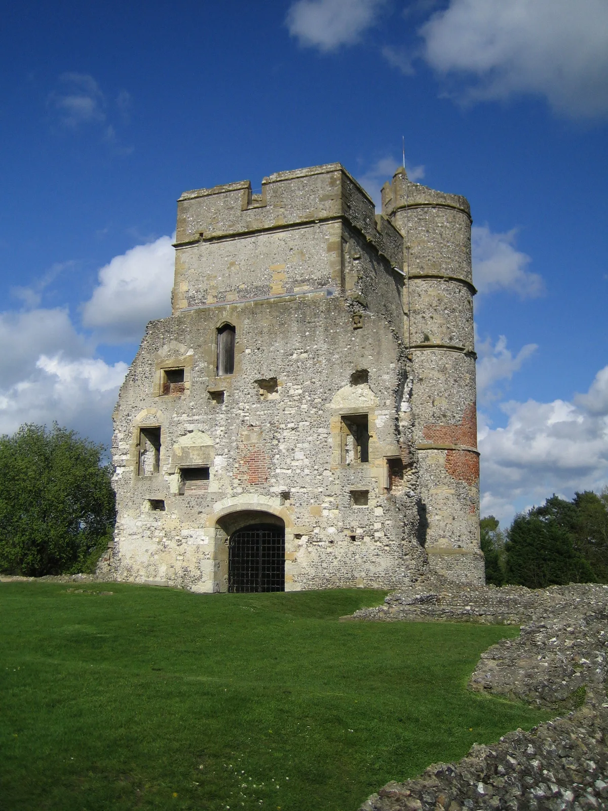
Donnington Castle
Castles · 0.7 km

Speen Manor
Manor houses · 0.7 km

The Hare & Hounds
Hotels · 0.8 km

Speen War Memorial
Memorials & monuments · 1.0 km

The Chequers
Hotels · 1.0 km

Bagnor
Towns & cities · 1.1 km

Tiny Cafe
Cafés · 1.1 km
Nearby
📷 5Historic bridges · South East England
Lockett's Bridge
Lockett's Bridge — Grade II listed building-listed bridge in england-south-east, United Kingdom.
📷 5Historic bridges · South East England
Oxford Road
Oxford Road is a historic bridge in the United Kingdom.
📷 5Historic bridges · South East England
Bridge Over Lake Approximately 400 Metres To South East Of Donnington Grove
Bridge Over Lake Approximately 400 Metres To South East Of Donnington Grove — Grade II listed building-listed bridge in england-south-east, United Kingdom.
📷 5Towns & cities · South East England
Donnington
Donnington — village in Berkshire, England, UK.
📷 5📷 5Castles · South East England
Donnington Castle
Donnington Castle — ruined medieval castle in Berkshire, England.
Where to eat & stay near Second Battle of Newbury
Places to stay
📷 7📷 7 📷 7
📷 7Hotels · South East England
Donnington Valley Hotel
Donnington Valley Hotel — a hotel in england south east.
 📷 5
📷 5Hotels · South East England
The Elephant at the Market
The Elephant at the Market — a hotel in england south east.
 📷 5
📷 5 📷 3
📷 3Caravan parks · South East England
Cherry Bird Country Park
Cherry Bird Country Park — a caravan park in england south east.
Places to eat & drink
📷 7 📷 7
📷 7 📷 7
📷 7 📷 7
📷 7Restaurants · South East England
The Woodspeen
The Woodspeen — a restaurant in england south east.
 📷 5
📷 5Cafés · South East England
Caffè Nero
Caffè Nero — a café in england south east. Cuisine: coffee shop. Brand: Caffè Nero.
 📷 5
📷 5Historic pubs · South East England
Old Drummer's Arms
Old Drummer's Arms in England South East, United Kingdom.
More forts in this region
 📷 5
📷 5 📷 5
📷 5 📷 5
📷 5Forts · South East England
Darnet Fort
Darnet Fort is a fort in the United Kingdom.
 📷 5
📷 5Forts · South East England
Fort Amherst
Fort Amherst is a fort in the United Kingdom.
Frequently asked questions
- Where is Second Battle of Newbury?
- Second Battle of Newbury is in South-East England, United Kingdom (postcode RG14 1UJ), in the parish of Speen.
- What is Second Battle of Newbury?
- Second Battle of Newbury is a fort in the United Kingdom.
- How do I get to Second Battle of Newbury?
- The nearest railway station is Newbury, about 2.0 km away. Drivers can use postcode RG14 1UJ.
- Is Second Battle of Newbury a protected site?
- Yes — Second Battle of Newbury is part of the River Lambourn SSSI Site of Special Scientific Interest and the River Kennet SSSI Site of Special Scientific Interest.
- How do I get to Second Battle of Newbury?
- The nearest railway station is Newbury, about 2.0 km away. Drivers can navigate to postcode RG14 1UJ.