
Towns & cities · East of England
Scole
Scole — village in South Norfolk, England, UK.

Wikimedia Commons contributors — see linked file page for photographer and licence licence

Plan your visit
- Typical visit
- 3 h–6 h
- Nearest railway station
- Diss · 2.4 km
- Free entry
- Family-friendly
- Dog-friendly
Getting there & planning your visit
To visit Scole, the nearest railway station is Diss, located 2.4 km away. Entry to the town is free.
About
Scole is a town, city, village or settlement in the United Kingdom. It covers approximately 14 km². Recent population estimates put it at around 1,339 people. Address: IP21. Wikidata describes it as: "village in South Norfolk, England, UK". Coordinates: 52.3662°, 1.1562°.
Photo gallery
Protected designations
- Area of Outstanding Natural Beauty: Suffolk Coast & Heaths
Designations sourced from Natural England open data under OGL v3.
From the Wikipedia article
Scole () is a village on the Norfolk–Suffolk border in England. It is 19 miles south of Norwich and lay on the old Roman road to Venta Icenorum, which was the main road until it was bypassed with a dual carriageway. It covers an area of 14.31 km2 (5.53 sq mi) and had a population of 1,339 in 563 households at the 2001 census; the population had increased to 1,367 at the 2011 Census. It lies on the north bank of the River Waveney. The parish church of St Andrew was rebuilt in the 1960s after being destroyed in an arson attack in 1963. There is an east window by Patrick Reyntiens dating from 1963. Scole is the birthplace of William Gooderham (1790) and Ezekiel Gooderham (1794), founders of the Gooderham and Worts distillery in Toronto, Canada, later to be the largest in the British Empire.
Excerpt from Wikipedia under CC BY-SA 4.0. See the source article linked in Sources below.
- Coordinates
- 52.3662, 1.1562
- County
- Norfolk
- District
- South Norfolk
- Parish
- Scole
- Postcode
- IP21
- Parliamentary constituency
- Waveney Valley
- Population
- 1,339
- Nearest railway station
- Diss — 2.4 km
Sources
- wikidata: Q963407 (CC0)
- wikipedia: Scole (CC BY-SA 4.0)
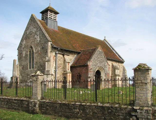
- commons: St Andrew's Church, Scole, Norfolk - geograph.org.uk - 814523.jpg (CC BY-SA 4.0)
Other places nearby

Scole Village Sign
Public art & sculpture · 0.0 km
Scole War Memorial
Memorials & monuments · 0.0 km

Scole Inn Hotel
Hotels · 0.0 km

Dragon
National landscapes (AONB) · 0.5 km

The Willows Campsite
Caravan parks · 0.5 km

Saint Mary
Archaeological sites · 1.1 km

Stuston
Villages · 1.7 km

Billingford Mill
Windmills · 1.8 km

Church of All Saints
Historic churches · 1.8 km
St Andrew's Church, Frenze
Historic churches · 2.1 km

Stuston Village Sign
Public art & sculpture · 2.1 km

Brome with Oakley Village Sign
Public art & sculpture · 2.3 km
Scole is a village located in Norfolk, in the East of England, with a population of 1,339. Our guide lists several nearby attractions within reach.
At a glance
- Population
- 1,339
- Administrative county
- Norfolk
- Constituency
- Waveney Valley
- Top categories near here
Things to see in Scole
14 attractions within 12 km. Full guide: things to do in Scole →
📷 3Windmills · East of England
Billingford Mill
Billingford Mill is a windmill in the United Kingdom.
📷 3Historic churches · East of England
Church of All Saints
Church of All Saints — church in Stuston, Suffolk, England, UK.
📷 3National landscapes (AONB) · East of England
Dragon
Dragon — Public artwork (sculpture).
📷 3Historic churches · East of England
St Andrew's Church, Frenze
St Andrew's Church, Frenze — church in Frenze, Norfolk, England, UK.
 📷 3
📷 3Manor houses · East of England
Wood Hall Manor
Wood Hall Manor — Grade II listed building-listed manor in england-east, United Kingdom.
📷 3Memorials & monuments · East of England
Scole War Memorial
Scole War Memorial — Grade II listed building-listed memorial in england-east, United Kingdom.
📷 3Public art & sculpture · East of England
Brome with Oakley Village Sign
Brome with Oakley Village Sign — a public art in england-east, United Kingdom.
📷 3Public art & sculpture · East of England
Scole Village Sign
Scole Village Sign — a public art in england-east, United Kingdom.
📷 3Public art & sculpture · East of England
Stuston Village Sign
Stuston Village Sign — a public art in england-east, United Kingdom.
 📷 5📷 5📷 5
Caravan parks · East of England
The Willows Campsite
The Willows Campsite — a caravan park in england east.
📷 5📷 5Nearby
📷 3Public art & sculpture · East of England
Scole Village Sign
Scole Village Sign — a public art in england-east, United Kingdom.
📷 3Memorials & monuments · East of England
Scole War Memorial
Scole War Memorial — Grade II listed building-listed memorial in england-east, United Kingdom.
📷 5📷 3National landscapes (AONB) · East of England
Dragon
Dragon — Public artwork (sculpture).
📷 5Caravan parks · East of England
The Willows Campsite
The Willows Campsite — a caravan park in england east.
📷 5Where to eat & stay near Scole
Places to stay
📷 5📷 5Caravan parks · East of England
The Willows Campsite
The Willows Campsite — a caravan park in england east.
📷 5 📷 5
📷 5Caravan parks · East of England
Westbrook Green Farm
Westbrook Green Farm — a caravan park in england east.
 📷 5
📷 5 📷 5
📷 5Caravan parks · East of England
Red Lion Campsite
Red Lion Campsite — a caravan park in england east.
Places to eat & drink
 📷 5
📷 5 📷 5
📷 5 📷 5
📷 5 📷 5
📷 5Restaurants · East of England
Hong Xin
Hong Xin — a restaurant in england east.
 📷 7
📷 7Historic pubs · East of England
The Fighting Cocks Public House
The Fighting Cocks Public House in England East, United Kingdom.
 📷 5
📷 5More towns in this region
 Flagship📷 10
 Flagship📷 10
Towns & cities · East of England
Cambridge
Cambridge — city in Cambridgeshire, England.
 Flagship📷 10
Towns & cities · East of England
Chelmsford
Chelmsford — city in Essex, United Kingdom.
 Flagship📷 10
Towns & cities · East of England
Colney Heath
Colney Heath — village and civil parish in St Albans, Hertfordshire, England, UK.
Frequently asked questions
- Where is Scole?
- Scole is in Norfolk, East of England, United Kingdom (postcode IP21), in the parish of Scole.
- What is Scole?
- Scole — village in South Norfolk, England, UK.
- How do I get to Scole?
- The nearest railway station is Diss, about 2.4 km away. Drivers can use postcode IP21.
- Is Scole a protected site?
- Yes — Scole is part of the Suffolk Coast & Heaths National Landscape (AONB).
- Is Scole free to visit?
- Yes, Scole is free to enter.
- How do I get to Scole?
- The nearest railway station is Diss, about 2.4 km away. Drivers can navigate to postcode IP21.