
Heritage railway stations · West Midlands
Sandon railway station
In or near Hopton.
Sandon railway station — a Grade II-listed railway station in england-west-midlands, United Kingdom.

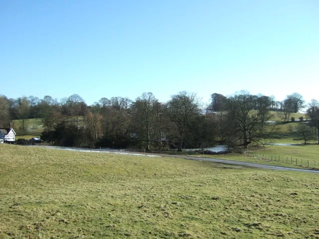
Geoff Pick — CC BY-SA 2.0 via Wikimedia Commons licence

Plan your visit
- Typical visit
- 1 h–2 h
- Nearest railway station
- Amerton Station · 4.9 km
- Free entry
Getting there & planning your visit
Sandon railway station is located in Staffordshire, with the postcode ST18 0DJ. The nearest railway station is Amerton Station, which is 4.9 km away. Entry to the station is free.
About
Sandon railway station is a Grade II-listed building in england-west-midlands, United Kingdom. Grade II status is conferred by Historic England (or Cadw, Historic Environment Scotland or NIEA equivalents) on buildings of exceptional national interest. See the linked Wikipedia article for full historical and architectural details.
Photo gallery
From the Wikipedia article
Sandon railway station was a railway station opened by the North Staffordshire Railway to serve the village of Sandon, Staffordshire, England. For some time it was called Sandon and Salt to avoid confusion with Salt and Sandon railway station opened by the Stafford and Uttoxeter Railway in 1867. Although in a country area and in some distance from the village it served, the station building was in an ornate Jacobean style with ornate gable ends and, on the entrance side, a substantial Porte-cochère. This was for the convenience of Dudley Ryder, 2nd Earl of Harrowby, who was about to have a new Jacobethan country house built in nearby Sandon Park. There was a decorated timber awning and, on the opposite platform, a small but similarly elegant waiting-room. The platforms and station buildings were built on the down, Stoke, side of the bridge of the present B5066 road, and at the other end was a long siding accessed from both running lines by trailing crossovers, with a short spur back to the station. To simplify shunting, authority had been given by the company managers to use a tow rope which was kept beneath the signal box. Further along the line was a private siding belonging to the Earl to service his gasworks which was also controlled by Sandon box. It was a busy main line but few trains called at the station. Under the 1923 grouping it became part of the London Midland and Scottish Railway. By 1938 there were only two trains on weekdays and four on Saturdays. The LMS closed the station to passengers on 6 January 1947 and British Railways closed it to goods on 5 September 1955. The station buildings gradually deteriorated until the Sandon Estate bought them in 1970. They were renovated in 1985 and are now a private home. The line is still open as a diversion of the Trent Valley Line between Rugeley Trent Valley via Colwich Junction and Stone.
Excerpt from Wikipedia under CC BY-SA 4.0. See the source article linked in Sources below.
- Coordinates
- 52.8609, -2.0807
- County
- Staffordshire
- District
- Stafford
- Parish
- Sandon and Burston
- Postcode
- ST18 0DJ
- Parliamentary constituency
- Stone, Great Wyrley and Penkridge
- Nearest railway station
- Amerton Station — 4.9 km
Sources
- wikidata: Q7416458 (CC0)
- wikipedia: Sandon railway station (CC BY-SA 4.0)
Other places nearby

Coots House
Historic houses · 0.2 km

Sandon
Villages · 0.7 km
Sandon Old Hall moated site
Archaeological sites · 1.0 km

Sandon Hall
Manor houses · 1.2 km

Burston House
Historic houses · 1.4 km

Trentham Tower
Memorials & monuments · 1.5 km

Salt Bridge (over Trent and Mersey Canal)
Historic bridges · 1.7 km

Salt
Villages · 1.7 km

Battle Of Hopton Heath Monument (1643)
Memorials & monuments · 2.9 km

Weston Hall
Historic houses · 3.0 km
Battle of Hopton Heath
Forts · 3.1 km

Hopton
Towns & cities · 3.1 km
Nearby
📷 3Historic houses · West Midlands
Coots House
Coots House — house in Sandon and Burston, Stafford, Staffordshire, England, UK.
📷 5📷 3Archaeological sites · West Midlands
Sandon Old Hall moated site
Sandon Old Hall moated site — archaeological site in Sandon and Burston, Stafford, England, UK.
📷 3Manor houses · West Midlands
Sandon Hall
Sandon Hall — a manor in england-west-midlands, United Kingdom.
📷 3Historic houses · West Midlands
Burston House
Burston House — house in Sandon and Burston, Stafford, Staffordshire, England, UK.
📷 3Memorials & monuments · West Midlands
Trentham Tower
Trentham Tower — Grade II* listed building-listed memorial in england-west-midlands, United Kingdom.
Where to eat & stay near Sandon railway station
Places to stay
 📷 7
📷 7 📷 5
📷 5Caravan parks · West Midlands
Green Man Caravan Site
Green Man Caravan Site — a caravan park in england east midlands.
 📷 5
📷 5 📷 5
📷 5Caravan parks · West Midlands
Boothstone Park homes
Boothstone Park homes — a caravan park in england west midlands.
 📷 5
📷 5Caravan parks · West Midlands
Red Lion Farm Caravan Park
Red Lion Farm Caravan Park — a caravan park in england west midlands.
 📷 5
📷 5Campsites · West Midlands
Spring Slade Lodge
Spring Slade Lodge — a campsite in england west midlands.
Places to eat & drink
 📷 5
📷 5Historic pubs · West Midlands
Shrewsbury Arms
Shrewsbury Arms in England West Midlands, United Kingdom.
 📷 5
📷 5Historic pubs · West Midlands
The Chains Public House
The Chains Public House in England West Midlands, United Kingdom.
 📷 5
📷 5 📷 5
📷 5Historic pubs · West Midlands
Eagle Inn Public House
Eagle Inn Public House in England West Midlands, United Kingdom.
 📷 7
📷 7 📷 7
📷 7More places in this region
.jpg?width=1200) 📷 3
📷 3 📷 3
📷 3Heritage railway stations · West Midlands
Brownhills Miner
Brownhills Miner — Public artwork (statue) by John McKenna.
 📷 3
📷 3Heritage railway stations · West Midlands
Choir of Survivors
Choir of Survivors — Public artwork (sculpture) by Helmut Heinze.
 📷 3
📷 3Heritage railway stations · West Midlands
Farley Clock Tower
Farley Clock Tower — Public artwork (architecture) by Albert Hopkins.
Frequently asked questions
- Where is Sandon railway station?
- Sandon railway station is in Staffordshire, the West Midlands, United Kingdom (postcode ST18 0DJ), in the parish of Sandon and Burston.
- What is Sandon railway station?
- Sandon railway station — a Grade II-listed railway station in england-west-midlands, United Kingdom.
- How do I get to Sandon railway station?
- The nearest railway station is Amerton Station, about 4.9 km away. The nearest town is Hopton. Drivers can use postcode ST18 0DJ.
- Is Sandon railway station a listed building?
- Sandon railway station is officially recognised as Grade II listed.
- Is Sandon railway station free to visit?
- Yes, Sandon railway station is free to enter.
- How do I get to Sandon railway station?
- The nearest railway station is Amerton Station, about 4.9 km away. Drivers can navigate to postcode ST18 0DJ.