
Hill forts · Scottish Highlands
Sand, Applecross
Sand, Applecross — cave and archaeological site in Highland, Scotland, UK.

Wikimedia Commons contributors — see linked file page for photographer and licence licence

Plan your visit
- Typical visit
- 1 h–2 h
- Free entry
- Dog-friendly
About
Sand, Applecross is a hill fort in the United Kingdom. Wikidata describes it as: "cave and archaeological site in Highland, Scotland, UK". Coordinates: 57.4703°, -5.8667°.
Photo gallery
From the Wikipedia article
Sand is an archaeological site on the Applecross Peninsula in Wester Ross, Scotland. Sand is the site of a major archaeological excavation on the Inner Sound coast of the Applecross Peninsula in Western Scotland, to the north of the small town of Applecross. A small number of shell middens were known as rare traces of Mesolithic settlement when a rock shelter and shell midden at Sand, Applecross on the coast of Wester Ross, Scotland, was selected for detailed excavation as part of a study of shell middens in the area around the Inner Sound between the Skye and the mainland. The Scotland’s First Settlers project (SFS) investigating the relationship of early inhabitants with the western seaboard chose this area which had known sites at An Corran in Staffin, Skye, and at Redpoint and Shieldaig in Torridon. Their surveys in 1999 and 2000 found 104 previously unknown sites, mostly caves and rock shelters with 21 "lithic scatters" and 9 open shell middens. A proportion of these sites will be more recent, but test pits at 4 sites found Loch a Sguirr on Raasay and Sand in Applecross to be Mesolithic. The indication is that there are many more surviving sites than had been expected. The rock shelter site at Sand on the Applecross peninsula, just to the north of Applecross itself, faces out across the Inner Sound westwards towards Skye and Raasay. Around 7,500 years BCE the first users of the rock shelter had worked antler and stone to make tools. As well as using local stone for their tools they had obtained distinctive stone from the island of Rùm, 30 km (19 mi) to the south, and Staffin on Skye, 10 km (6.2 mi) to the west, showing that they were able to cross open sea. Gradually a large pile of shells, mainly limpets, built up into a large midden. Abundant fragments of stone "pot-boilers" and bevel ended bone tools indicate that the shellfish were being cooked and the contents scooped out. There were also bones from red deer and birds and an antler harpoon for catching a…
Excerpt from Wikipedia under CC BY-SA 4.0. See the source article linked in Sources below.
- Coordinates
- 57.4703, -5.8667
- Address
- Applecross Peninsula
Sources
- wikidata: Q7415746 (CC0)
- wikipedia: Sand, Applecross (CC BY-SA 4.0)
- commons: Sand Bay and the Inner Sound - geograph.org.uk - 1257782.jpg (CC BY-SA 4.0)
Other places nearby

BUTEC
Islands · 0.4 km

Applecross War Memorial
Memorials & monuments · 3.9 km

Beinn a' Chlachain
Mountains & hills · 4.1 km

Lonbain
Villages · 4.2 km

Applecross Heritage Centre
Museums · 4.3 km

Hartfield Cave
Caves · 4.3 km
Old Parish Church, Applecross
Historic churches · 4.3 km

Hartfield House
Hostels · 4.4 km

Applecross Bay
Natural landmarks · 4.6 km

Applecross Bay
Mountains & hills · 4.7 km

Applecross House
Manor houses · 4.8 km

Applecross Campsite
Campsites · 5.3 km
Nearby
📷 5📷 3Memorials & monuments · Scottish Highlands
Applecross War Memorial
Applecross War Memorial — a memorial in scotland-highlands, United Kingdom.
📷 3Mountains & hills · Scottish Highlands
Beinn a' Chlachain
Beinn a' Chlachain — a mountain in scotland-highlands, United Kingdom.
📷 5📷 3Museums · Scottish Highlands
Applecross Heritage Centre
Applecross Heritage Centre — a museum in scotland-highlands, United Kingdom.
📷 3Where to eat & stay near Sand, Applecross
Places to stay
📷 5Hostels · Scottish Highlands
Hartfield House
Hartfield House — a hostel in scotland highlands.
📷 5Campsites · Scottish Highlands
Applecross Campsite
Applecross Campsite — a campsite in scotland highlands.
 📷 5
📷 5Campsites · Scottish Highlands
Shieldaig Camping and Cabins
Shieldaig Camping and Cabins — a campsite in scotland highlands.
 📷 5
📷 5Hostels · Scottish Highlands
Raasay Youth Hostel
Raasay Youth Hostel — a hostel in scotland highlands.
 📷 5
📷 5 📷 5
📷 5More places in this region
 📷 3
📷 3Hill forts · Scottish Highlands
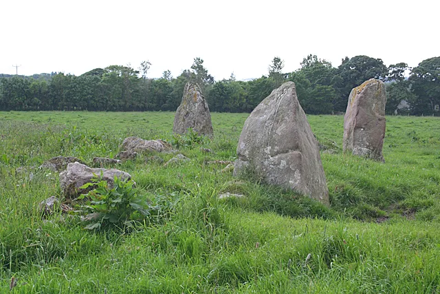
Aquhorthies stone circle
Aquhorthies stone circle — architectural structure in Aberdeenshire, Scotland, UK.
 📷 3
📷 3Hill forts · Scottish Highlands
Auchinhove
Auchinhove — archaeological site in Moray, Scotland, UK.
 📷 3
📷 3Hill forts · Scottish Highlands
Balbridie
Balbridie — Neolithic timber hall remains in Aberdeenshire, Scotland, UK.
 📷 3
📷 3Hill forts · Scottish Highlands
Balnageith Farmhouse
Balnageith Farmhouse — archaeological site in Moray, Scotland, UK.
Frequently asked questions
- Where is Sand, Applecross?
- Sand, Applecross is in the Scottish Highlands, United Kingdom.
- What is Sand, Applecross?
- Sand, Applecross — cave and archaeological site in Highland, Scotland, UK.
- How do I get to Sand, Applecross?
- Its coordinates are 57.4703°, -5.8667°.
- Is Sand, Applecross free to visit?
- Yes, Sand, Applecross is free to enter.