
Follies · East of England
Salvin Trafford's Mausoleum
In or near Belaugh.
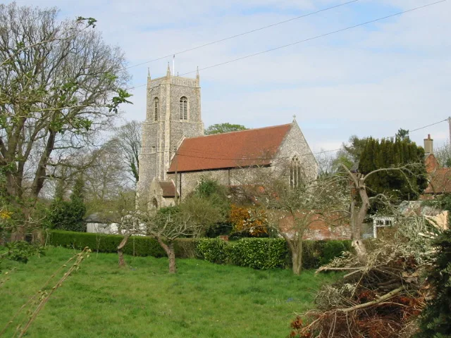
Salvin Trafford's Mausoleum is a folly in the United Kingdom.

Wikimedia Commons contributors — see linked file page for photographer and licence licence

Plan your visit
- Typical visit
- 20 min–45 min
- Nearest railway station
- Hoveton and Wroxham · 1.2 km
- Free entry
- Dog-friendly
About
Salvin Trafford's Mausoleum is a folly — a piece of decorative architecture built more for the view than any practical purpose — in the United Kingdom. Coordinates: 52.7070°, 1.3978°.
Photo gallery
From the Wikipedia article
The Trafford Mausoleum, is a memorial in Wroxham, Norfolk, England. Commissioned after the death of Sigismund Trafford Southwell in 1827, the mausoleum was designed by Anthony Salvin in Gothic Revival style. It is a Grade II listed structure.
Excerpt from Wikipedia under CC BY-SA 4.0. See the source article linked in Sources below.
Background
History
The building has been used to bury members of the Trafford family. The Traffords of Wroxham Hall (now demolished) held land in the area from the Middle Ages. Sigismund Trafford Southwell, High Sheriff of Norfolk in 1818, died in 1827. His wife Margaret approached Anthony Salvin to design a mausoleum which was constructed c.1830. It was built in the churchyard of St Mary the Virgin, Wroxham. Salvin exhibited the design at the Royal Academy in 1830. The style is Early English Gothic, described in the Norfolk 1: Norwich and the North-East volume of Pevsner as a; "correct, rather cold later 13th century style". The mausoleum is a Grade II listed structure.
Sourced from Wikipedia under CC BY-SA 4.0.
- Coordinates
- 52.7070, 1.3978
- County
- Norfolk
- District
- Broadland
- Parish
- Wroxham
- Postcode
- NR12 8SG
- Parliamentary constituency
- Broadland and Fakenham
- Established
- 1830
- Nearest railway station
- Hoveton and Wroxham — 1.2 km
Sources
- osm: w350656915 (ODbL)
- wikipedia: Trafford Mausoleum, Wroxham (CC BY-SA 4.0)
- commons: St Mary, Wroxham, Norfolk - Trafford mausoleum - geograph.org.uk - 804985.jpg (CC BY-SA 4.0)
Other places nearby

Church of St Mary
Historic churches · 0.0 km

Wroxham War Memorial
Memorials & monuments · 0.2 km
Wroxham Village Sign
Public art & sculpture · 0.3 km

Wroxham South Village Sign
Public art & sculpture · 0.6 km

Barton House Railway
Museums · 0.8 km

Wroxham Bridge Village Sign
Public art & sculpture · 0.9 km

Wroxham Bridge
Historic bridges · 0.9 km

Wroxham
Museums · 1.0 km

Mystleigh Model Railway
Natural landmarks · 1.1 km

Church of St Peter
Historic churches · 1.1 km
Belaugh
Towns & cities · 1.2 km

Belaugh Village Sign
Public art & sculpture · 1.3 km
Nearby
📷 3Historic churches · East of England
Church of St Mary
Church of St Mary — Grade I listed church in Wroxham, Norfolk, England, UK.
📷 3Memorials & monuments · East of England
Wroxham War Memorial
Wroxham War Memorial — Grade II listed building-listed memorial in england-east-midlands, United Kingdom.
📷 3Public art & sculpture · East of England
Wroxham Village Sign
Wroxham Village Sign — a public art in england-east-midlands, United Kingdom.
📷 3Public art & sculpture · East of England
Wroxham South Village Sign
Wroxham South Village Sign — a public art in england-east-midlands, United Kingdom.
📷 3Museums · East of England
Barton House Railway
Barton House Railway — a museum in england-east-midlands, United Kingdom.
📷 3Public art & sculpture · East of England
Wroxham Bridge Village Sign
Wroxham Bridge Village Sign — a public art in england-east-midlands, United Kingdom.
Where to eat & stay near Salvin Trafford's Mausoleum
Places to stay
 📷 5
📷 5Campsites · East of England
Camping Corner
Camping Corner — a campsite in england east.
 📷 5
📷 5Hotels · East of England
Norfolk Mead Hotel & Spa
Norfolk Mead Hotel & Spa — a hotel in england east midlands.
 📷 5
📷 5 📷 5
📷 5Campsites · East of England
Decoy Broad Campsite
Decoy Broad Campsite — a campsite in england east.
 📷 5
📷 5Campsites · East of England
Hautbois Residential & Activities Centre
Hautbois Residential & Activities Centre — a campsite in england east midlands.
 📷 5
📷 5Places to eat & drink
 📷 7
📷 7Historic pubs · East of England
Recruiting Sergeant Inn
Recruiting Sergeant Inn in England East, United Kingdom.
 📷 5
📷 5 📷 5
📷 5 📷 5
📷 5Restaurants · East of England
The Town House
The Town House — a restaurant in england east. Brand: Stonehouse Pizza and Carvery.
 📷 7
📷 7Historic pubs · East of England
The Castle Public House
The Castle Public House in England East, United Kingdom.
 📷 7
📷 7Historic pubs · East of England
Lollards Pit
Lollards Pit in England East, United Kingdom.
More follies in this region
 📷 5
📷 5 📷 5
📷 5Follies · East of England
Audley End Ring Hill Temple
Audley End Ring Hill Temple — Folly or eyecatcher.
 📷 5
📷 5Follies · East of England
Barrington-White mausoleum
Barrington-White mausoleum is a folly in the United Kingdom.
 📷 5
📷 5Follies · East of England
Bridge End Garden Summerhouse
Bridge End Garden Summerhouse — Folly or eyecatcher.
Frequently asked questions
- Where is Salvin Trafford's Mausoleum?
- Salvin Trafford's Mausoleum is in Norfolk, East of England, United Kingdom (postcode NR12 8SG), in the parish of Wroxham.
- What is Salvin Trafford's Mausoleum?
- Salvin Trafford's Mausoleum is a folly in the United Kingdom.
- How do I get to Salvin Trafford's Mausoleum?
- The nearest railway station is Hoveton and Wroxham, about 1.2 km away. The nearest town is Belaugh. Drivers can use postcode NR12 8SG.
- When was Salvin Trafford's Mausoleum built?
- Built or established in 1830.
- Who owns Salvin Trafford's Mausoleum?
- Salvin Trafford's Mausoleum is owned by | designation1 = Grade II listed building.
- Is Salvin Trafford's Mausoleum free to visit?
- Yes, Salvin Trafford's Mausoleum is free to enter.
- How do I get to Salvin Trafford's Mausoleum?
- The nearest railway station is Hoveton and Wroxham, about 1.2 km away. Drivers can navigate to postcode NR12 8SG.