
Canals · West Midlands
Saltisford Canal Arm
In or near Ashow.
Saltisford Canal Arm — canal in Warwick, UK.

Wikimedia Commons contributors — see linked file page for photographer and licence licence

Plan your visit
- Typical visit
- 1 h–2 h
- Nearest railway station
- Warwick Parkway · 0.8 km
- Free entry
- Dog-friendly
Getting there & planning your visit
To visit Saltisford Canal Arm, the nearest railway station is Warwick Parkway, located 0.8 km away. The postcode for sat-nav is CV34 5RJ, and entry is free.
About
Saltisford Canal Arm is a canal in the United Kingdom. Part of Grand Union Canal. Wikidata describes it as: "canal in Warwick, UK". Coordinates: 52.2877°, -1.6012°.
Photo gallery
See it from the streetimagery from 2020
Imagery © Mapillary contributors, CC BY-SA 4.0
From the Wikipedia article
The Saltisford Canal Arm is a short stretch of canal located in the town of Warwick, Warwickshire, England. The Warwick and Birmingham Canal Act 1793 (33 Geo. 3. c. 38) allowed construction of the new canal, which was completed and officially opened on 19 December 1799, with trading starting 19 March 1800. Originally it was not an arm at all, but the terminus of the Warwick and Birmingham Canal. It took on the appearance of a branch (or "arm") when the Warwick and Napton Canal joined the Warwick and Birmingham Canal at Budbrooke junction, 1⁄3 mile (0.54 km) from the terminus, when both canals were completed in 1799. It is one of a few surviving arms of the much longer Grand Union Canal. Its initial purpose was purely to allow goods to be transported near to Warwick town centre with its castle and market and an consequently an industrial area grew up around the terminus basins and its 20 wharves. With this, industries came to Saltisford to make use of the facilities available. Among these were extensive timber yards for the boat building industry of Joseph Monks and Thomas Sanders. There were also yards for slate, and lime from Derbyshire for the brick and tile works at Emscote. The building of the gas works next to the end of the arm in 1822 also greatly increased its usage. However, in 1845 the Great Western Railway built a line passing through Leamington Spa and Warwick, with a narrow gauge line connecting the railway with the gasworks, taking away a major use of the canal, and the start of the gradual decline in the arm. It stayed under the control of the Warwick and Birmingham Canal until 1927, when it was purchased by the Regent's Canal company which, two years later, was renamed the Grand Union. In the 1930s, the site was used extensively as a workyard and storage area during the reconstruction of the nearby Hatton Locks. The Transport Act 1947 saw the canal network as a whole nationalised and British Waterways was formed after the Transport Act 1962 which…
Excerpt from Wikipedia under CC BY-SA 4.0. See the source article linked in Sources below.
- Coordinates
- 52.2877, -1.6012
- County
- Warwickshire
- District
- Warwick
- Parish
- Warwick
- Postcode
- CV34 5RJ
- Parliamentary constituency
- Warwick and Leamington
- Nearest railway station
- Warwick Parkway — 0.8 km
Sources
- wikidata: Q7406143 (CC0)
- wikipedia: Saltisford Canal Arm (CC BY-SA 4.0)
- commons: Saltisford Canal Arm 2.jpg (CC BY-SA 4.0)
Other places nearby

The Marble House
Historic houses · 0.8 km

The Globe
Restaurants · 0.9 km

Hill Close Gardens
Gardens · 0.9 km

The Herons and Fishes
Public art & sculpture · 0.9 km

Randolph Adolphus Turpin 1928-1966
Public art & sculpture · 0.9 km

Warwick Racecourse Caravan Club Site
Caravan parks · 0.9 km

The Thomas Lloyd
Historic pubs · 1.0 km
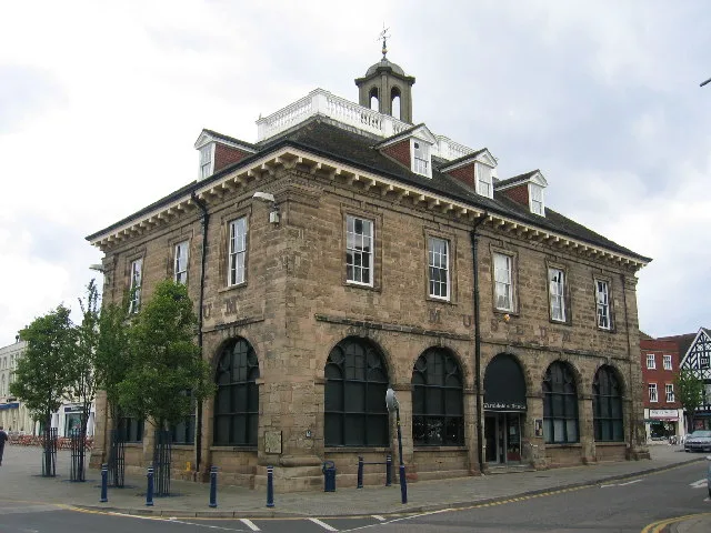
Market Hall Museum
Museums · 1.0 km

Market Hall Warwickshire Museum
Museums · 1.0 km

The Tilted Wig
Historic pubs · 1.0 km

Lobster
Cafés · 1.0 km
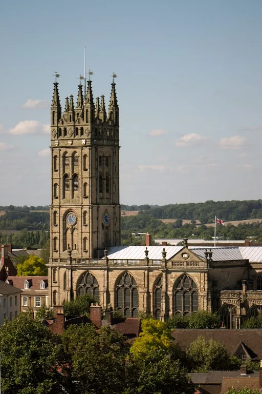
Collegiate Church of St Mary, Warwick
Historic churches · 1.1 km
Nearby
📷 3Historic houses · West Midlands
The Marble House
The Marble House — house in Warwick, Warwick, England, UK.
📷 7Restaurants · West Midlands
The Globe
The Globe — a restaurant in england west midlands.
📷 3Gardens · West Midlands
Hill Close Gardens
Hill Close Gardens — a garden in West Midlands, United Kingdom.
📷 3Public art & sculpture · West Midlands
The Herons and Fishes
The Herons and Fishes — a public art in West Midlands, United Kingdom.
📷 3Public art & sculpture · West Midlands
Randolph Adolphus Turpin 1928-1966
Randolph Adolphus Turpin 1928-1966 — a public art in West Midlands, United Kingdom.
📷 5Caravan parks · West Midlands
Warwick Racecourse Caravan Club Site
Warwick Racecourse Caravan Club Site — a caravan park in england west midlands.
Where to eat & stay near Saltisford Canal Arm
Places to stay
📷 5Caravan parks · West Midlands
Warwick Racecourse Caravan Club Site
Warwick Racecourse Caravan Club Site — a caravan park in england west midlands.
 📷 5
📷 5Hotels · West Midlands
Warwick Arms Hotel
Warwick Arms Hotel — a hotel in england west midlands.
 📷 6
📷 6Hotels · West Midlands
The Regent Hotel
The Regent Hotel — a hotel in england west midlands.
 📷 7
📷 7 📷 5
📷 5Campsites · West Midlands
Hatton Scout Campsite
Hatton Scout Campsite — a campsite in england west midlands.
 📷 7
📷 7Hotels · West Midlands
The Angel Hotel
The Angel Hotel — a hotel in england west midlands.
Places to eat & drink
📷 7Restaurants · West Midlands
The Globe
The Globe — a restaurant in england west midlands.
📷 3Historic pubs · West Midlands
The Thomas Lloyd
The Thomas Lloyd — Historic pub — listed building or notable heritage status.
📷 3Historic pubs · West Midlands
The Tilted Wig
The Tilted Wig — Historic pub — listed building or notable heritage status.
📷 6 📷 5
📷 5Restaurants · West Midlands
PizzaExpress
PizzaExpress — a restaurant in england west midlands. Cuisine: pizza. Brand: PizzaExpress.
 📷 5
📷 5Restaurants · West Midlands
Warwick Spice
Warwick Spice — a restaurant in england west midlands.
More places in this region
 📷 5
📷 5 📷 3
📷 3 📷 4
📷 4 📷 3
📷 3Frequently asked questions
- Where is Saltisford Canal Arm?
- Saltisford Canal Arm is in Warwickshire, the West Midlands, United Kingdom (postcode CV34 5RJ), in the parish of Warwick.
- What is Saltisford Canal Arm?
- Saltisford Canal Arm — canal in Warwick, UK.
- How do I get to Saltisford Canal Arm?
- The nearest railway station is Warwick Parkway, about 0.8 km away. The nearest town is Ashow. Drivers can use postcode CV34 5RJ.
- Is Saltisford Canal Arm free to visit?
- Yes, Saltisford Canal Arm is free to enter.
- How do I get to Saltisford Canal Arm?
- The nearest railway station is Warwick Parkway, about 0.8 km away. Drivers can navigate to postcode CV34 5RJ.