
Villages · South Wales
Saint Ishmael’s
In or near Johnston.
Saint Ishmael’s — a village in wales south.

Alan Hughes — CC BY-SA 2.0 via Wikimedia Commons licence
Plan your visit
- Typical visit
- 1 h–2 h
- Nearest railway station
- Milford Haven · 6.7 km
About
A British village — settlements of this size traditionally cluster a green, parish church, pub and post office around historic land routes.
Photo gallery
Place summary
Saint Ishmael’s is a village located in South Wales, within the parish of St. Ishmael's. This small community is characterised by its rural setting and local Welsh culture. The postcode for the area is SA62.
AI-generated from the structured facts on this page (operator, designation, listing, era). Not a substitute for visiting.
- Coordinates
- 51.7236, -5.1383
- District
- Pembrokeshire
- Parish
- St. Ishmael's
- Postcode
- SA62 3ST
- Parliamentary constituency
- Mid and South Pembrokeshire
- Nearest railway station
- Milford Haven — 6.7 km
Sources
- manual: geonames-2638781 (CC BY 4.0)
Other places nearby
St Ishmaels Tump
Literary houses · 0.2 km

Lindsway Bay
Natural landmarks · 1.3 km

Sandyhaven Tower
Literary houses · 1.7 km
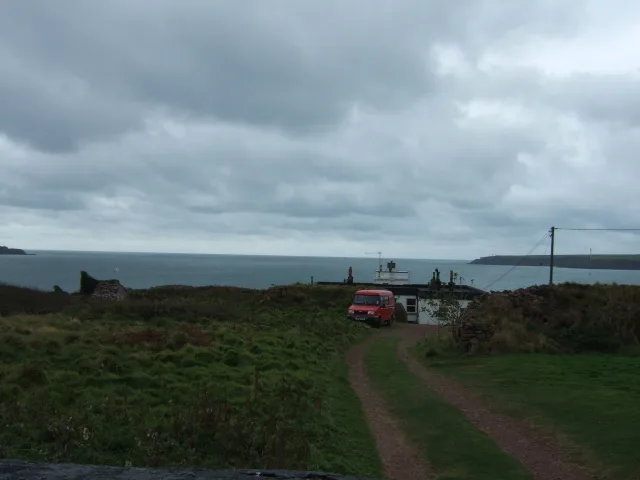
Great Castle Head Light
Lighthouses · 2.0 km

Great Castle Head
Vineyards · 2.0 km
Longoar Bay
Natural landmarks · 2.1 km
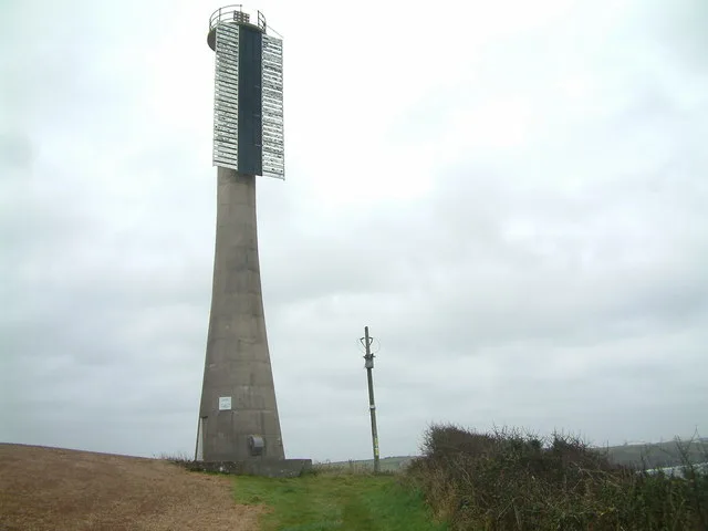
Little Castle Head Light
Lighthouses · 2.1 km

Butts Bay
Natural landmarks · 2.1 km

Mullock Bridge
Historic bridges · 2.3 km
Little Castle Head, St Ishmael's
Vineyards · 2.3 km
Sleeping Bay
Natural landmarks · 2.4 km

Sandy Haven Campsite
Campsites · 2.4 km
Nearby
📷 4Literary houses · South Wales
St Ishmaels Tump
St Ishmaels Tump — a literary house museum in wales south.
📷 5📷 5Literary houses · South Wales
Sandyhaven Tower
Sandyhaven Tower — a literary house museum in wales south.
📷 3Lighthouses · South Wales
Great Castle Head Light
Great Castle Head Light — lighthouse, Grade II listed building in Pembrokeshire, Wales; situated on cliff-top at Great Castle Head some 1.5 km SSW of Sandy Haven, reached by long drive from Sandy Haven- St Ishmaels road.
📷 5Vineyards · South Wales
Great Castle Head
Great Castle Head — a UK vineyard in wales south, producing English or Welsh wine from cool-climate grape varieties.
📷 5Where to eat & stay near Saint Ishmael’s
Places to stay
📷 5 📷 5
📷 5 📷 5
📷 5 📷 5
📷 5Caravan parks · South Wales
Hasguard Cross Caravan Park
Hasguard Cross Caravan Park — a caravan park in wales south.
 📷 5📷 5
Campsites · South Wales
Redlands Touring Caravan & Camping Park
Redlands Touring Caravan & Camping Park — a campsite in wales south.
Places to eat & drink
 📷 5
📷 5
 📷 7
📷 7More places in this region


Frequently asked questions
- Where is Saint Ishmael’s?
- Saint Ishmael’s is in South Wales, United Kingdom (postcode SA62 3ST), in the parish of St. Ishmael's.
- What is Saint Ishmael’s?
- Saint Ishmael’s — a village in wales south.
- How do I get to Saint Ishmael’s?
- The nearest railway station is Milford Haven, about 6.7 km away. Drivers can use postcode SA62 3ST.
- How do I get to Saint Ishmael’s?
- The nearest railway station is Milford Haven, about 6.7 km away. Drivers can navigate to postcode SA62 3ST.