
Cemeteries · North West England
Rudheath Cemetery
In or near Lach Dennis.
Rudheath Cemetery is a cemetery in the United Kingdom.

Dr Duncan Pepper — CC BY-SA 2.0 via Wikimedia Commons licence

Plan your visit
- Typical visit
- 30 min–1 h
- Nearest railway station
- Northwich · 1.8 km
- Free entry
- Dog-friendly
Getting there & planning your visit
To visit Rudheath Cemetery, the nearest railway station is Northwich, located 1.8 km away. The postcode for sat-nav is CW9 7NY, and entry is free.
About
Rudheath Cemetery is a named cemetery in the United Kingdom. Coordinates: 53.2458°, -2.4930°. This entry is part of The Great Britain Guide, a free, ad-free, open-data tourist directory.
Photo gallery
From the Wikipedia article
Rudheath is a village and civil parish in the unitary authority of Cheshire West and Chester and the ceremonial county of Cheshire, in the north west of England, approximately 2 miles east of Northwich. The civil parish also includes the area of Broken Cross. The population of the civil parish as taken at the 2011 census was 3,807. Rudheath has a parish council, the lowest level of local government. Rudheath is the location of Rudheath Primary Academy, and the Rudheath Senior Academy. Both schools provide education to school-age children from the village and the surrounding area. Contemporary major local employers include Frank Roberts & Sons, a bakery that has been associated with the area since 1887. Two of Frank Roberts & Sons's three main business divisions, Roberts Bakery and The Little Treats Co, are based on the A556 in Rudheath and Aldred's The Bakers, is located in Ilkeston, Derbyshire. Morrisons supermarket has a large distribution centre on the A530, while Orange, Barclays Bank and The Hut Group all have business centres at Gadbrook Park, off the A556. Broken Cross was named for a wayside cross which formerly stood at the junction of King Street and Penny's Lane, and was probably broken by the 17th century. A farm and the Old Broken Cross public house were named for the former cross.
Excerpt from Wikipedia under CC BY-SA 4.0. See the source article linked in Sources below.
- Coordinates
- 53.2458, -2.4930
- District
- Cheshire West and Chester
- Parish
- Rudheath
- Postcode
- CW9 7NY
- Parliamentary constituency
- Mid Cheshire
- Nearest railway station
- Northwich — 1.8 km
Sources
Other places nearby

Shipbrook Bridge
Historic bridges · 1.1 km
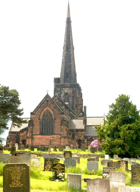
St Wilfrid's Church, Davenham
Historic churches · 1.3 km

The Rudheath Senior Academy
Natural landmarks · 1.3 km

Players Theatre
Theatres · 1.4 km

Davenham
Castles · 1.6 km

River Dane
Historic churches · 1.6 km

Weaver Hall Museum and Workhouse
Museums · 1.6 km

Witton Cemetery
Cemeteries · 1.7 km
Davenham War Memorial
Memorials & monuments · 1.7 km

Weaver Viaduct
Historic bridges · 1.7 km
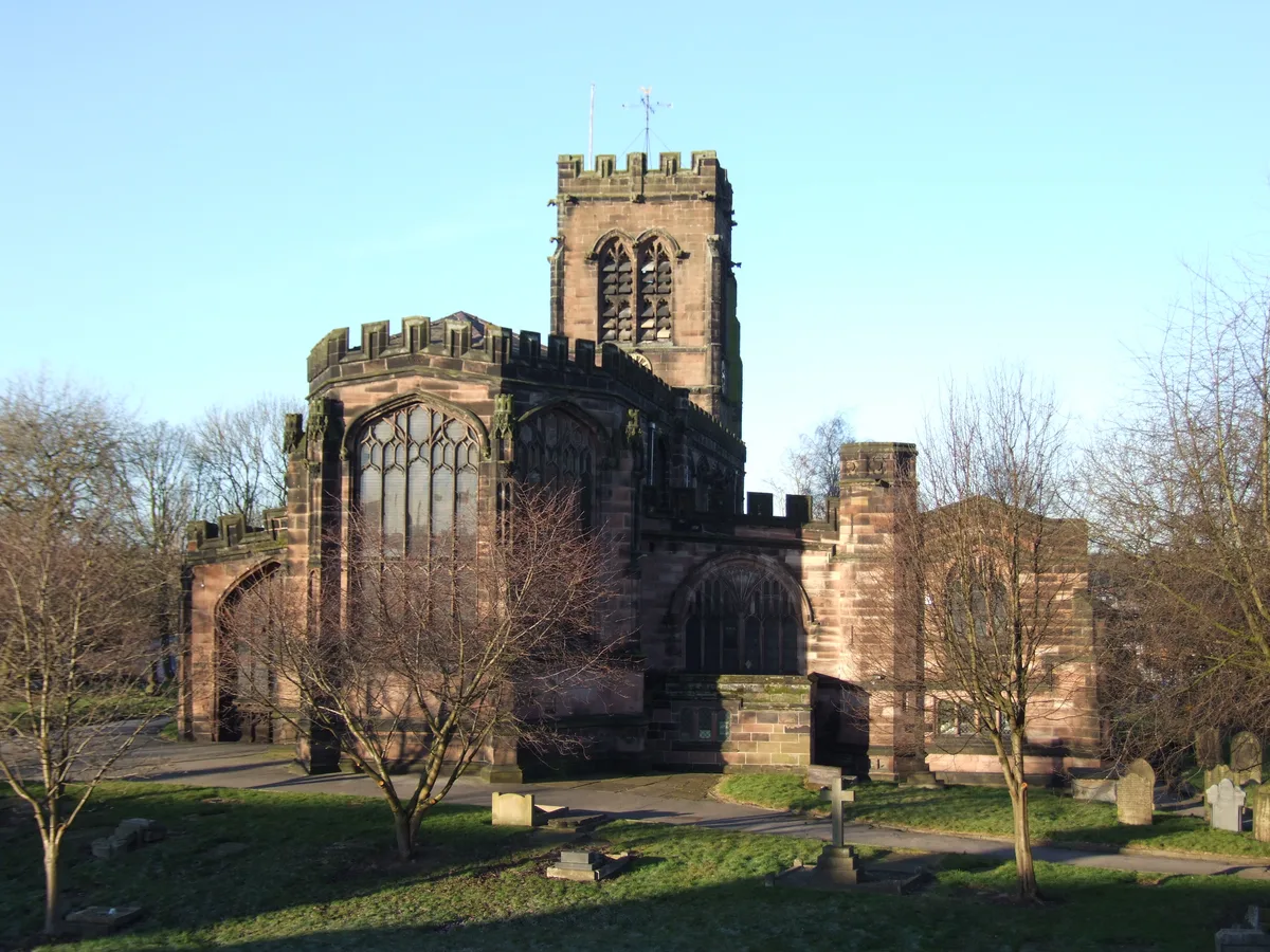
St Helen Witton Church, Northwich
Historic churches · 1.8 km

Harlequin Theatre, Northwich
Open-air theatres · 1.9 km
Nearby
📷 3Historic bridges · North West England
Shipbrook Bridge
Shipbrook Bridge — Grade II listed building-listed bridge in england-west-midlands, United Kingdom.
📷 5Historic churches · North West England
St Wilfrid's Church, Davenham
St Wilfrid's Church, Davenham — church in Davenham, Cheshire, England, UK.
📷 5Natural landmarks · North West England
The Rudheath Senior Academy
The Rudheath Senior Academy — a school heritage in england-west-midlands, United Kingdom.
📷 3📷 5Castles · North West England
Davenham
Davenham (; DAY-və-nəm) is a village in Cheshire, England. It is part of the Borough of Cheshire West and Chester. It had a population of 2,745 at the 2011 census. It is in the centre of the Cheshire
📷 5Historic churches · North West England
River Dane
River Dane — a church in england-west-midlands, United Kingdom.
Where to eat & stay near Rudheath Cemetery
Places to stay
 📷 5
📷 5 📷 5
📷 5Caravan parks · North West England
Vale Royal River Park
Vale Royal River Park — a caravan park in england west midlands.
 📷 5
📷 5Campsites · North West England
Yatehouse Farm Camping & Caravan Park
Yatehouse Farm Camping & Caravan Park — a campsite in england west midlands.
 📷 5
📷 5Caravan parks · North West England
Pickmere Lake Caravan Park
Pickmere Lake Caravan Park — a caravan park in england west midlands.
 📷 5
📷 5Caravan parks · North West England
Lamb Cottage Caravan Park
Lamb Cottage Caravan Park — a caravan park in england west midlands.
 📷 5
📷 5Caravan parks · North West England
Woodlands Park
Woodlands Park — a caravan park in england west midlands.
Places to eat & drink
 📷 5
📷 5Historic pubs · North West England
George and Dragon, Great Budworth
George and Dragon, Great Budworth in England North West, United Kingdom.
 📷 5
📷 5Historic pubs · North West England
Swettenham Arms
Swettenham Arms in England North West, United Kingdom.
 📷 5
📷 5Historic pubs · North West England
Old Hall Hotel, Sandbach
Old Hall Hotel, Sandbach in England North West, United Kingdom.
 📷 5
📷 5Historic pubs · North West England
The Commercial Hotel
The Commercial Hotel in England North West, United Kingdom.
 📷 5
📷 5 📷 3
📷 3Historic pubs · North West England
Tricorn
Tricorn — Historic pub — listed building or notable heritage status.
More cemeteries in this region
 📷 5
📷 5Cemeteries · North West England
Brooklands Cemetery
Brooklands Cemetery is a cemetery in the United Kingdom.
 📷 4
📷 4Cemeteries · North West England
Congleton Cemetery
Congleton Cemetery is a cemetery in the United Kingdom.
 📷 5
📷 5Cemeteries · North West England
Coppenhall Cemetery
Coppenhall Cemetery is a cemetery in the United Kingdom.
 📷 3
📷 3Cemeteries · North West England
Former site of St. Saviour's Church
Former site of St. Saviour's Church is a cemetery in the United Kingdom.
Frequently asked questions
- Where is Rudheath Cemetery?
- Rudheath Cemetery is in the West Midlands, United Kingdom (postcode CW9 7NY), in the parish of Rudheath.
- What is Rudheath Cemetery?
- Rudheath Cemetery is a cemetery in the United Kingdom.
- How do I get to Rudheath Cemetery?
- The nearest railway station is Northwich, about 1.8 km away. Drivers can use postcode CW9 7NY.
- Is Rudheath Cemetery free to visit?
- Yes, Rudheath Cemetery is free to enter.
- How do I get to Rudheath Cemetery?
- The nearest railway station is Northwich, about 1.8 km away. Drivers can navigate to postcode CW9 7NY.