Mountains & hills · Scottish Highlands
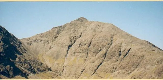
Ruadh Stac
Ruadh Stac — a hill or mountain in scotland highlands.

thejackrustles — CC BY-SA 2.0 via Wikimedia Commons licence
Plan your visit
- Typical visit
- 3 h–8 h
- Best time of year
- Late spring – early autumn (May–Oct)
About
A British hill or mountain, named on Ordnance Survey maps and walked by hill-baggers. Ruadh Stac is a named hill or mountain in scotland highlands, recorded in the GeoNames UK gazetteer. British landmarks of this type are typically marked on Ordnance Survey maps and recorded in the national gazetteer for cartographic and navigational reference. Coordinates and feature classification are sourced from the GeoNames open dataset.
Photo gallery
Place summary
Ruadh Stac is a mountain located in the Scottish Highlands. It is notable for its rugged terrain and dramatic landscapes, characteristic of the region. The mountain offers various walking trails, attracting hikers and outdoor enthusiasts. Visitors can expect a challenging yet rewarding experience, surrounded by the natural beauty of the Highlands.
AI-generated from the structured facts on this page (operator, designation, listing, era). Not a substitute for visiting.
- Coordinates
- 57.2325, -6.1195
Sources
- manual: geonames-12607872 (CC BY 4.0)
Other places nearby
Loading nearby places…
Nearby
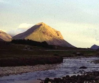
📷 5Mountains & hills · Scottish Highlands
Ruadh Stac
Ruadh Stac — mountain in scotland highlands. Elevation: 493 m.
 📷 5
📷 5Mountains & hills · Scottish Highlands
Druim Eadar Da Choire
Druim Eadar Da Choire — a hill or mountain in scotland highlands.
 📷 3
📷 3Mountains & hills · Scottish Highlands
Garbh-bheinn
Garbh-bheinn — Named summit at 808 m.
 📷 5
📷 5Mountains & hills · Scottish Highlands
Marsco
Marsco — Named summit at 736 m.
 📷 5
📷 5Natural landmarks · Scottish Highlands
Marsco
Marsco — mountain on the Isle of Skye, in Highland, Scotland, UK.
 📷 5
📷 5Mountains & hills · Scottish Highlands
Blabheinn
Blabheinn — a hill or mountain in scotland highlands.
Where to eat & stay near Ruadh Stac
Places to stay
 📷 5
📷 5Hostels · Scottish Highlands
Sligachan Bunkhouse
Sligachan Bunkhouse — a hostel in scotland highlands.
 📷 5
📷 5Campsites · Scottish Highlands
Sligachan Campsite
Sligachan Campsite — a campsite in scotland highlands.
 📷 5
📷 5Hostels · Scottish Highlands
Glenbrittle Youth Hostel
Glenbrittle Youth Hostel — a hostel in scotland highlands. Brand: Hostelling Scotland.
 📷 5
📷 5Campsites · Scottish Highlands
Glenbrittle Campsite
Glenbrittle Campsite — a campsite in scotland highlands.
 📷 5
📷 5Campsites · Scottish Highlands
Camping Skye
Camping Skye — a campsite in scotland highlands.
 📷 5
📷 5Hostels · Scottish Highlands
Broadford Backpackers Hostel
Broadford Backpackers Hostel — a hostel in scotland highlands.
More mountains in this region
 📷 3
📷 3Mountains & hills · Scottish Highlands
A' Bhuidheanach Bheag
A' Bhuidheanach Bheag — Named summit at 936 m.
 📷 3
📷 3Mountains & hills · Scottish Highlands
A' Chailleach
A' Chailleach — Named summit at 997 m.
 📷 3
📷 3Mountains & hills · Scottish Highlands
A' Chailleach
A' Chailleach — Named summit at 930 m.
 📷 3
📷 3Mountains & hills · Scottish Highlands
A' Chaoirnich
A' Chaoirnich — Named summit at 875 m.
Frequently asked questions
- Where is Ruadh Stac?
- Ruadh Stac is in the Scottish Highlands, United Kingdom.
- What is Ruadh Stac?
- Ruadh Stac — a hill or mountain in scotland highlands.
- How do I get to Ruadh Stac?
- Its coordinates are 57.2325°, -6.1195°.