
Archaeological sites · South West England
Round 200m north west of Penventinnie
In or near Truro.
Round 200m north west of Penventinnie — archaeological site in Kenwyn, Truro, England, UK.

Wikimedia Commons contributors — see linked file page for photographer and licence licence

Plan your visit
- Typical visit
- 45 min–1.5 h
- Nearest railway station
- Truro · 2.6 km
- Free entry
- Dog-friendly
About
Round 200m north west of Penventinnie is a place of interest in South-West England. Officially recognised as scheduled monument. The site is within the Cornwall National Landscape (AONB), and is a designated Site of Special Scientific Interest. The nearest railway station is Truro, about 2.6 km away.
Photo gallery
Protected designations
- Site of Special Scientific Interest: Carrick Heaths SSSI
- Area of Outstanding Natural Beauty: Cornwall
Designations sourced from Natural England open data under OGL v3.
Place summary
Round 200m north west of Penventinnie in South-West England, this archaeological site is designated as a scheduled monument. It is located within the Carrick Heaths Site of Special Scientific Interest and the Cornwall Area of Outstanding Natural Beauty.
AI-generated from the structured facts on this page (operator, designation, listing, era). Not a substitute for visiting.
- Coordinates
- 50.2730, -5.0976
- District
- Cornwall
- Parish
- Kenwyn
- Postcode
- TR4 9EG
- Parliamentary constituency
- Truro and Falmouth
- Nearest railway station
- Truro — 2.6 km
Sources
- wikidata: Q17677511 (CC0)
- commons: Penventinnie Round - geograph.org.uk - 2794883.jpg (CC BY-SA 4.0)
Other places nearby

Penventinnie Round
Archaeological sites · 0.0 km

Bosvisack Round
Archaeological sites · 1.1 km

Bosvisack Round
Archaeological sites · 1.1 km

Threemilestone
Historic churches · 1.6 km

Summer Valley Tour. Park
Campsites · 2.1 km

Shortlanesend and Allet
Historic churches · 2.2 km

Bosvigo gardens
Gardens · 2.3 km

Kenwyn
Historic churches · 2.3 km

Truro Caravan and Camping Park
Caravan parks · 2.3 km

Kenwyn War Memorial
Memorials & monuments · 2.4 km
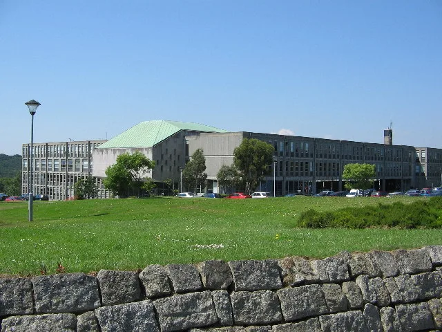
New County Hall
Galleries · 2.5 km
Church of St Keyne
Historic churches · 2.6 km
Nearby
📷 3Archaeological sites · South West England
Penventinnie Round
Penventinnie Round — a archaeological in england-south-west, United Kingdom.
📷 2Archaeological sites · South West England
Bosvisack Round
Bosvisack Round — a archaeological in england-south-west, United Kingdom.
📷 5Archaeological sites · South West England
Bosvisack Round
Bosvisack Round — archaeological in england south west.
📷 5Historic churches · South West England
Threemilestone
Threemilestone — a church in england-south-west, United Kingdom.
📷 4Campsites · South West England
Summer Valley Tour. Park
Summer Valley Tour. Park — a campsite in england south west.
📷 5Historic churches · South West England
Shortlanesend and Allet
Shortlanesend (Cornish: Penn an Vownder, meaning end of the lane) is a village in Kenwyn parish, Cornwall, England, United Kingdom. It lies two miles north of the city of Truro at grid reference SW 80
Where to eat & stay near Round 200m north west of Penventinnie
Places to stay
📷 4Campsites · South West England
Summer Valley Tour. Park
Summer Valley Tour. Park — a campsite in england south west.
📷 5Caravan parks · South West England
Truro Caravan and Camping Park
Truro Caravan and Camping Park — a caravan park in england south west.
 📷 5
📷 5Campsites · South West England
Tomperrow Scout Campsite
Tomperrow Scout Campsite — a campsite in england south west.
 📷 5
📷 5Caravan parks · South West England
Fernleigh Barn Caravan Site
Fernleigh Barn Caravan Site — a caravan park in england south west.
 📷 6
📷 6Hotels · South West England
Alverton Manor Hotel
Alverton Manor Hotel — a hotel in england south west.
 📷 5
📷 5Caravan parks · South West England
Kiliwerris Touring Park
Kiliwerris Touring Park — a caravan park in england south west.
Places to eat & drink
 📷 5
📷 5Historic pubs · South West England
The Wig And Pen Public House And Attached Forecourt Walls And Railings
The Wig And Pen Public House And Attached Forecourt Walls And Railings in England South West, United Kingdom.
 📷 7
📷 7Historic pubs · South West England
Daniell Arms Public House
Daniell Arms Public House in England South West, United Kingdom.
 📷 3
📷 3Historic pubs · South West England
Seven Stars
Seven Stars — Historic pub — listed building or notable heritage status.
 📷 5
📷 5Historic pubs · South West England
Kings Arms
Kings Arms — Historic pub — listed building or notable heritage status.
 📷 5
📷 5Historic pubs · South West England
The Famous Barrel Public House
The Famous Barrel Public House in England South West, United Kingdom.
 📷 5
📷 5Historic pubs · South West England
The Kimberley Public House
The Kimberley Public House in England South West, United Kingdom.
More archaeological sites in this region
 📷 5
📷 5Archaeological sites · South West England
Battlesbury Camp Monuments: hillfort, settlement, cemetery, barrows, enclosure, and field systems
Battlesbury Camp Monuments: hillfort, settlement, cemetery, barrows, enclosure, and field systems — archaeological site in Warminster, Wiltshire, England, UK.
 📷 2
📷 2Archaeological sites · South West England
Blandford Forest
Blandford Forest — forest in Blandford Forum, England.
 📷 5
📷 5Archaeological sites · South West England
Boulsbury Wood
Boulsbury Wood — protected area in Dorset and Hampshire, England.
.jpg?width=1200) 📷 5
📷 5Archaeological sites · South West England
Cranborne Chase
Cranborne Chase — Plateau in southern England.
Frequently asked questions
- Where is Round 200m north west of Penventinnie?
- Round 200m north west of Penventinnie is in South-West England, United Kingdom (postcode TR4 9EG), in the parish of Kenwyn.
- What is Round 200m north west of Penventinnie?
- Round 200m north west of Penventinnie — archaeological site in Kenwyn, Truro, England, UK.
- How do I get to Round 200m north west of Penventinnie?
- The nearest railway station is Truro, about 2.6 km away. Drivers can use postcode TR4 9EG.
- Is Round 200m north west of Penventinnie a listed building?
- Round 200m north west of Penventinnie is officially recognised as scheduled monument listed.
- Is Round 200m north west of Penventinnie a protected site?
- Yes — Round 200m north west of Penventinnie is part of the Carrick Heaths SSSI Site of Special Scientific Interest and the Cornwall National Landscape (AONB).
- Is Round 200m north west of Penventinnie free to visit?
- Yes, Round 200m north west of Penventinnie is free to enter.
- How do I get to Round 200m north west of Penventinnie?
- The nearest railway station is Truro, about 2.6 km away. Drivers can navigate to postcode TR4 9EG.