Natural landmarks · Northern Ireland
Rostrevor
Also known as: Ros Treabhair
In or near Killowen.
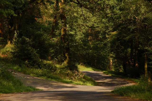
Rostrevor in Northern Ireland, United Kingdom.

Rossographer — CC BY-SA 2.0 via Wikimedia Commons licence
Plan your visit
- Typical visit
- 1 h–2 h
- Free entry
- Dog-friendly
About
Rostrevor is a place of interest in Northern Ireland, United Kingdom — drawn from open-data sources for visitor reference. See the linked Wikipedia article for the full description.
Photo gallery
360° viewimagery from 2024
Imagery © Mapillary contributors, CC BY-SA 4.0
From the Wikipedia article
Rostrevor (Irish: Ros Treabhair) is a village and townland in County Down, Northern Ireland. It lies at the foot of Slieve Martin on the coast of Carlingford Lough, near Warrenpoint. The Kilbroney River flows through the village and Rostrevor Forest is nearby. 7.5 miles (12 km) south-east of Newry, the village is within the Newry, Mourne and Down local government district. Rostrevor had a population of 2,800 in the 2011 Census.
Excerpt from Wikipedia under CC BY-SA 4.0. See the source article linked in Sources below.
- Coordinates
- 54.1000, -6.2000
- District
- Newry, Mourne and Down
- Postcode
- BT34 3EQ
- Parliamentary constituency
- South Down
Sources
Other places nearby

Tom Dunn Statue & Shared Space
Public art & sculpture · 0.2 km

Cloughmore
Natural landmarks · 0.6 km

Ross Monument
Memorials & monuments · 0.7 km

Kilbroney Park
Parks · 0.7 km

Kilbroney Youth Centre C.O.I
Hostels · 0.7 km

Kilbroney Caravan Park
Caravan parks · 0.9 km
Rostrevor Forest
Archaeological sites · 1.0 km

Touring in the Trees - Kilbroney
Caravan parks · 1.1 km

Kilbroney Standing Stone
Stone circles · 1.4 km

Rostrevor Forest - x-country MTB - Section20
Mountain bike trails · 1.5 km

Rostrevor Forest - x-country MTB - Section 4
Mountain bike trails · 1.8 km

Rostrevor Forest - x-country MTB - Section 5
Mountain bike trails · 1.8 km
Nearby
📷 3Public art & sculpture · Northern Ireland
Tom Dunn Statue & Shared Space
Tom Dunn Statue & Shared Space — a public art in northern-ireland, United Kingdom.
📷 5📷 3Memorials & monuments · Northern Ireland
Ross Monument
Ross Monument — a memorial in northern-ireland, United Kingdom.
📷 4📷 5Hostels · Northern Ireland
Kilbroney Youth Centre C.O.I
Kilbroney Youth Centre C.O.I — a hostel in northern ireland.
📷 5Caravan parks · Northern Ireland
Kilbroney Caravan Park
Kilbroney Caravan Park — a caravan park in northern ireland.
Where to eat & stay near Rostrevor
Places to stay
📷 5Hostels · Northern Ireland
Kilbroney Youth Centre C.O.I
Kilbroney Youth Centre C.O.I — a hostel in northern ireland.
📷 5Caravan parks · Northern Ireland
Kilbroney Caravan Park
Kilbroney Caravan Park — a caravan park in northern ireland.
📷 5Caravan parks · Northern Ireland
Touring in the Trees - Kilbroney
Touring in the Trees - Kilbroney — a caravan park in northern ireland.
 📷 5
📷 5 📷 5
📷 5Caravan parks · Northern Ireland
Loughside Holiday Park
Loughside Holiday Park — a caravan park in northern ireland.
📷 5Caravan parks · Northern Ireland
Cranfield Bay Holiday Village
Cranfield Bay Holiday Village — a caravan park in northern ireland.
More natural landmarks in this region
 Flagship📷 4
Natural landmarks · Northern Ireland
Lough Erne
Lough Erne — lake in County Fermanagh, Northern Ireland, UK.
 Flagship📷 4
Natural landmarks · Northern Ireland
Lough Neagh
Lough Neagh — large lake in Northern Ireland.
 📷 3
📷 3Natural landmarks · Northern Ireland
Ballysaggart Lough
Ballysaggart Lough — lake in the United Kingdom.
 📷 5
📷 5Natural landmarks · Northern Ireland
Belmore Mountain
Belmore Mountain — mountain in the United Kingdom.
Frequently asked questions
- Where is Rostrevor?
- Rostrevor is in Northern Ireland, United Kingdom (postcode BT34 3EQ).
- What is Rostrevor?
- Rostrevor in Northern Ireland, United Kingdom.
- How do I get to Rostrevor?
- Drivers can use postcode BT34 3EQ.
- Is Rostrevor free to visit?
- Yes, Rostrevor is free to enter.
- How do I get to Rostrevor?
- Drivers can navigate to postcode BT34 3EQ. It sits within the South Down parliamentary constituency.