
Other places · Scottish Highlands
Ross and Cromarty
Also known as: Ros agus Cromba
Ross and Cromarty in Scotland Islands, United Kingdom.

Hugh Venables — CC BY-SA 2.0 via Wikimedia Commons licence

Plan your visit
- Typical visit
- 1 h–2 h
- Nearest railway station
- Achanalt · 8.2 km
Getting there & planning your visit
To visit Ross and Cromarty in the Scottish Highlands, the nearest railway station is Achanalt, which is 8.2 km away. There are no details provided regarding entry fees or accessibility.
About
Ross and Cromarty is a place of interest in Scotland Islands, United Kingdom — drawn from open-data sources for visitor reference. See the linked Wikipedia article for the full description.
Photo gallery
From the Wikipedia article
Ross and Cromarty (Scottish Gaelic: Ros agus Cromba) is an area in the Highlands and Islands of Scotland. In modern usage, it is a registration county and a lieutenancy area. Between 1889 and 1975 it was a county. Historically, Ross-shire and Cromartyshire were separate counties, with Cromartyshire comprising a number of disconnected tracts of land scattered across Ross-shire. The two counties shared a sheriff from 1748, and were both included in the Ross and Cromarty constituency from 1832. They were formally united into a single county called Ross and Cromarty in 1889. The mainland part of the county had a coast to the east onto the Moray Firth, and a coast to the west onto the Minch. Much of the mainland is sparsely populated, including parts of the Northwest Highlands mountains. The mainland's principal towns are all on the east coast, including Dingwall (the county town), Alness, Cromarty, Fortrose, Invergordon and Tain. The largest settlement on the west coast was the village of Ullapool. The county also covered parts of the Outer Hebrides, principally the Isle of Lewis, including the town of Stornoway. The neighbouring counties were Sutherland to the north and Inverness-shire to the south. The county ceased to be used for local government purposes in 1975. Since then, the mainland has been part of the Highland region, which became a single-tier council area in 1996. The Outer Hebrides parts of the county became part of the Western Isles, which since 1998 has used only the Scots Gaelic version of its name, Na h-Eileanan an Iar. The pre-1975 county boundaries are still used for certain functions, being a registration county. There was a local government district called Ross and Cromarty from 1975 to 1996, which was a lower-tier district within the Highland region, covering most but not all of the mainland part of the pre-1975 county. The Ross and Cromarty lieutenancy area, which prior to 1975 had been the county, was redefined in 1975 to be the Ross and…
Excerpt from Wikipedia under CC BY-SA 4.0. See the source article linked in Sources below.
- Coordinates
- 57.6667, -5.0000
- Nearest railway station
- Achanalt — 8.2 km
Sources
- wikidata: Q1586842 (CC0)
- wikipedia: Ross and Cromarty (CC BY-SA 4.0)
Other places nearby
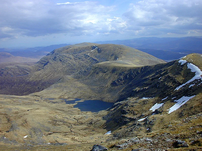
Meall Gorm
Mountains & hills · 1.8 km

Fannich Forest
Battlefields & battle sites · 1.9 km

Meall Gorm SE Top
Mountains & hills · 2.3 km

Meall Gorm SE top
Mountains & hills · 2.3 km

Loch Fannich
Reservoirs & lochs · 2.8 km

Meall nam Peithirean
Mountains & hills · 2.9 km

Sgùrr a' Chadha Dheirg
Mountains & hills · 2.9 km

Sgurr a' Chadha Dheirg
Mountains & hills · 2.9 km

Loch Li
Lakes · 3.0 km
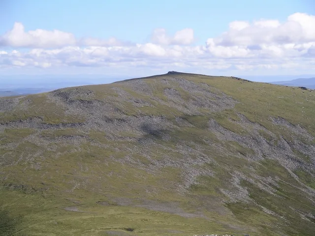
An Coileachan
Mountains & hills · 3.0 km

Meallan na Saobhaidhe
Mountains & hills · 3.0 km

Loch Gorm
Lakes · 3.1 km
Nearby
📷 3📷 5Battlefields & battle sites · Scottish Highlands
Fannich Forest
Fannich Forest in Scotland Highlands, United Kingdom.
📷 3Mountains & hills · Scottish Highlands
Meall Gorm SE Top
Meall Gorm SE Top — a mountain in scotland-highlands, United Kingdom.
📷 5Mountains & hills · Scottish Highlands
Meall Gorm SE top
Meall Gorm SE top — mountain in scotland highlands. Elevation: 922 m.
📷 5Reservoirs & lochs · Scottish Highlands
Loch Fannich
Loch Fannich — lake in Highland, Scotland, UK, outflows east to River Grudie.
📷 3Mountains & hills · Scottish Highlands
Meall nam Peithirean
Meall nam Peithirean — a mountain in scotland-highlands, United Kingdom, 974 m.
Where to eat & stay near Ross and Cromarty
Places to stay
 📷 5
📷 5Caravan parks · Scottish Highlands
Ledgowan Lodge Campsite
Ledgowan Lodge Campsite — a caravan park in scotland highlands.
 📷 5
📷 5Hostels · Scottish Highlands
Forest Way Bunkhouse
Forest Way Bunkhouse — a hostel in scotland highlands.
 📷 5
📷 5Hostels · Scottish Highlands
Kinlochewe Bunkhouse
Kinlochewe Bunkhouse — a hostel in scotland highlands.
 📷 5
📷 5Caravan parks · Scottish Highlands
Kinlochewe Caravan Club Site
Kinlochewe Caravan Club Site — a caravan park in scotland highlands.
 📷 5
📷 5Campsites · Scottish Highlands
Beinn Eighe Campsite
Beinn Eighe Campsite — a campsite in scotland highlands.
More places in this region
 📷 3
📷 3Other places · Scottish Highlands
The Eternal Present: Gneiss Granite Gabbro
The Eternal Present: Gneiss Granite Gabbro — Public artwork (sculpture) by Janet McEwan.
 📷 3
📷 3Other places · Scottish Highlands
The Gordon Highlanders
The Gordon Highlanders — Public artwork (statue) by Mark Richards.
 📷 4
📷 4Other places · Scottish Highlands
Central Library, Aberdeen
The Central Library is the principal public library for the city of Aberdeen, Scotland. It opened in 1892 and is operated by Aberdeen City Council as part of the Aberdeen City Libraries network.
 📷 3
📷 3Other places · Scottish Highlands
Craigendarroch Resort
The Craigendarroch Resort in Ballater, Scotland, is a resort complex close to the banks of the River Dee. It is located on a hillside just west of the village of Ballater, 42 miles west of Aberdeen an
Frequently asked questions
- Where is Ross and Cromarty?
- Ross and Cromarty is in the Scottish Highlands, United Kingdom.
- What is Ross and Cromarty?
- Ross and Cromarty in Scotland Islands, United Kingdom.
- How do I get to Ross and Cromarty?
- The nearest railway station is Achanalt, about 8.2 km away. Its coordinates are 57.6667°, -5.0000°.