
Caravan parks · South West England
Rosefield
In or near Westport.
Rosefield — a caravan park in england south east.

Lachlan — CC BY-SA 2.0 via Wikimedia Commons licence

Plan your visit
- Typical visit
- 1 h–2 h
- Nearest railway station
- Chippenham · 8.8 km
About
Rosefield is a caravan park located in england south east. Caravan park listed with verified location and OSM metadata. Touring pitches, static availability and seasonal opening vary — confirm directly with the park.
Photo gallery
Protected designations
- Area of Outstanding Natural Beauty: Cotswolds
Designations sourced from Natural England open data under OGL v3.
Place summary
Rosefield is a caravan park located in South-East England. This site offers a range of facilities for visitors seeking outdoor accommodation. Guests can expect a natural setting with ample space for caravans and camping. The park provides a convenient base for exploring the surrounding region.
AI-generated from the structured facts on this page (operator, designation, listing, era). Not a substitute for visiting.
- Coordinates
- 51.5407, -2.1303
- District
- Wiltshire
- Parish
- Hullavington
- Postcode
- SN14 6BF
- Parliamentary constituency
- South Cotswolds
- Nearest railway station
- Chippenham — 8.8 km
Sources
- osm: w1341553812 (ODbL)
Other places nearby

Hullavington
Villages · 1.5 km

Two Unidentified Monuments In The Churchyard 3 Metres South Of Nave, Church Of St Mary
Memorials & monuments · 1.7 km

Corston and Rodbourne War Memorial Cross
Memorials & monuments · 2.1 km

The Radnor Arms
Historic pubs · 2.1 km

Corston
Villages · 2.2 km

Stanton St Quintin
Villages · 2.6 km

Clanville Fields CS
Caravan parks · 3.0 km

Norton Manor
Manor houses · 3.2 km

Foxley
Villages · 3.9 km

Upper Seagry
Villages · 3.9 km

Foxley Manor
Manor houses · 4.0 km
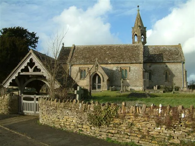
St Margaret of Antioch Church, Leigh Delamere
Historic churches · 4.1 km
Nearby
📷 5📷 5Memorials & monuments · South West England
Two Unidentified Monuments In The Churchyard 3 Metres South Of Nave, Church Of St Mary
Two Unidentified Monuments In The Churchyard 3 Metres South Of Nave, Church Of St Mary — Grade II listed building-listed memorial in england-south-east, United Kingdom.
📷 5Memorials & monuments · South West England
Corston and Rodbourne War Memorial Cross
Corston and Rodbourne War Memorial Cross — Grade II listed building-listed memorial in england-south-east, United Kingdom.
📷 5Historic pubs · South West England
The Radnor Arms
The Radnor Arms in England South West, United Kingdom.
📷 5📷 5Villages · South West England
Stanton St Quintin
Stanton St Quintin — a village in england south east.
Where to eat & stay near Rosefield
Places to stay
📷 5Caravan parks · South West England
Clanville Fields CS
Clanville Fields CS — a caravan park in england south east.
 📷 5
Campsites · South West England
Burton Hill Caravan Park
Burton Hill Caravan Park — a campsite in england south east.
 📷 5
Hotels · South West England
Whatley Manor
Whatley Manor — a hotel in england south east.
 📷 5
Hotels · South West England
The Kings Arms Hotel
The Kings Arms Hotel — a hotel in england south east.
 📷 7
Hotels · South West England
Bell House Hotel
Bell House Hotel — a hotel in england south east.
 📷 5
Caravan parks · South West England
Southfield Farm Caravan Site
Southfield Farm Caravan Site — a caravan park in england south east.
Places to eat & drink
📷 5Historic pubs · South West England
The Radnor Arms
The Radnor Arms in England South West, United Kingdom.
 📷 5
Historic pubs · South West England
The Three Cups Public House
The Three Cups Public House in England South West, United Kingdom.
 📷 7
Historic pubs · South West England
The Neeld Arms
The Neeld Arms in England South West, United Kingdom.
 📷 5
Historic pubs · South West England
Old Road Tavern
Old Road Tavern in England South West, United Kingdom.
 📷 7
Historic pubs · South West England
Jolly Trooper Public House
Jolly Trooper Public House in England South West, United Kingdom.
 📷 5
Historic pubs · South West England
The Three Crowns Public House
The Three Crowns Public House in England South West, United Kingdom.
More places in this region
 📷 5📷 5
Caravan parks · South West England
Clanville Fields CS
Clanville Fields CS — a caravan park in england south east.
 📷 5
Caravan parks · South West England
Copse Farm Camping
Copse Farm Camping — a caravan park in england south east.
 📷 5
Caravan parks · South West England
Avon Valley Farm CAMC CL
Avon Valley Farm CAMC CL — a caravan park in england south east.
Frequently asked questions
- Where is Rosefield?
- Rosefield is in South-West England, United Kingdom (postcode SN14 6BF), in the parish of Hullavington.
- What is Rosefield?
- Rosefield — a caravan park in england south east.
- How do I get to Rosefield?
- The nearest railway station is Chippenham, about 8.8 km away. The nearest town is Westport. Drivers can use postcode SN14 6BF.
- Is Rosefield a protected site?
- Yes — Rosefield is part of the Cotswolds National Landscape (AONB).
- How do I get to Rosefield?
- Drivers can navigate to postcode SN14 6BF. It sits within the South Cotswolds parliamentary constituency.