
Manor houses · South East England
Rooting Manor
In or near Pluckley.
Rooting Manor — Grade II listed building-listed manor in england-south-east, United Kingdom.

David Anstiss — CC BY-SA 2.0 via Wikimedia Commons licence

Plan your visit
- Typical visit
- 1 h–2 h
- Nearest railway station
- Pluckley · 3.0 km
- Limited wheelchair access
Getting there & planning your visit
To visit Rooting Manor, the nearest railway station is Pluckley, located 3 km away. The postcode for sat-nav is TN27 0PY. Accessibility is limited for wheelchair users.
About
Rooting Manor is a Grade II listed building-listed manor in england-south-east, United Kingdom, registered on the National Heritage List for England (NHLE entry 1145824). Listed status protects buildings and structures of special architectural or historic interest. See the linked Wikipedia article for further details.
Photo gallery
Heritage listing
Details 1. 5272 LITTLE CHART ROOTING LANE Rooting Manor TQ 94 NW 10/33 14.2.67. II 2. An L-shaped timber-framed building dating from late C14, with ornamental timbering and plaster infilling exposed above the ground floor of the south window bay of the east front, but otherwise refronted with red brick in the C18. Stringcourse. Half-hipped gable end to the south containing an attic window. Half-hipped tiled roof. Three Dering windows. Gabled porch. The back wing is faced with stone rubble. Crown post roof inside. Listing NGR: TQ9455445085 Legacy The contents of this record have been generated from a legacy data system. Legacy System number: 181059 Legacy System: LBS
From the Historic England List Entry under OGL v3.
Protected designations
- Area of Outstanding Natural Beauty: High Weald
- Area of Outstanding Natural Beauty: Kent Downs
Designations sourced from Natural England open data under OGL v3.
Place summary
Rooting Manor is a Grade II listed building located in South-East England. It is notable for its architectural significance and historical importance within the region.
AI-generated from the structured facts on this page (operator, designation, listing, era). Not a substitute for visiting.
- Coordinates
- 51.1719, 0.7817
- County
- Kent
- District
- Ashford
- Parish
- Little Chart
- Postcode
- TN27 0PY
- Parliamentary constituency
- Weald of Kent
- Nearest railway station
- Pluckley — 3 km
- Official site
- heritage.kent.gov.uk
Sources
- wikidata: Q26438965 (CC0)
Other places nearby

Little Chart
Villages · 0.8 km
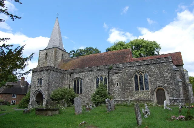
Pluckley
Towns & cities · 1.7 km

Church of St Nicholas, Pluckley
Historic churches · 1.9 km

St Mary's Church
Archaeological sites · 1.9 km

Church of St Margaret, Hothfield
Historic churches · 2.5 km

Hothfield
Villages · 2.5 km
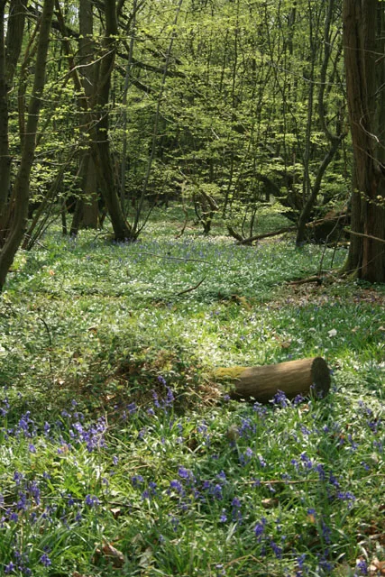
Hoad's Wood
Archaeological sites · 2.8 km

Holiday Inn Ashford - North
Hotels · 2.8 km

The Woolpack
Restaurants · 2.9 km

Pivington Manor
Manor houses · 3.1 km

Chapel At Newlands Stud Farm
Chapels · 3.3 km

Wickens Manor
Manor houses · 3.6 km
Nearby
📷 5Flagship📷 10📷 5Historic churches · South East England
Church of St Nicholas, Pluckley
Church of St Nicholas, Pluckley — Grade I listed building-listed church in england-south-east, United Kingdom.
📷 5Archaeological sites · South East England
St Mary's Church
St Mary's Church — archaeological in england south east.
📷 5Historic churches · South East England
Church of St Margaret, Hothfield
Church of St Margaret, Hothfield — Grade I listed building-listed church in england-south-east, United Kingdom.
📷 5Where to eat & stay near Rooting Manor
Places to stay
📷 5Hotels · South East England
Holiday Inn Ashford - North
Holiday Inn Ashford - North — a hotel in england south east.
 📷 5
📷 5Caravan parks · South East England
Kent Gliding Club Caravan Park
Kent Gliding Club Caravan Park — a caravan park in england south east.
 📷 5
📷 5Campsites · South East England
Dunn Street Farm Campsite
Dunn Street Farm Campsite — a campsite in england south east.
 📷 5
📷 5Hotels · South East England
Hampton by Hilton Ashford International
Hampton by Hilton Ashford International — a hotel in england south east. 3-star. Brand: Hampton.
 📷 5
📷 5Campsites · South East England
Chequertree Trout & Coarse Fishery
Chequertree Trout & Coarse Fishery — a campsite in england south east.
 📷 4
📷 4Hotels · South East England
Chilston Park
Chilston Park — a hotel in england south east.
Places to eat & drink
📷 7Restaurants · South East England
The Woolpack
The Woolpack — a restaurant in england south east. Cuisine: british. Brand: Beefeater.
 📷 6
📷 6Historic pubs · South East England
King's Head Public House
King's Head Public House in England South East, United Kingdom.
 📷 5
📷 5Historic pubs · South East England
The George Public House
The George Public House in England South East, United Kingdom.
 📷 5
📷 5Historic pubs · South East England
The William Harvey Public House
The William Harvey Public House in England South East, United Kingdom.
 📷 5
📷 5Historic pubs · South East England
The Blacksmith's Arms Public House
The Blacksmith's Arms Public House in England South East, United Kingdom.
 📷 5
📷 5Historic pubs · South East England
The Bonny Cravat Inn
The Bonny Cravat Inn in England South East, United Kingdom.
More places in this region
 📷 5
📷 5Manor houses · South East England
Albury Manor
Albury Manor — a manor in england-london, United Kingdom.
 📷 5
📷 5Manor houses · South East England
Weardale Manor
Weardale Manor — a manor in england-london, United Kingdom.
 📷 5
📷 5Manor houses · South East England
Rowbarns Manor
Rowbarns Manor — a manor in england-london, United Kingdom.
 📷 5
📷 5Manor houses · South East England
Sutton Place
Sutton Place — a manor in england-london, United Kingdom.
Frequently asked questions
- Where is Rooting Manor?
- Rooting Manor is in Kent, South-East England, United Kingdom (postcode TN27 0PY), in the parish of Little Chart.
- What is Rooting Manor?
- Rooting Manor — Grade II listed building-listed manor in england-south-east, United Kingdom.
- How do I get to Rooting Manor?
- The nearest railway station is Pluckley, about 3.0 km away. The nearest town is Pluckley. Drivers can use postcode TN27 0PY.
- Is Rooting Manor a listed building?
- Rooting Manor is officially recognised as Grade II listed building listed.
- Is Rooting Manor a protected site?
- Yes — Rooting Manor is part of the High Weald National Landscape (AONB) and the Kent Downs National Landscape (AONB).
- How do I get to Rooting Manor?
- The nearest railway station is Pluckley, about 3.0 km away. Drivers can navigate to postcode TN27 0PY.