Natural landmarks · Northern Ireland
Roogagh River
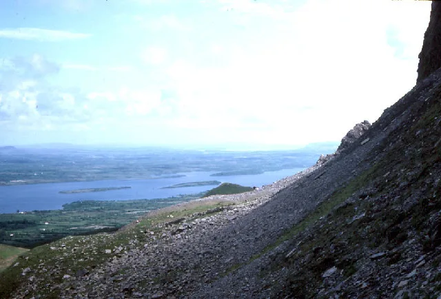
Roogagh River in Northern Ireland, United Kingdom.

Kenneth Allen — CC BY-SA 2.0 via Wikimedia Commons licence
Plan your visit
- Typical visit
- 1 h–2 h
- Free entry
- Dog-friendly
About
Roogagh River is a place of interest in Northern Ireland, United Kingdom — drawn from open-data sources for visitor reference. See the linked Wikipedia article for the full description.
Photo gallery
From the Wikipedia article
The Roogagh River is one of the main tributaries for Lough Melvin. It flows through Garrison, a small village in County Fermanagh, Northern Ireland, 5 miles south of Belleek, at the eastern end of Lough Melvin. The "Ground Bridge" on the Roogagh River at Tullybelcoo is a short active river cave. The passage is approximately 45m long and the Roogagh River flows through an outcrop of the Carboniferous Dartry Limestone. This is a unique karstic feature in Northern Ireland.
Excerpt from Wikipedia under CC BY-SA 4.0. See the source article linked in Sources below.
- Coordinates
- 54.4000, -8.0833
- District
- Fermanagh and Omagh
- Postcode
- BT93 4EL
- Parliamentary constituency
- Fermanagh and South Tyrone
Sources
- wikidata: Q7366162 (CC0)
- wikipedia: Roogagh River (CC BY-SA 4.0)
Other places nearby

Melvin Centre
Campsites · 1.7 km
Lough Melvin Holiday Centre
Hostels · 1.7 km

Garrison
Natural landmarks · 1.7 km

Garrison
Villages · 1.9 km

Scotts Irish Whisky
Distilleries · 1.9 km
Roogagh Waterfall
Waterfalls · 2.0 km

Cashelnadrea
Natural landmarks · 3.3 km

Scribbagh
Villages · 5.7 km

Gortnalee
Villages · 6.0 km
Lough Melvin
Natural landmarks · 6.5 km
Tullygerravra
Natural landmarks · 6.8 km

Lattone Lough
Lakes · 7.1 km
Nearby
📷 5📷 5Hostels · Northern Ireland
Lough Melvin Holiday Centre
Lough Melvin Holiday Centre — a hostel in northern ireland.
📷 4Natural landmarks · Northern Ireland
Garrison
Garrison in Northern Ireland, United Kingdom.
📷 5📷 3Distilleries · Northern Ireland
Scotts Irish Whisky
Scotts Irish Whisky — Whisky/spirit distillery.
📷 5Where to eat & stay near Roogagh River
Places to stay
📷 5📷 5Hostels · Northern Ireland
Lough Melvin Holiday Centre
Lough Melvin Holiday Centre — a hostel in northern ireland.
 📷 5
📷 5Caravan parks · Northern Ireland
Rushin House Caravan Park
Rushin House Caravan Park — a caravan park in northern ireland.
 📷 5
📷 5 📷 5
📷 5Caravan parks · Northern Ireland
Clareview Caravan Park
Clareview Caravan Park — a caravan park in northern ireland.
More natural landmarks in this region
 Flagship📷 4
Natural landmarks · Northern Ireland
Lough Erne
Lough Erne — lake in County Fermanagh, Northern Ireland, UK.
 Flagship📷 4
Natural landmarks · Northern Ireland
Lough Neagh
Lough Neagh — large lake in Northern Ireland.
 📷 3
📷 3Natural landmarks · Northern Ireland
Ballysaggart Lough
Ballysaggart Lough — lake in the United Kingdom.
 📷 5
📷 5Natural landmarks · Northern Ireland
Belmore Mountain
Belmore Mountain — mountain in the United Kingdom.
Frequently asked questions
- Where is Roogagh River?
- Roogagh River is in Northern Ireland, United Kingdom (postcode BT93 4EL).
- What is Roogagh River?
- Roogagh River in Northern Ireland, United Kingdom.
- How do I get to Roogagh River?
- Drivers can use postcode BT93 4EL.
- Is Roogagh River free to visit?
- Yes, Roogagh River is free to enter.
- How do I get to Roogagh River?
- Drivers can navigate to postcode BT93 4EL. It sits within the Fermanagh and South Tyrone parliamentary constituency.