
Historic bridges · East of England
Road Bridge Over The River Stour On The Great Yeldham Road Approximately 84 Yards South-East Of The Junction With Nethergate Street
In or near Poslingford.
Road Bridge Over The River Stour On The Great Yeldham Road Approximately 84 Yards South-East Of The Junction With Nethergate Street — Grade II listed building-listed bridge in england-east, United Kin

Glyn Baker — CC BY-SA 2.0 via Wikimedia Commons licence

Plan your visit
- Typical visit
- 15 min–30 min
- Nearest railway station
- Castle Hedingham · 8.7 km
- Free entry
- Dog-friendly
Getting there & planning your visit
The nearest railway station is Castle Hedingham, located 8.7 km away. Entry to the bridge is free, and the postcode for sat-nav is CO10 8NS.
About
Road Bridge Over The River Stour On The Great Yeldham Road Approximately 84 Yards South-East Of The Junction With Nethergate Street is a Grade II listed building-listed bridge in england-east, United Kingdom, registered on the National Heritage List for England (NHLE entry 1194234). Listed status protects buildings and structures of special architectural or historic interest. See the linked Wikipedia article for further details.
Photo gallery
See it from the streetimagery from 2025
Imagery © Mapillary contributors, CC BY-SA 4.0
Heritage listing
Details 1. CLARE Road bridge over the 2006 River Stour on the Great Yeldham Road approximately 84 yds south-east of the junction with Nethergate Street TL 74 SE 16/764 II 2. A small cast iron road bridge dated 1813 consisting of 3 elliptical arches, the centre one having the date cast at the crown. The soffits of the arches have cast iron ribs. The cast iron face of the bridge is ridged above the arches, with brick infilled to road level and a plain cast iron railing with oval handrail. This bridge was erected only 34 years after the 1st cast iron bridge to be built (Coalbrookdale 1779). Listing NGR: TL7677544896 Legacy The contents of this record have been generated from a legacy data system. Legacy System number: 282928 Legacy System: LBS
From the Historic England List Entry under OGL v3.
Place summary
The Road Bridge over the River Stour is located on the Great Yeldham Road, approximately 84 yards south-east of its junction with Nethergate Street in Suffolk. This bridge is designated as a Grade II listed building.
AI-generated from the structured facts on this page (operator, designation, listing, era). Not a substitute for visiting.
- Coordinates
- 52.0742, 0.5780
- County
- Suffolk
- District
- West Suffolk
- Parish
- Clare
- Postcode
- CO10 8NS
- Parliamentary constituency
- West Suffolk
- Nearest railway station
- Castle Hedingham — 8.7 km
Sources
- wikidata: Q26488864 (CC0)
Other places nearby
_(geograph_6756650).jpg?width=1200)
Verandah House
Historic houses · 0.1 km
_(geograph_6757446).jpg?width=1200)
Stour House
Historic houses · 0.1 km

Cliftons
Historic houses · 0.2 km
Clare Village Sign
Public art & sculpture · 0.2 km
_(geograph_6756721).jpg?width=1200)
Red House
Historic houses · 0.2 km

Chapel To Clare Priory
Chapels · 0.2 km

Nethergate Hotel
Historic houses · 0.3 km
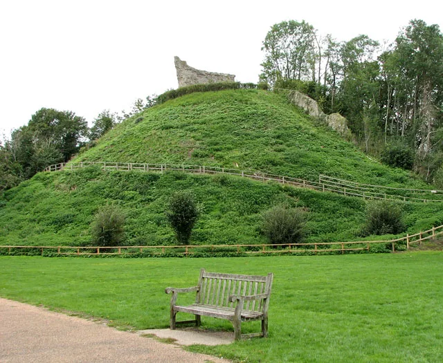
Clare Castle
Castles · 0.4 km

Telephone Kiosk
Galleries · 0.5 km

Clare War Memorial
Memorials & monuments · 0.5 km

Tuckermans
Cafés · 0.5 km

Clare Ancient House Museum
Museums · 0.5 km
Nearby
📷 3Historic houses · East of England
Verandah House
Verandah House — house in Clare, West Suffolk, England, UK.
📷 3Historic houses · East of England
Stour House
Stour House — house in Clare, West Suffolk, England, UK.
📷 3Historic houses · East of England
Cliftons
Cliftons — a Grade I-listed historic house in england-east, United Kingdom.
📷 3Public art & sculpture · East of England
Clare Village Sign
Clare Village Sign — a public art in england-east, United Kingdom.
📷 3Historic houses · East of England
Red House
Red House — house in Clare, West Suffolk, England, UK.
📷 3Chapels · East of England
Chapel To Clare Priory
Chapel To Clare Priory — Grade I listed chapel in Clare, West Suffolk, England, UK.
Where to eat & stay near Road Bridge Over The River Stour On The Great Yeldham Road Approximately 84 Yards South-East Of The Junction With Nethergate Street
Places to stay
 📷 7
📷 7 📷 7
📷 7Hotels · East of England
George and Dragon Hotel
George and Dragon Hotel — a hotel in england east.
 📷 7
📷 7B&Bs · East of England
The Crown Inn
The Crown Inn — a bed-and-breakfast in england east.
 📷 7
📷 7B&Bs · East of England
Bull Hotel
Bull Hotel — a bed-and-breakfast in england east.
 📷 7
📷 7
Campsites · East of England
Brighthouse Farm Caravan & Campsite
Brighthouse Farm Caravan & Campsite — a campsite in england east.
Places to eat & drink
📷 7 📷 5
📷 5Historic pubs · East of England
House Approximately 20 Yards North East Of Nos 5 And 6 (Hainault Cottage)
House Approximately 20 Yards North East Of Nos 5 And 6 (Hainault Cottage) in England East, United Kingdom.
 📷 7
📷 7Historic pubs · East of England
The Red Cow Public House
The Red Cow Public House in England East, United Kingdom.
 📷 7
📷 7Historic pubs · East of England
Railway Arms Public House
Railway Arms Public House in England East, United Kingdom.
 📷 6
📷 6Historic pubs · East of England
The Swan Public House
The Swan Public House in England East, United Kingdom.
 📷 7
📷 7Historic pubs · East of England
The Three Bottles Public House
The Three Bottles Public House in England East, United Kingdom.
More bridges in this region
.JPG?width=1200) 📷 5
📷 5Historic bridges · East of England
Albert Bridge
Albert Bridge is a historic bridge in the United Kingdom.
.jpg?width=1200) 📷 5
📷 5Historic bridges · East of England
Bedford Town Bridge
Bedford Town Bridge is a historic bridge in the United Kingdom.
 📷 5
📷 5Historic bridges · East of England
Bethnal Green and King's Lynn Line
Bethnal Green and King's Lynn Line is a historic bridge in the United Kingdom.
 📷 5
📷 5Historic bridges · East of England
Bethnal Green and King's Lynn Line
Bethnal Green and King's Lynn Line is a historic bridge in the United Kingdom.
Frequently asked questions
- Where is Road Bridge Over The River Stour On The Great Yeldham Road Approximately 84 Yards South-East Of The Junction With Nethergate Street?
- Road Bridge Over The River Stour On The Great Yeldham Road Approximately 84 Yards South-East Of The Junction With Nethergate Street is in Suffolk, East of England, United Kingdom (postcode CO10 8NS), in the parish of Clare.
- What is Road Bridge Over The River Stour On The Great Yeldham Road Approximately 84 Yards South-East Of The Junction With Nethergate Street?
- Road Bridge Over The River Stour On The Great Yeldham Road Approximately 84 Yards South-East Of The Junction With Nethergate Street — Grade II listed building-listed bridge in england-east, United Kin
- How do I get to Road Bridge Over The River Stour On The Great Yeldham Road Approximately 84 Yards South-East Of The Junction With Nethergate Street?
- The nearest railway station is Castle Hedingham, about 8.7 km away. Drivers can use postcode CO10 8NS.
- Is Road Bridge Over The River Stour On The Great Yeldham Road Approximately 84 Yards South-East Of The Junction With Nethergate Street a listed building?
- Road Bridge Over The River Stour On The Great Yeldham Road Approximately 84 Yards South-East Of The Junction With Nethergate Street is officially recognised as Grade II listed building listed.
- Is Road Bridge Over The River Stour On The Great Yeldham Road Approximately 84 Yards South-East Of The Junction With Nethergate Street free to visit?
- Yes, Road Bridge Over The River Stour On The Great Yeldham Road Approximately 84 Yards South-East Of The Junction With Nethergate Street is free to enter.
- How do I get to Road Bridge Over The River Stour On The Great Yeldham Road Approximately 84 Yards South-East Of The Junction With Nethergate Street?
- Drivers can navigate to postcode CO10 8NS. It sits within the West Suffolk parliamentary constituency.