
Historic bridges · South East England
Road Bridge Over Sherborne Brook At East End Of Mareslaid Copse And Road Side Wall To North
In or near Upper Rissington.
Road Bridge Over Sherborne Brook At East End Of Mareslaid Copse And Road Side Wall To North — Grade II listed building-listed bridge in england-west-midlands, United Kingdom.

don cload — CC BY-SA 2.0 via Wikimedia Commons licence

Plan your visit
- Typical visit
- 15 min–30 min
- Free entry
- Dog-friendly
About
Road Bridge Over Sherborne Brook At East End Of Mareslaid Copse And Road Side Wall To North is a Grade II listed building-listed bridge in england-west-midlands, United Kingdom, registered on the National Heritage List for England (NHLE entry 1340790). Listed status protects buildings and structures of special architectural or historic interest. See the linked Wikipedia article for further details.
Photo gallery
Heritage listing
Details SHERBORNE - SP 1614-1714 9/171 Road bridge over Sherborne Brook at east end of Mareslaid Copse and road side wall to north GV II Road bridge and wall to north. C19. Coursed squared and dressed limestone. Five round-headed arches over Sherborne Brook. Arch off-centre left slightly taller than the others. Parapet with steeply pitched saddleback coping on west side of bridge. Bridge parapet continues as wall c1m - 1.25m in height as far as Northfield Barn (q.v.). Listing NGR: SP1768314768 Legacy The contents of this record have been generated from a legacy data system. Legacy System number: 130609 Legacy System: LBS
From the Historic England List Entry under OGL v3.
Protected designations
- Area of Outstanding Natural Beauty: Cotswolds
Designations sourced from Natural England open data under OGL v3.
Place summary
The Road Bridge Over Sherborne Brook is located at the east end of Mareslaid Copse in Sherborne, Gloucestershire. This structure is designated as a Grade II listed building, highlighting its historical significance in the West Midlands region.
AI-generated from the structured facts on this page (operator, designation, listing, era). Not a substitute for visiting.
- Coordinates
- 51.8312, -1.7448
- County
- Gloucestershire
- District
- Cotswold
- Parish
- Sherborne
- Postcode
- GL54 3DJ
- Parliamentary constituency
- North Cotswolds
Sources
- wikidata: Q26624937 (CC0)
Other places nearby

Sherborne Park Estate
Parks · 1.1 km

Road Bridge Over Sherborne Brook C60M West Of Sherbrooke House
Historic bridges · 1.4 km

Sherborne
Villages · 1.7 km

Windrush Mill
Mills · 2.0 km

Bridge Over Sherborne Brook In Grounds Of Haycroft House
Historic bridges · 2.1 km

Windrush
Villages · 2.2 km

Five Monuments, Including Annathe Newman Monument, In The Churchyard Of The Church Of St Peter, Circa 4.5 Metres North Of The To
Memorials & monuments · 2.4 km
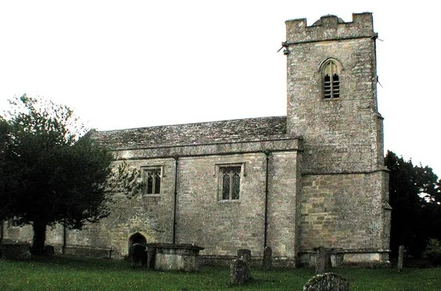
Church of St Peter
Historic churches · 2.4 km

William Trinder Monument And Monuments Either Side, In The Churchyard Of The Church Of St Peter, Circa 5 Metres South Of The Sou
Memorials & monuments · 2.4 km

Windrush Camp
Archaeological sites · 2.5 km

Windrush camp
Vineyards · 2.5 km

Clapton
Villages · 2.6 km
Nearby
📷 3Parks · South East England
Sherborne Park Estate
Sherborne Park Estate — a other in england-west-midlands, United Kingdom.
📷 3Historic bridges · South East England
Road Bridge Over Sherborne Brook C60M West Of Sherbrooke House
Road Bridge Over Sherborne Brook C60M West Of Sherbrooke House — Grade II listed building-listed bridge in england-west-midlands, United Kingdom.
📷 5📷 3Mills · South East England
Windrush Mill
Windrush Mill — Grade II* listed watermill in Windrush, Cotswold, England, UK.
📷 3Historic bridges · South East England
Bridge Over Sherborne Brook In Grounds Of Haycroft House
Bridge Over Sherborne Brook In Grounds Of Haycroft House — Grade II listed building-listed bridge in england-west-midlands, United Kingdom.
📷 5Where to eat & stay near Road Bridge Over Sherborne Brook At East End Of Mareslaid Copse And Road Side Wall To North
Places to stay
 📷 5
📷 5 📷 5📷 5
 📷 5
📷 5Campsites · South East England
Cotswold Carp Farm
Cotswold Carp Farm — a campsite in england west midlands.
 📷 5
📷 5Campsites · South East England
Cotswold Carp Farm
Cotswold Carp Farm — a campsite in england west midlands.
 📷 7
📷 7Hotels · South East England
The Old Manse
The Old Manse — a hotel in england west midlands.
Places to eat & drink
 📷 7
📷 7Historic pubs · South East England
Inn For All Seasons
Inn For All Seasons in England South East, United Kingdom.
 📷 7
📷 7Restaurants · South East England
The Rose Tree
The Rose Tree — a restaurant in england west midlands.
 📷 7
📷 7 📷 7
📷 7Restaurants · South East England
Spice lounge
Spice lounge — a restaurant in england west midlands.
 📷 7
📷 7Historic pubs · South West England
Fossebridge Inn
Fossebridge Inn in England South East, United Kingdom.
 📷 7
📷 7Historic pubs · South East England
Golden Ball Inn
Golden Ball Inn in England South East, United Kingdom.
More bridges in this region
 📷 5
📷 5Historic bridges · South East England
Briary Hill Bridge east
Briary Hill Bridge east is a historic bridge in the United Kingdom.
 📷 5
📷 5Historic bridges · South East England
Briary Hill Bridge west
Briary Hill Bridge west is a historic bridge in the United Kingdom.
 📷 5
📷 5Historic bridges · South East England
Bridge 157 VIR (Bath Hard Road)
Bridge 157 VIR (Bath Hard Road) is a historic bridge in the United Kingdom.
 📷 5
📷 5Historic bridges · South East England
Dorking Arch Bridge
Dorking Arch Bridge is a historic bridge in the United Kingdom.
Frequently asked questions
- Where is Road Bridge Over Sherborne Brook At East End Of Mareslaid Copse And Road Side Wall To North?
- Road Bridge Over Sherborne Brook At East End Of Mareslaid Copse And Road Side Wall To North is in Gloucestershire, the West Midlands, United Kingdom (postcode GL54 3DJ), in the parish of Sherborne.
- What is Road Bridge Over Sherborne Brook At East End Of Mareslaid Copse And Road Side Wall To North?
- Road Bridge Over Sherborne Brook At East End Of Mareslaid Copse And Road Side Wall To North — Grade II listed building-listed bridge in england-west-midlands, United Kingdom.
- How do I get to Road Bridge Over Sherborne Brook At East End Of Mareslaid Copse And Road Side Wall To North?
- Drivers can use postcode GL54 3DJ.
- Is Road Bridge Over Sherborne Brook At East End Of Mareslaid Copse And Road Side Wall To North a listed building?
- Road Bridge Over Sherborne Brook At East End Of Mareslaid Copse And Road Side Wall To North is officially recognised as Grade II listed building listed.
- Is Road Bridge Over Sherborne Brook At East End Of Mareslaid Copse And Road Side Wall To North a protected site?
- Yes — Road Bridge Over Sherborne Brook At East End Of Mareslaid Copse And Road Side Wall To North is part of the Cotswolds National Landscape (AONB).
- Is Road Bridge Over Sherborne Brook At East End Of Mareslaid Copse And Road Side Wall To North free to visit?
- Yes, Road Bridge Over Sherborne Brook At East End Of Mareslaid Copse And Road Side Wall To North is free to enter.
- How do I get to Road Bridge Over Sherborne Brook At East End Of Mareslaid Copse And Road Side Wall To North?
- Drivers can navigate to postcode GL54 3DJ. It sits within the North Cotswolds parliamentary constituency.