
Natural landmarks · Mid Wales
River Severn
Also known as: Afon Hafren, An tSabhrainn
River Severn in Wales Mid, United Kingdom.

OLU — CC BY-SA 2.0 via Wikimedia Commons licence

Plan your visit
- Typical visit
- 1 h–2 h
- Dog-friendly
About
River Severn is a place of interest in Wales Mid, United Kingdom — drawn from open-data sources for visitor reference. See the linked Wikipedia article for the full description.
Photo gallery
From the Wikipedia article
The River Severn (Welsh: Afon Hafren, pronounced [ˈavɔn ˈhavrɛn]) is the longest river in Great Britain, with a length of 220 miles (354 km). It is also the river with the most voluminous flow of water by far in all of England and Wales, with an average flow rate of 107 m3/s (3,800 cu ft/s) at Apperley, Gloucestershire. It rises in the Cambrian Mountains in mid Wales, at an altitude of 610 m (2,000 ft), on the Plynlimon massif, which lies close to the Ceredigion/Powys border near Llanidloes. The river then flows through Shropshire, Worcestershire and Gloucestershire. The county towns of Shrewsbury, Worcester and Gloucester lie on its course. The Severn's major tributaries are the Vyrnwy, the Tern, the Teme, the Warwickshire Avon, and the Worcestershire Stour. By convention, the River Severn is usually considered to end, and the Severn Estuary to begin, after the Prince of Wales Bridge, between Severn Beach in South Gloucestershire and Sudbrook, Monmouthshire. The total area of the estuary's drainage basin is 4,409 square miles (11,419 km2). That figure excludes the area of the River Wye and the Bristol Avon, both of which flow into the Severn Estuary. The estuary discharges into the Bristol Channel, which opens into the Celtic Sea and from there into the Atlantic Ocean.
Excerpt from Wikipedia under CC BY-SA 4.0. See the source article linked in Sources below.
Background
Description
Paddle steamers were operated in the Severn Estuary from the mid 19th century to the late 1970s by P & A Campbell of Bristol. The vessels, Cardiff Queen, Bristol Queen, Glen Usk, Glen Gower and Britannia all operated on this route in the 1950s and 1960s. Since 1986 Waverley Excursions has operated occasional sailings to Sharpness and Lydney by the MV Balmoral. A number of ferries were also operated on the tidal river, for example at New Passage, Purton and Arlingham. The last ferry was the Aust Ferry, which closed in 1966 when the Severn Bridge opened. One of the Aust ferries, Severn Princess, is still in Chepstow although largely derelict.
Sourced from Wikipedia under CC BY-SA 4.0.
- Coordinates
- 52.4944, -3.7375
- Official site
- www.nwl.ac.uk
Sources
- wikidata: Q19682 (CC0)
- wikipedia: River Severn (CC BY-SA 4.0)
Other places nearby

Carnfachbugeilyn
Mountains & hills · 0.6 km

Pumlumon Cwmbiga
Mountains & hills · 1.3 km

WWW
Memorials & monuments · 1.5 km

Carreg Wen
Archaeological sites · 1.6 km

Blaen Hafren
Waterfalls · 2.1 km
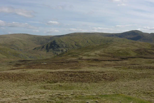
Pen Pumlumon Arwystli
Mountains & hills · 2.2 km

Foel Uchaf
Mountains & hills · 2.2 km

Foel Uchaf
Mountains & hills · 2.3 km
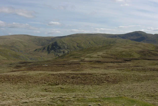
Pen Pumlumon Arwystli
Natural landmarks · 2.3 km

Cwm y Derw
Mountains & hills · 2.3 km

Lluest Newydd
Historic houses · 2.5 km

Pen Cerrig Tewion
Mountains & hills · 2.8 km
Nearby
📷 3Mountains & hills · Mid Wales
Carnfachbugeilyn
Carnfachbugeilyn — a mountain in wales-mid, United Kingdom, 622 m.
📷 4📷 3📷 3Archaeological sites · Mid Wales
Carreg Wen
Carreg Wen — a archaeological in wales-mid, United Kingdom.
📷 5📷 3Mountains & hills · Mid Wales
Pen Pumlumon Arwystli
Pen Pumlumon Arwystli — Named summit at 741 m.
Where to eat & stay near River Severn
Places to stay
 📷 5
📷 5 📷 5
📷 5 📷 5
📷 5Caravan parks · Mid Wales
Maesperthi Caravan & Lodge Park
Maesperthi Caravan & Lodge Park — a caravan park in wales mid.
 📷 7
📷 7Hotels · Mid Wales
George Borrow Hotel
George Borrow Hotel — a hotel in wales mid.
📷 5Caravan parks · Mid Wales
Maesperthi Caravan & Lodge Park
Maesperthi Caravan & Lodge Park — a caravan park in wales mid.
 📷 5
📷 5Caravan parks · Mid Wales
Glangwy Farm Camping
Glangwy Farm Camping — a caravan park in wales mid.
Places to eat & drink
 📷 5
📷 5Cafés · Mid Wales
Llywernog Silver Lead Mine
Llywernog Silver Lead Mine — a café in wales mid.
 📷 5
📷 5Restaurants · Mid Wales
The White Lion Hotel
The White Lion Hotel — a restaurant in wales mid.
 📷 6
📷 6 📷 7
📷 7 📷 5
📷 5 📷 5
📷 5More natural landmarks in this region
 📷 3
📷 3 📷 3
📷 3 📷 3
📷 3Natural landmarks · Mid Wales
Llyn Gwernan
Llyn Gwernan is a natural landmark in the United Kingdom.
 📷 3
📷 3Frequently asked questions
- Where is River Severn?
- River Severn is in Mid Wales, United Kingdom.
- What is River Severn?
- River Severn in Wales Mid, United Kingdom.
- How do I get to River Severn?
- Its coordinates are 52.4944°, -3.7375°.