
Natural landmarks · North West England
River Lyvennet
Also known as: Afon Lyvennet
In or near Cliburn.
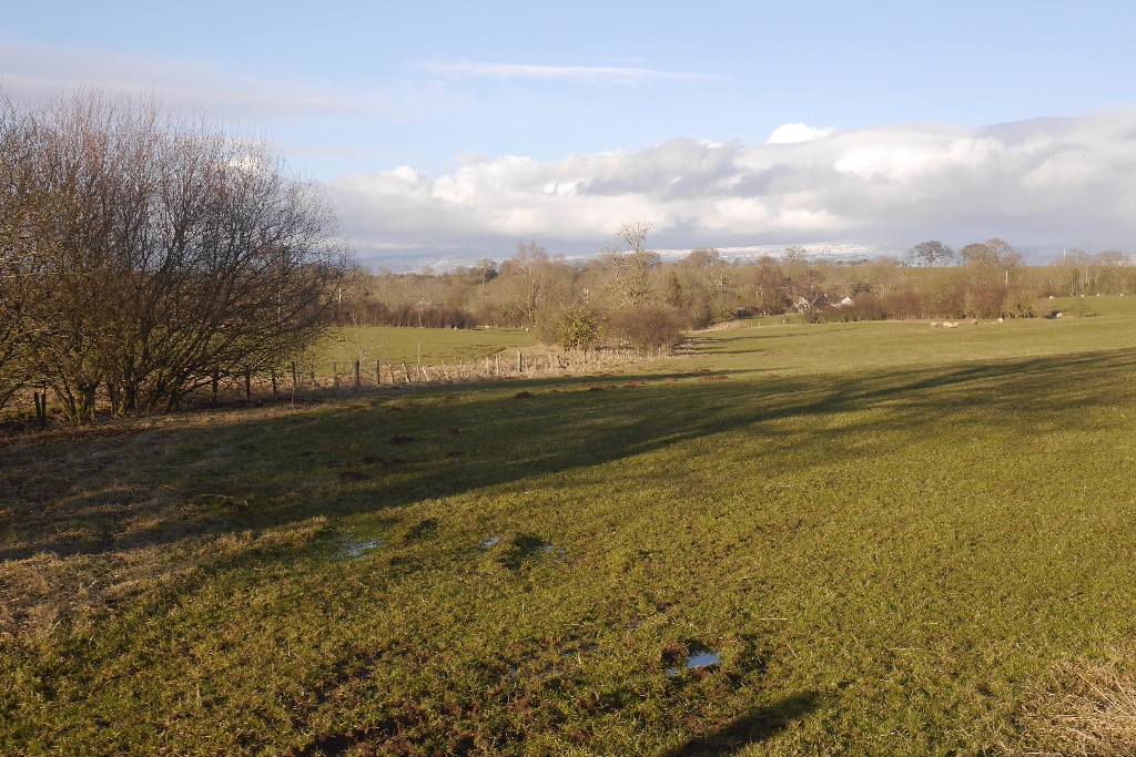
River Lyvennet in England North East, United Kingdom.

Keith Wright — CC BY-SA 2.0 via Wikimedia Commons licence

Plan your visit
- Typical visit
- 1 h–2 h
- Nearest railway station
- Langwathby · 8.2 km
- Dog-friendly
Getting there & planning your visit
To visit the River Lyvennet, the nearest railway station is Langwathby, located 8.2 km away. The postcode for the area is CA10 1SS. Entry to the natural landmark is free, and accessibility details are not provided.
About
River Lyvennet is a place of interest in England North East, United Kingdom — drawn from open-data sources for visitor reference. See the linked Wikipedia article for the full description.
Photo gallery
Protected designations
- Site of Special Scientific Interest: River Eden and Tributaries SSSI
- Area of Outstanding Natural Beauty: North Pennines
Designations sourced from Natural England open data under OGL v3.
From the Wikipedia article
The River Lyvennet is a river flowing through the county of Cumbria in England. The source of the Lyvennet (as Lyvennet Beck) is close to Robin Hood's Grave on Crosby Ravensworth Moor, an area rich in ancient remains. From there, the beck flows northwards through Crosby Ravensworth, Maulds Meaburn and King's Meaburn, emerging as the River Lyvennet. The river is joined by the River Leith shortly before the Lyvennet's own confluence with the River Eden. It is 17.326 kilometres (10.766 mi) long and has a catchment area of 52.094 square kilometres (20.114 sq mi). The Environment Agency, Natural England and the Eden Rivers Trust have partnered to, over the course of two years, restore bends and turns to parts of the river that had previously been straightened for land management purposes. This can help prevent flooding and has encouraged Atlantic salmon to return to spawn. Volunteers planted 10,000 wildflowers of over 30 native species on the surrounding land. The river is also home to brown trout. Several Pedigree cattle herds are named after the river, including Lyvennet Simmentals of Greystone House, King's Meaburn. The Lyvennet valley may preserve the name of Taliesin's "Llwyfenydd" and would thus be associated with the post-Roman Brythonic kingdom of Rheged. The meaning of the Welsh word "llwyfen" is the elm tree.
Excerpt from Wikipedia under CC BY-SA 4.0. See the source article linked in Sources below.
- Coordinates
- 54.6283, -2.6078
- District
- Westmorland and Furness
- Parish
- Temple Sowerby
- Postcode
- CA10 1SS
- Parliamentary constituency
- Westmorland and Lonsdale
- Nearest railway station
- Langwathby — 8.2 km
Sources
- wikidata: Q7337614 (CC0)
- wikipedia: River Lyvennet (CC BY-SA 4.0)
Other places nearby

Temple Sowerby railway station
Heritage railway stations · 0.5 km

May Pole
Memorials & monuments · 1.0 km
Temple Sowerby
Historic churches · 1.1 km

Kings Arms Hotel
Hotels · 1.1 km

Low Moor Caravan and Campsite
Caravan parks · 1.6 km

Cliburn Mill Bridge
Historic bridges · 1.6 km
River Leith
Natural landmarks · 1.7 km

Crossrigg Hall
Historic houses · 2.0 km

Bridge Over River Lyvennet To South Of Crossrigg Hall
Historic bridges · 2.1 km

Cliburn railway station
Heritage railway stations · 2.2 km

Acorn Bank Garden & Watermill
Watermills · 2.3 km

Acorn Bank
Manor houses · 2.3 km
Nearby
📷 3Heritage railway stations · North West England
Temple Sowerby railway station
Temple Sowerby railway station in England North East, United Kingdom.
📷 4Memorials & monuments · North West England
May Pole
May Pole — a memorial in scotland-lowlands, United Kingdom.
📷 5Historic churches · North West England
Temple Sowerby
Temple Sowerby in England North East, United Kingdom.
📷 5Hotels · North West England
Kings Arms Hotel
Kings Arms Hotel — a hotel in scotland lowlands.
📷 5Caravan parks · North East England
Low Moor Caravan and Campsite
Low Moor Caravan and Campsite — a caravan park in scotland lowlands.
📷 3Historic bridges · North West England
Cliburn Mill Bridge
Cliburn Mill Bridge — Grade II listed building-listed bridge in scotland-lowlands, United Kingdom.
Where to eat & stay near River Lyvennet
Places to stay
📷 5Hotels · North West England
Kings Arms Hotel
Kings Arms Hotel — a hotel in scotland lowlands.
📷 5Caravan parks · North East England
Low Moor Caravan and Campsite
Low Moor Caravan and Campsite — a caravan park in scotland lowlands.
 📷 5
📷 5Caravan parks · North West England
Grange Court (C & MC CL)
Grange Court (C & MC CL) — a caravan park in scotland lowlands.
 📷 5
📷 5Caravan parks · North West England
Highgate Holiday Park
Highgate Holiday Park — a caravan park in england north east.
 📷 5
📷 5Campsites · North West England
Greengill Campsite
Greengill Campsite — a campsite in england north east.
 📷 5
📷 5Caravan parks · North West England
Newby End Farm Caravan Site
Newby End Farm Caravan Site — a caravan park in england north east.
Places to eat & drink
 📷 3
📷 3 📷 5
📷 5Historic pubs · North East England
1, Scattergate
1, Scattergate in England North East, United Kingdom.
 📷 7
📷 7Historic pubs · North West England
Two Lions public house and integral stables
Two Lions public house and integral stables in Scotland Lowlands, United Kingdom.
 📷 6
📷 6Historic pubs · North West England
Gloucester Arms
Gloucester Arms in Scotland Lowlands, United Kingdom.
 📷 7
📷 7Cafés · North West England
Narrowbar Cafe
Narrowbar Cafe — a café in scotland lowlands.
 📷 5
📷 5Historic pubs · North West England
Horse And Farrier Inn And Stables
Horse And Farrier Inn And Stables in Scotland Lowlands, United Kingdom.
More natural landmarks in this region
 📷 3
📷 3Natural landmarks · North West England
Statue of Oliver Cromwell
Statue of Oliver Cromwell — Public artwork (statue).
 📷 3
📷 3Natural landmarks · North West England
Dagfields Craft Centre
Dagfields Craft Centre — a other in england-west-midlands, United Kingdom.
 📷 3
📷 3Natural landmarks · North West England
Weaver Valley Cruises
Weaver Valley Cruises — a other in england-west-midlands, United Kingdom.
 📷 3
📷 3Natural landmarks · North West England
Golden Gates
Golden Gates — a other in england-west-midlands, United Kingdom.
Frequently asked questions
- Where is River Lyvennet?
- River Lyvennet is in North-East England, United Kingdom (postcode CA10 1SS), in the parish of Temple Sowerby.
- What is River Lyvennet?
- River Lyvennet in England North East, United Kingdom.
- How do I get to River Lyvennet?
- The nearest railway station is Langwathby, about 8.2 km away. Drivers can use postcode CA10 1SS.
- Is River Lyvennet a protected site?
- Yes — River Lyvennet is part of the River Eden and Tributaries SSSI Site of Special Scientific Interest and the North Pennines National Landscape (AONB).
- How do I get to River Lyvennet?
- Drivers can navigate to postcode CA10 1SS. It sits within the Westmorland and Lonsdale parliamentary constituency.