
Beaches · South West England
River Heddon
In or near Challacombe.
The River Heddon is a river in Devon, in the south of England. Running along the western edges of Exmoor, the river reaches the North Devon coast at Heddon's Mouth. The nearest road access to the beac

David Smith — CC BY-SA 2.0 via Wikimedia Commons licence

Plan your visit
- Typical visit
- 1 h–3 h
- Best time of year
- Summer (Jun–Aug)
- Nearest railway station
- Killington Lane · 1.5 km
- Free entry
- Family-friendly
- Dog-friendly
Getting there & planning your visit
To visit River Heddon in North Devon, the nearest railway station is Killington Lane, located 1.5 km away. Entry to the beach is free. The postcode for sat-nav is EX31 4RL.
About
The River Heddon is a river in Devon, in the south of England. Running along the western edges of Exmoor, the river reaches the North Devon coast at Heddon's Mouth. The nearest road access to the beach is at Hunter's Inn, approximately 1.6-kilometre (1 mi) south of sea-fall. The named river flows for 8.8 kilometres (5.5 mi) and drains an area of 17.07 square kilometres (6.59 sq mi). The Heddon Valley is renowned for its natural environment, with bridges and stepping stones along the river, meadows, and walks which start from the National Trust shop and information centre which has been in the ownership of the National Trust since 1963. The cobbled beach at Heddon's Mouth is approximately 300 metres (980 ft) wide and is only accessible through footpaths on the National Trust land or via the South West Coast Path. There are remains of a lime kiln on its western edge. The valley immediately landwards of the beach has steep slopes to its east and west, with the hills climbing over 200 metres (660 ft) in altitude within 500 metres (1,600 ft) of the river. The remains of a Roman fortlet are visible on the hilltop to the east of Heddon's Mouth. The Lynton & Barnstaple Railway once ran through part of the valley, halting at the small village of Parracombe.
Photo gallery
From the Wikipedia article
The River Heddon is a river in Devon, in the south of England. Running along the western edges of Exmoor, the river reaches the North Devon coast at Heddon's Mouth. The nearest road access to the beach is at Hunter's Inn, approximately 1.6-kilometre (1 mi) south of sea-fall. The named river flows for 8.8 kilometres (5.5 mi) and drains an area of 17.07 square kilometres (6.59 sq mi). The Heddon Valley is renowned for its natural environment, with bridges and stepping stones along the river, meadows, and walks which start from the National Trust shop and information centre which has been in the ownership of the National Trust since 1963. The cobbled beach at Heddon's Mouth is approximately 300 metres (980 ft) wide and is only accessible through footpaths on the National Trust land or via the South West Coast Path. There are remains of a lime kiln on its western edge. The valley immediately landwards of the beach has steep slopes to its east and west, with the hills climbing over 200 metres (660 ft) in altitude within 500 metres (1,600 ft) of the river. The remains of a Roman fortlet are visible on the hilltop to the east of Heddon's Mouth. The Lynton & Barnstaple Railway once ran through part of the valley, halting at the small village of Parracombe.
Excerpt from Wikipedia under CC BY-SA 4.0. See the source article linked in Sources below.
- Coordinates
- 51.1833, -3.9000
- County
- Devon
- District
- North Devon
- Parish
- Parracombe
- Postcode
- EX31 4RL
- Parliamentary constituency
- North Devon
- Nearest railway station
- Killington Lane — 1.5 km
- Official site
- ancientmonuments.uk
Sources
- wikipedia: River Heddon (CC BY-SA 4.0)
Other places nearby

Holwell Castle
Literary houses · 0.4 km

Holwell Castle Motte and Bailey
Castles · 0.4 km
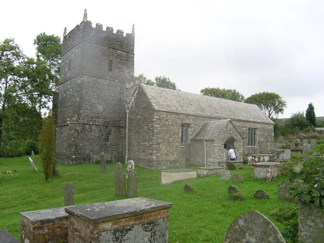
St Petrock's Church, Parracombe
Historic churches · 0.6 km

Fox And Goose
B&Bs · 0.7 km

Parracombe
Castles · 0.8 km

Holwell Barrow
Burial mounds & barrows · 1.2 km

Beacon Castle (Settlement)
Castles · 1.8 km
Beacon Castle
Castles · 1.8 km

Beacon Castle
Vineyards · 1.8 km

Lynton and Barnstaple Railway
Natural landmarks · 2.2 km
Woody Bay railway station
Heritage railway stations · 2.2 km

Voley Castle (Settlement)
Castles · 2.5 km
Nearby
📷 5Literary houses · South West England
Holwell Castle
Holwell Castle — a literary house museum in england south west.
📷 3Castles · South West England
Holwell Castle Motte and Bailey
Holwell Castle Motte and Bailey — a castle in england-south-west, United Kingdom.
📷 4Historic churches · South West England
St Petrock's Church, Parracombe
St Petrock's Church, Parracombe — church in Cornwall, England, UK.
📷 6B&Bs · South West England
Fox And Goose
Fox And Goose — a bed-and-breakfast in england south west.
📷 5Castles · South West England
Parracombe
Parracombe — a castle in england-south-west, United Kingdom.
Burial mounds & barrows · South West England
Holwell Barrow
Holwell Barrow — a burial mound in england-south-west, United Kingdom.
Where to eat & stay near River Heddon
Places to stay
📷 6B&Bs · South West England
Fox And Goose
Fox And Goose — a bed-and-breakfast in england south west.
 📷 5
📷 5 📷 5
📷 5Hotels · South West England
Hunter's Inn
Hunter's Inn — a hotel in england south west.
 📷 5
📷 5Campsites · South West England
Caffyns Farm
Caffyns Farm — a campsite in england south west.
 📷 5
📷 5Campsites · South West England
Greenacres Touring Caravan Park
Greenacres Touring Caravan Park — a campsite in england south west.
 📷 5
📷 5Campsites · South West England
The Camping & Caravanning Club Lynton.
The Camping & Caravanning Club Lynton. — a campsite in england south west.
Places to eat & drink
 📷 7
📷 7Historic pubs · South West England
Rising Sun Hotel (Main Part)
Rising Sun Hotel (Main Part) in England South West, United Kingdom.
 📷 7
📷 7Historic pubs · South West England
Rock House Hotel
Rock House Hotel in England South West, United Kingdom.
 📷 5
📷 5Historic pubs · South West England
The Blue Ball Inn
The Blue Ball Inn in England South West, United Kingdom.
 📷 5
📷 5Historic pubs · South West England
Pack o' Cards
Pack o' Cards in England South West, United Kingdom.
 📷 5
📷 5Restaurants · South West England
Barum Gate
Barum Gate — a restaurant in england south west. Cuisine: british. Brand: Table Table.
 📷 5
📷 5More beaches in this region
 📷 5
📷 5Beaches · South West England
Alum Chine Beach
Alum Chine Beach is a beach in the United Kingdom.
 📷 5
📷 5Beaches · South West England
Bournemouth Beach
Bournemouth Beach — beach in Bournemouth, Dorset, UK.
 📷 5
📷 5Beaches · South West England
Bournemouth East Beach
Bournemouth East Beach is a beach in the United Kingdom.
 📷 5
📷 5Beaches · South West England
Bournemouth West Beach
Bournemouth West Beach is a beach in the United Kingdom.
Frequently asked questions
- Where is River Heddon?
- River Heddon is in Devon, South-West England, United Kingdom (postcode EX31 4RL), in the parish of Parracombe.
- What is River Heddon?
- The River Heddon is a river in Devon, in the south of England. Running along the western edges of Exmoor, the river reaches the North Devon coast at Heddon's Mouth. The nearest road access to the beac
- How do I get to River Heddon?
- The nearest railway station is Killington Lane, about 1.5 km away. Drivers can use postcode EX31 4RL.
- Is River Heddon free to visit?
- Yes, River Heddon is free to enter.
- How do I get to River Heddon?
- The nearest railway station is Killington Lane, about 1.5 km away. Drivers can navigate to postcode EX31 4RL.