
Historic bridges · Central Scotland
River Cart Aqueduct
In or near Elderslie.
River Cart Aqueduct is a historic bridge in the United Kingdom.

Wikimedia Commons contributors — see linked file page for photographer and licence licence

Plan your visit
- Typical visit
- 15 min–30 min
- Nearest railway station
- Hawkhead · 0.5 km
- Free entry
- Dog-friendly
Getting there & planning your visit
To visit the River Cart Aqueduct, the nearest railway station is Hawkhead, located 0.5 km away. Entry is free, and the postcode for navigation is PA1 1LX.
About
River Cart Aqueduct is a named historic bridge in the United Kingdom. Records date its origin to 1809. OpenStreetMap heritage rating: 2/5. Coordinates: 55.8400°, -4.4064°.
Photo gallery
From the Wikipedia article
The River Cart Aqueduct, sometimes known as the Blackhall Bridge, is a railway bridge and former navigable aqueduct in Paisley, Renfrewshire, Scotland. It opened in 1811 as an aqueduct to carry the Glasgow, Paisley and Johnstone Canal over the White Cart Water. Following the closure of the canal in 1881, it was converted to a railway bridge in 1885, and now carries the Paisley Canal Line. It is registered as a Category A listed building by Historic Environment Scotland.
Excerpt from Wikipedia under CC BY-SA 4.0. See the source article linked in Sources below.
Background
History
The aqueduct was built between 1808 and 1810, and opened in 1811 to carry the Glasgow, Paisley and Johnstone Canal. John Rennie and Thomas Telford were involved in the engineering process. The contractor was John Simpson and the cost of construction was £5,440. The canal was closed in 1881, and converted to run the Paisley Canal Line, which opened in 1885.
Architecture
It is a freestone masonry segmental arch of 88 ft span and a height over the water of about 30 ft. The bridge is probably the longest span masonry aqueduct of the canal age on a British canal, and one of the world's earliest bridges carrying a public railway. It was widened to carry the double track railway, and the line crosses the bridge at a slight skew because of the easing of the sharp canal curvature. When the aqueduct carried the canal, it was only the width of a single boat, making it necessary to wait for another boat to pass at times.
Sourced from Wikipedia under CC BY-SA 4.0.
- Coordinates
- 55.8400, -4.4064
- District
- Renfrewshire
- Postcode
- PA1 1LX
- Parliamentary constituency
- Paisley and Renfrewshire South
- Established
- 1809
- Nearest railway station
- Hawkhead — 0.5 km
- Opening
- 1811 (opened in 1885 as railway bridge)
Sources
- osm: w936314079 (ODbL)
- wikipedia: River Cart Aqueduct (CC BY-SA 4.0)
- commons: Paisley Blackhall bridge.jpg (CC BY-SA 4.0)
Other places nearby

Paisley and Johnstone Canal
Canals · 0.0 km
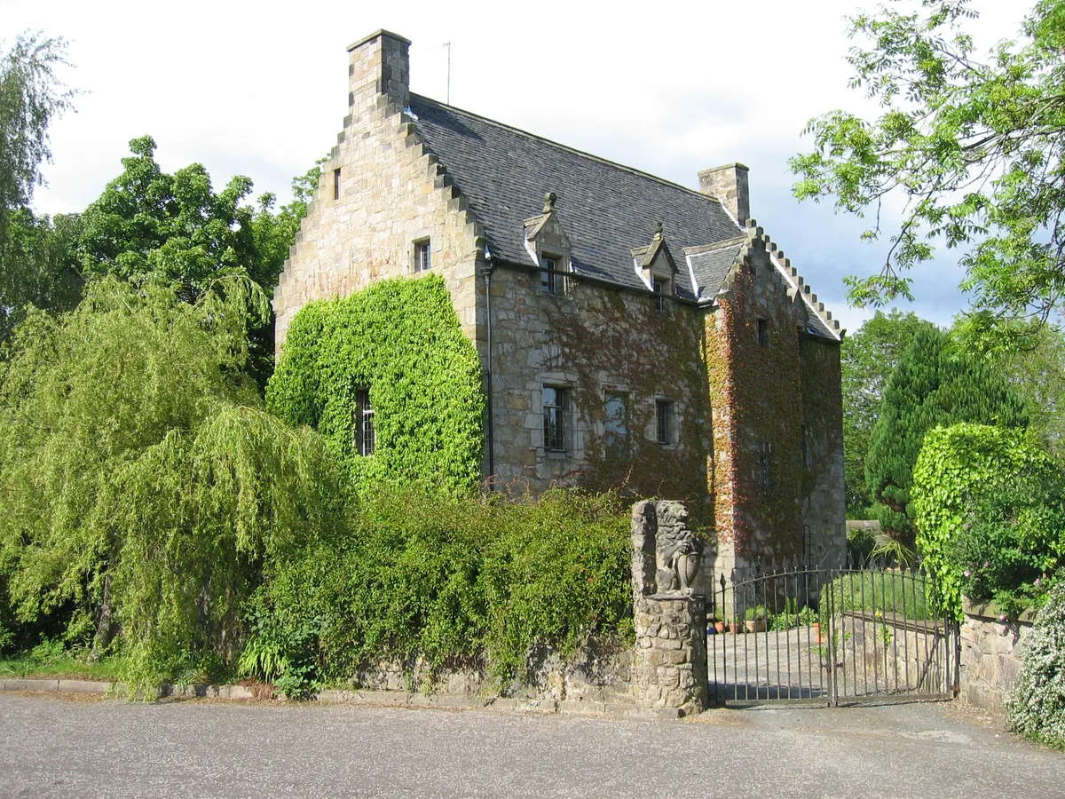
Blackhall Manor
Castles · 0.4 km

Sapper 300 Memorial
Memorials & monuments · 0.6 km
91st and 93rd Argyll and Sutherland Highlanders Memorial
Memorials & monuments · 0.7 km

Bridge, Anchor Thread Mills, Paisley
Historic bridges · 0.7 km

Paisley Victoria Cross Recipients Memorial
Memorials & monuments · 0.7 km

Glen Cinema Disaster Memorial
Memorials & monuments · 0.7 km
Covid-19 Pandemic Memorial
Memorials & monuments · 0.8 km

Arthur Allison Memorial Hall
Memorials & monuments · 0.8 km
Archibald McKenzie Memorial Fountain
Memorials & monuments · 0.8 km
Hawkhead Cemetery
Cemeteries · 0.8 km

Alexander Wilson Memorial
Memorials & monuments · 0.8 km
Nearby
📷 3Canals · Central Scotland
Paisley and Johnstone Canal
Paisley and Johnstone Canal — canal in Glasgow City, Scotland, UK.
📷 3📷 3Memorials & monuments · Central Scotland
Sapper 300 Memorial
Sapper 300 Memorial — a memorial in Central Scotland, United Kingdom.
📷 3Memorials & monuments · Central Scotland
91st and 93rd Argyll and Sutherland Highlanders Memorial
91st and 93rd Argyll and Sutherland Highlanders Memorial — a memorial in Central Scotland, United Kingdom.
📷 5Historic bridges · Central Scotland
Bridge, Anchor Thread Mills, Paisley
Bridge, Anchor Thread Mills, Paisley — category B listed building-listed bridge in scotland-central, United Kingdom.
📷 3Memorials & monuments · Central Scotland
Paisley Victoria Cross Recipients Memorial
Paisley Victoria Cross Recipients Memorial — a memorial in Central Scotland, United Kingdom.
Where to eat & stay near River Cart Aqueduct
Places to stay
 📷 5
📷 5Caravan parks · Central Scotland
Dunroman Caravan Park
Dunroman Caravan Park — a caravan park in scotland central.
 📷 5
📷 5Caravan parks · Central Scotland
Jubilee Caravan Park
Jubilee Caravan Park — a caravan park in scotland central.
 📷 7
📷 7Hotels · Central Scotland
Sherbrooke Castle Hotel
Sherbrooke Castle Hotel — a hotel in scotland central.
 📷 5
📷 5 📷 7
📷 7Hotels · Central Scotland
One Devonshire Gardens
One Devonshire Gardens — a hotel in scotland central.
 📷 5
📷 5Hotels · Central Scotland
Hilton Garden Inn Glasgow City Centre
Hilton Garden Inn Glasgow City Centre — a hotel in scotland central. 4-star. Brand: Hilton Garden Inn.
Places to eat & drink
 📷 5
📷 5Historic pubs · Central Scotland
Fiesta Lounge, 15 Gilmour Street, Paisley
Fiesta Lounge, 15 Gilmour Street, Paisley in Scotland Central, United Kingdom.
 📷 5
📷 5Historic pubs · Central Scotland
Hayweighs, 7-9 King Street, Paisley
Hayweighs, 7-9 King Street, Paisley in Scotland Central, United Kingdom.
 📷 7
📷 7Historic pubs · Central Scotland
Wheatsheaf Public House, 1-3 Canal Street, Renfrew
Wheatsheaf Public House, 1-3 Canal Street, Renfrew in Scotland Central, United Kingdom.
 📷 7
📷 7Historic pubs · Central Scotland
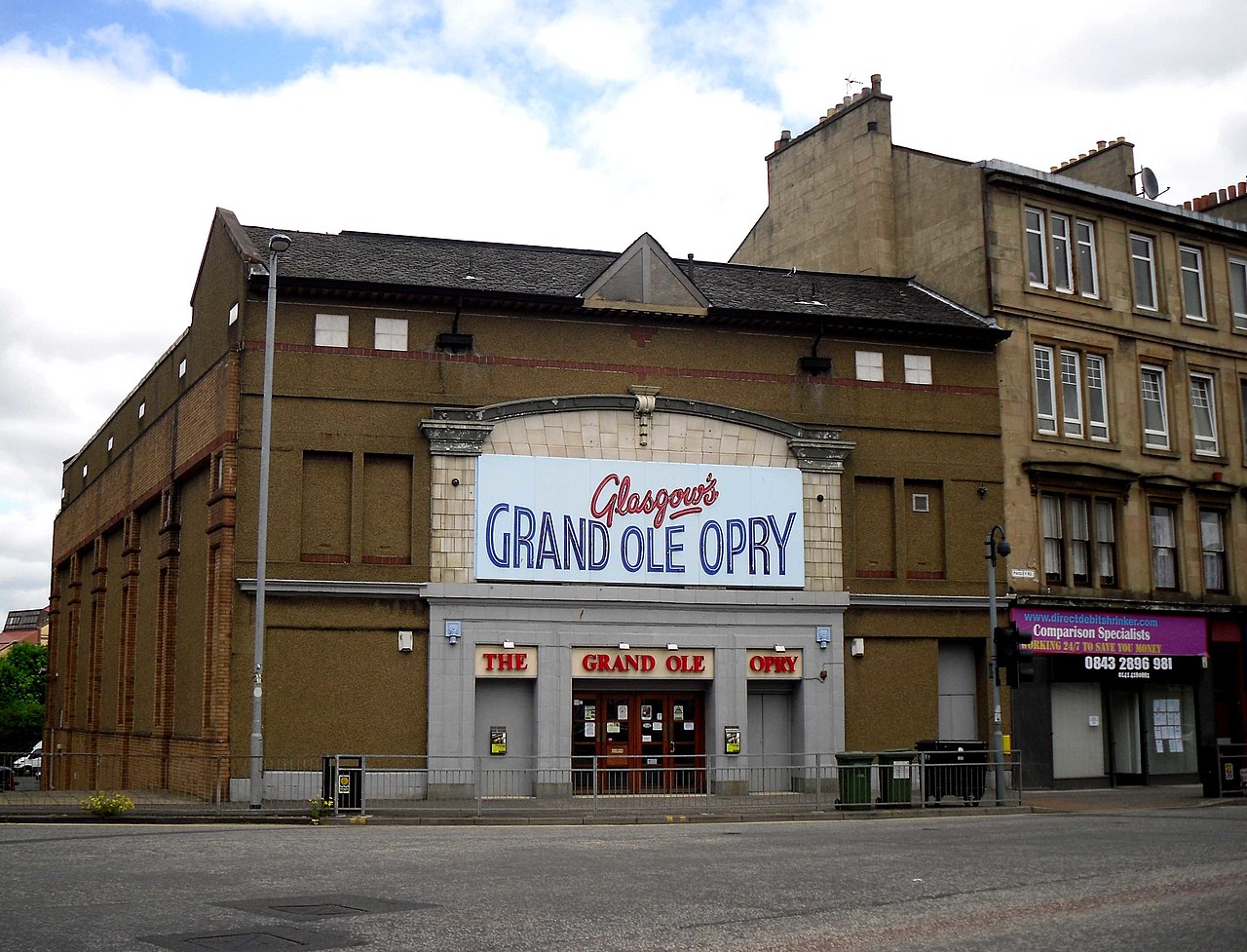
Old Toll Bar, 3 Paisley Road West, Glasgow
Old Toll Bar, 3 Paisley Road West, Glasgow in Scotland Central, United Kingdom.
 📷 5
📷 5Historic pubs · Central Scotland
Hubbard Tea Rooms, 508, 510, 512 Great Western Road, Glasgow
Hubbard Tea Rooms, 508, 510, 512 Great Western Road, Glasgow in Scotland Central, United Kingdom.
 📷 5
📷 5Historic pubs · Central Scotland
The Buttery, 646, 650, 652, 654 Argyle Street, Glasgow
The Buttery, 646, 650, 652, 654 Argyle Street, Glasgow in Scotland Central, United Kingdom.
Other bridges from this era
 📷 5
📷 5Historic bridges · London
Chertsey Bridge
Chertsey Bridge is a historic bridge in the United Kingdom.
 📷 5
📷 5Historic bridges · London
Macclesfield Bridge
Macclesfield Bridge is a historic bridge in the United Kingdom.
 📷 5
📷 5Historic bridges · London
Staines Bridge
Staines Bridge is a historic bridge in the United Kingdom.
 📷 5
📷 5Historic bridges · London
Vauxhall Bridge
Vauxhall Bridge is a historic bridge in the United Kingdom.
More bridges in this region
 📷 3
📷 3Historic bridges · Central Scotland
Kelloe House
Kelloe House in England North East, United Kingdom.
 📷 4
📷 4Historic bridges · Central Scotland
Chirnsidebridge
Chirnsidebridge in England North East, United Kingdom.
 📷 3
📷 3.jpg?width=1200) 📷 3
📷 3Historic bridges · Central Scotland
Achnamara Clapper Bridge
Achnamara Clapper Bridge is a historic bridge in the United Kingdom.
Frequently asked questions
- Where is River Cart Aqueduct?
- River Cart Aqueduct is in central Scotland, United Kingdom (postcode PA1 1LX).
- What is River Cart Aqueduct?
- River Cart Aqueduct is a historic bridge in the United Kingdom.
- How do I get to River Cart Aqueduct?
- The nearest railway station is Hawkhead, about 0.5 km away. The nearest town is Elderslie. Drivers can use postcode PA1 1LX.
- When was River Cart Aqueduct built?
- Built or established in 1809.
- Who owns River Cart Aqueduct?
- River Cart Aqueduct is owned by | maint =.
- Is River Cart Aqueduct free to visit?
- Yes, River Cart Aqueduct is free to enter.
- How do I get to River Cart Aqueduct?
- The nearest railway station is Hawkhead, about 0.5 km away. Drivers can navigate to postcode PA1 1LX.