
Museums · West Midlands
River Blythe
In or near Meriden.
The River Blythe flows through the English Midlands from central Warwickshire, through the Borough of Solihull and on to Coleshill in north Warwickshire. It runs along the Meriden Gap in the Midlands

Richard Law — CC BY-SA 2.0 via Wikimedia Commons licence

Plan your visit
- Typical visit
- 1.5 h–3 h
- Best time of year
- Year-round
- Nearest railway station
- Birmingham International · 3.6 km
- Family-friendly
- Limited wheelchair access
Getting there & planning your visit
To visit the River Blythe in North Warwickshire, the nearest railway station is Birmingham International, located 3.6 km away. Entry is free, but please note that wheelchair accessibility is limited. The postcode for sat-nav is CV7 7HF.
About
The River Blythe flows through the English Midlands from central Warwickshire, through the Borough of Solihull and on to Coleshill in north Warwickshire. It runs along the Meriden Gap in the Midlands Plateau, is fed by the River Cole and is a tributary of the River Tame beside the West Midland Bird Club's Ladywalk reserve. This then joins the River Trent, whose waters reach the North Sea via the Humber Estuary. The river rises at various sources near Earlswood Lakes, but the principal tributary is listed as Spring Brook (52.350915°N 1.843601°W / 52.350915; -1.843601; grid reference SP107725). From here it winds north east, skirting Cheswick Green, towards Solihull. Here it passes through a local wildlife park, Malvern and Brueton Park and Nature Reserve, where it briefly splits/outpours for approximately 250 metres to form Brueton Park Lake. From here it meanders east, past several old country houses—Old Berry Hall, Ravenshaw Hall and Eastcote Hall—before turning sharply south towards Barston, which is encircled within a large meander of the river. At Temple Balsall the Cuttle Brook feeds the river, which now arcs north, and again close by Barston. Past Hampton in Arden the river is fed by Shadow Brook, at Diddington Hall. Travelling further north it passes to the east of Coleshill, and is fed by the River Cole, only a few hundred yards before it itself feeds into the River Tame (52.522317°N 1.688242°W / 52.522317; -1.688242; grid reference SP212916), at Ladywalk Nature Re
Photo gallery
Protected designations
- Site of Special Scientific Interest: River Blythe SSSI
Designations sourced from Natural England open data under OGL v3.
From the Wikipedia article
The River Blythe flows through the English Midlands from central Warwickshire, through the Borough of Solihull and on to Coleshill in north Warwickshire. It runs along the Meriden Gap in the Midlands Plateau, is fed by the River Cole and is a tributary of the River Tame beside the West Midland Bird Club's Ladywalk reserve. This then joins the River Trent, whose waters reach the North Sea via the Humber Estuary.
The river rises at various sources near Earlswood Lakes, but the principal tributary is listed as Spring Brook (52.350915°N 1.843601°W / 52.350915; -1.843601; grid reference SP107725). From here it winds north east, skirting Cheswick Green, towards Solihull. Here it passes through a local wildlife park, Malvern and Brueton Park and Nature Reserve, where it briefly splits/outpours for approximately 250 metres to form Brueton Park Lake. From here it meanders east, past several old country houses—Old Berry Hall, Ravenshaw Hall and Eastcote Hall—before turning sharply south towards Barston, which is encircled within a large meander of the river. At Temple Balsall the Cuttle Brook feeds the river, which now arcs north, and again close by Barston. Past Hampton in Arden the river is fed by Shadow Brook, at Diddington Hall. Travelling further north it passes to the east of Coleshill, and is fed by the River Cole, only a few hundred yards before it itself feeds into the River Tame (52.522317°N 1.688242°W / 52.522317; -1.688242; grid reference SP212916), at Ladywalk Nature Reserve.
The river is "a particularly fine example of a lowland river on clay" according to its Sites of Special Scientific Interest citation. The SSSI was notified in 1989, and includes a 24-mile (39 km) stretch of the river from near its source to the point it joins the River Tame. The Blythe has a wide range of natural geographical features such as riffles, pools, small cliffs and meanders, combined with a high diversity of substrate types ranging from fine silt and clay in the lower reaches t
Excerpt from Wikipedia under CC BY-SA 4.0. See the source article linked in Sources below.
- Coordinates
- 52.4667, -1.6792
- County
- Warwickshire
- District
- North Warwickshire
- Parish
- Great Packington
- Postcode
- CV7 7HF
- Parliamentary constituency
- North Warwickshire and Bedworth
- Nearest railway station
- Birmingham International — 3.6 km
Sources
- wikipedia: River Blythe (CC BY-SA 4.0)
Other places nearby
Little Packington Bridge
Historic bridges · 0.3 km
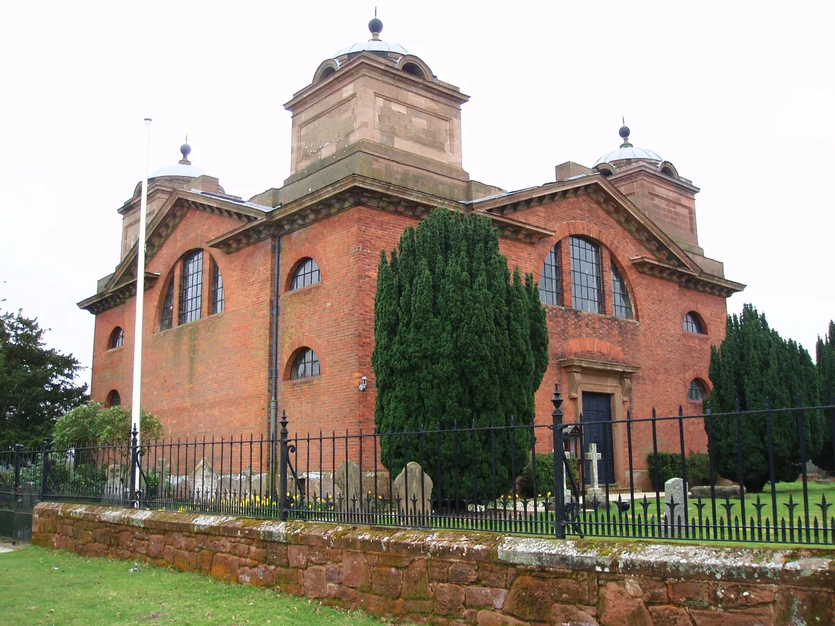
St James' Church, Great Packington
Historic churches · 1.8 km

Little Packington
Villages · 1.9 km

Broadwaters Scout Camp, Alfrey Activity Centre
Campsites · 1.9 km

Bridge Approximately 300 Metres South East Of Packington Hall
Historic bridges · 1.9 km

Maxstoke
Villages · 1.9 km

Precinct Wall, 60 Metres Northwest of Old Rectory
Holy wells · 2.0 km

Precinct Wall, East of Outer Gatehouse and Bounding Churchyard of St Michael and All Saints on the West
Holy wells · 2.2 km

The Coleshill School
Natural landmarks · 2.7 km

Great Packington
Villages · 2.7 km

Duke End Bridge
Historic bridges · 2.7 km

Hilton Birmingham Metropole
Hotels · 3.0 km
Nearby
📷 3Historic bridges · West Midlands
Little Packington Bridge
Little Packington Bridge — a Grade II*-listed bridge in england-west-midlands, United Kingdom.
📷 3Historic churches · West Midlands
St James' Church, Great Packington
St James' Church, Great Packington — Grade I listed church in Warwickshire, England, UK.
📷 5📷 5Campsites · West Midlands
Broadwaters Scout Camp, Alfrey Activity Centre
Broadwaters Scout Camp, Alfrey Activity Centre — a campsite in england west midlands.
📷 3Historic bridges · West Midlands
Bridge Approximately 300 Metres South East Of Packington Hall
Bridge Approximately 300 Metres South East Of Packington Hall — Grade II listed building-listed bridge in england-west-midlands, United Kingdom.
📷 5Where to eat & stay near River Blythe
Places to stay
📷 5Campsites · West Midlands
Broadwaters Scout Camp, Alfrey Activity Centre
Broadwaters Scout Camp, Alfrey Activity Centre — a campsite in england west midlands.
📷 5Hotels · West Midlands
Hilton Birmingham Metropole
Hilton Birmingham Metropole — a hotel in england west midlands. 4-star. Brand: Hilton.
 📷 4
📷 4Caravan parks · West Midlands
Somers Wood
Somers Wood — a caravan park in england west midlands.
 📷 5
📷 5Caravan parks · West Midlands
Maxstoke Hall Farm
Maxstoke Hall Farm — a caravan park in england west midlands.
 📷 7
📷 7Hotels · West Midlands
Hilton Garden Inn Birmingham Airport
Hilton Garden Inn Birmingham Airport — a hotel in england west midlands. 4-star. Brand: Hilton Garden Inn.
 📷 5
📷 5Campsites · West Midlands
Yew Tree Cottage Camping and Caravan
Yew Tree Cottage Camping and Caravan — a campsite in england west midlands.
Places to eat & drink
 📷 5
📷 5 📷 4
📷 4Historic pubs · West Midlands
The Bull's Head
The Bull's Head — Historic pub — listed building or notable heritage status.
 📷 3
📷 3Historic pubs · West Midlands
The Green Man
The Green Man — Historic pub — listed building or notable heritage status.
 📷 3
📷 3Historic pubs · West Midlands
The White Lion
The White Lion — Historic pub — listed building or notable heritage status.
 📷 5
📷 5Historic pubs · West Midlands
White Hart
White Hart — Historic pub — listed building or notable heritage status.
 📷 5
📷 5Historic pubs · West Midlands
Butchers Public House
Butchers Public House in England East Midlands, United Kingdom.
More museums in this region
 📷 3
📷 3Museums · West Midlands
Redfern Cottage
Redfern Cottage — a museum in england-east-midlands, United Kingdom.
 📷 3
📷 3Museums · West Midlands
Museum of Cannock Chase
Museum of Cannock Chase — a museum in england-east-midlands, United Kingdom.
 📷 5
📷 5Museums · West Midlands
Cannock Chase District
Cannock Chase is a designated Area of Outstanding Natural Beauty and National Landscape in Staffordshire, England. It gives its name to Cannock Chase District, a non-metropolitan local government dist
 📷 5
📷 5Museums · West Midlands
Uttoxeter
Uttoxeter — a museum in england-east-midlands, United Kingdom.
Frequently asked questions
- Where is River Blythe?
- River Blythe is in Warwickshire, the West Midlands, United Kingdom (postcode CV7 7HF), in the parish of Great Packington.
- What is River Blythe?
- The River Blythe flows through the English Midlands from central Warwickshire, through the Borough of Solihull and on to Coleshill in north Warwickshire. It runs along the Meriden Gap in the Midlands
- How do I get to River Blythe?
- The nearest railway station is Birmingham International, about 3.6 km away. Drivers can use postcode CV7 7HF.
- Is River Blythe a protected site?
- Yes — River Blythe is part of the River Blythe SSSI Site of Special Scientific Interest.
- How do I get to River Blythe?
- The nearest railway station is Birmingham International, about 3.6 km away. Drivers can navigate to postcode CV7 7HF.