
Natural landmarks · Northern Ireland
River Bann
Also known as: Afon Bann, An Bhanna
In or near Kilrea.
River Bann in Northern Ireland, United Kingdom.

STEPHEN TAGGART — CC BY-SA 2.0 via Wikimedia Commons licence

Plan your visit
- Typical visit
- 1 h–2 h
- Nearest railway station
- Ballymoney · 8.3 km
- Free entry
- Dog-friendly
Getting there & planning your visit
To visit the River Bann, the nearest railway station is Ballymoney, which is 8.3 km away. The postcode for the area is BT51 5UZ. Entry to the site is free.
About
River Bann is a place of interest in Northern Ireland, United Kingdom — drawn from open-data sources for visitor reference. See the linked Wikipedia article for the full description.
Photo gallery
From the Wikipedia article
The River Bann (from Irish: An Bhanna, meaning "the goddess"; Ulster-Scots: Bann Wattèr) is the longest river in Northern Ireland, its length, Upper and Lower Bann combined, being 129 km (80 mi). The total length of the River Bann, including its path through the 30 km (19 mi) long Lough Neagh is 159 km (99 mi). Another length of the River Bann given is 90 mi. The river winds its way from the southeast corner of Ulster to the northwest coast, pausing in the middle to widen into Lough Neagh. The River Bann catchment has an area of 5,775 km2. The River Bann has a mean discharge rate of 92 m3/s. According to C. Michael Hogan, the Bann River Valley is a settlement area for some of the first human arrivals in Ireland after the most recent glacial retreat. The river has played an important part in the industrialisation in Northern Ireland, especially in the linen industry. Today salmon and eel fisheries are the most important economic features of the river. The river is often used as a dividing line between the eastern and western areas of Northern Ireland, often labelled the "Bann divide". Towns, councils and businesses "west of the Bann" are often seen as having less investment and government spending than those to the east. It is also seen as a religious, economic and political divide, with Catholics and Irish nationalists being in the majority to the west, and Ulster Protestants and unionists in the majority to the east; and with the financial and industrial capital of Greater Belfast to the east with the west of the Bann being more agricultural and rural. The Lough Neagh catchment drains 43% of the landmass of Northern Ireland, as well as some border areas in the Republic of Ireland, all in Ulster. The Rivers Agency manages the water level in the lough using a barrage at Toome. The current drainage scheme was engineered by Major Percy Shepherd and was enabled by the Lough Neagh and Lower Bann Drainage and Navigation Act (Northern Ireland) 1955. The levels are…
Excerpt from Wikipedia under CC BY-SA 4.0. See the source article linked in Sources below.
Background
History
Ptolemy's Geography (2nd century AD) described a river mouth called Αργιτα (Argita, "shining"), referring to the Bann. The Lower Bann provides the only outlet for Lough Neagh, the largest freshwater lake in the British Isles, which is fed by six major rivers, including the Upper Bann. The ability of the lough to absorb large quantities of flood water is limited, and consequently, the areas around the lough are prone to flooding. The Lower Bann encountered a large shoal of rock at Portna, which reduced the effectiveness of the outflow, and in 1738, Francis Hutchinson, the Bishop of Down and Connor petitioned the Irish Parliament to do something about the shoals, and hence the annual flooding…
Sourced from Wikipedia under CC BY-SA 4.0.
- Coordinates
- 55.0022, -6.5792
- District
- Causeway Coast and Glens
- Postcode
- BT51 5UZ
- Parliamentary constituency
- East Londonderry
- Nearest railway station
- Ballymoney — 8.3 km
Sources
- wikidata: Q19691 (CC0)
- wikipedia: River Bann (CC BY-SA 4.0)
Other places nearby

Artiforty
Natural landmarks · 1.3 km

Artiloman
Natural landmarks · 1.9 km
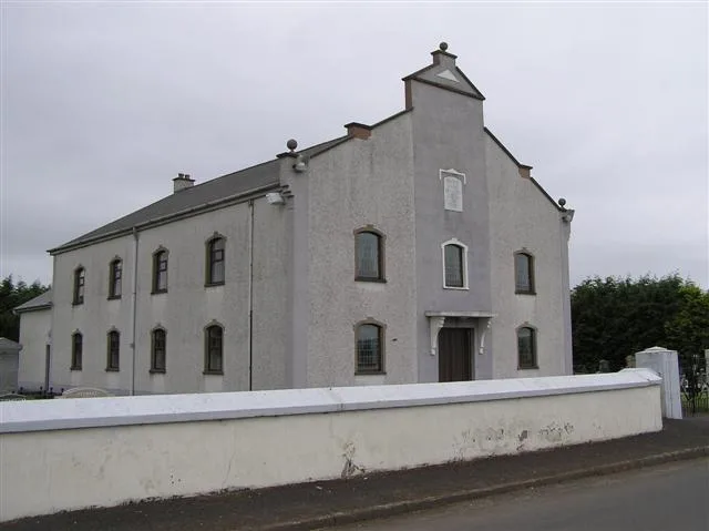
Moneydig Presbyterian Church
Historic churches · 2.0 km

Artnagross
Natural landmarks · 2.5 km

Movangher Caster Bawn
Historic houses · 2.5 km

Ballaghbeddy
Natural landmarks · 2.6 km
.png?width=1200)
Mullaghmore Airfield
Natural landmarks · 2.9 km
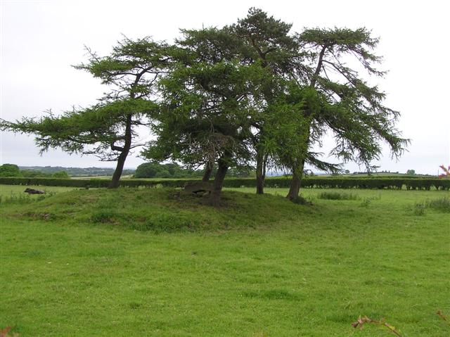
Moneydig
Villages · 3.2 km

Agivey River
Natural landmarks · 3.5 km

Kilrea
Towns & cities · 4.0 km

Aghadowey railway station
Natural landmarks · 4.6 km

Finvoy
Villages · 4.8 km
Nearby
📷 3📷 3📷 3Historic churches · Northern Ireland
Moneydig Presbyterian Church
Moneydig Presbyterian Church is a historic church in the United Kingdom.
📷 5📷 5Historic houses · Northern Ireland
Movangher Caster Bawn
Movangher Caster Bawn — a historic house in northern-ireland, United Kingdom.
📷 3Natural landmarks · Northern Ireland
Ballaghbeddy
Ballaghbeddy in Northern Ireland, United Kingdom.
Where to eat & stay near River Bann
Places to stay
 📷 5
📷 5 📷 5
📷 5 📷 5
📷 5Caravan parks · Northern Ireland
Tullans Farm Caravan Park
Tullans Farm Caravan Park — a caravan park in northern ireland.
 📷 5
📷 5Caravan parks · Northern Ireland
Bush Caravan Park
Bush Caravan Park — a caravan park in northern ireland.
 📷 5
📷 5Caravan parks · Northern Ireland
Bellemont Caravan Park
Bellemont Caravan Park — a caravan park in northern ireland.
 📷 3
📷 3Caravan parks · Northern Ireland
Ballyleese Town and Country Caravan Park
Ballyleese Town and Country Caravan Park — a caravan park in northern ireland.
More natural landmarks in this region
 Flagship📷 4
Natural landmarks · Northern Ireland
Lough Erne
Lough Erne — lake in County Fermanagh, Northern Ireland, UK.
 Flagship📷 4
Natural landmarks · Northern Ireland
Lough Neagh
Lough Neagh — large lake in Northern Ireland.
 📷 3
📷 3Natural landmarks · Northern Ireland
Ballysaggart Lough
Ballysaggart Lough — lake in the United Kingdom.
 📷 5
📷 5Natural landmarks · Northern Ireland
Belmore Mountain
Belmore Mountain — mountain in the United Kingdom.
Frequently asked questions
- Where is River Bann?
- River Bann is in Northern Ireland, United Kingdom (postcode BT51 5UZ).
- What is River Bann?
- River Bann in Northern Ireland, United Kingdom.
- How do I get to River Bann?
- The nearest railway station is Ballymoney, about 8.3 km away. The nearest town is Kilrea. Drivers can use postcode BT51 5UZ.
- Is River Bann free to visit?
- Yes, River Bann is free to enter.
- How do I get to River Bann?
- Drivers can navigate to postcode BT51 5UZ. It sits within the East Londonderry parliamentary constituency.