
Literary houses · Mid Wales
Ringwork and cultivation remains 260m west of St Michael's Church
In or near Priestweston.
Ringwork and cultivation remains 260m west of St Michael's Church — a literary house museum in wales mid.

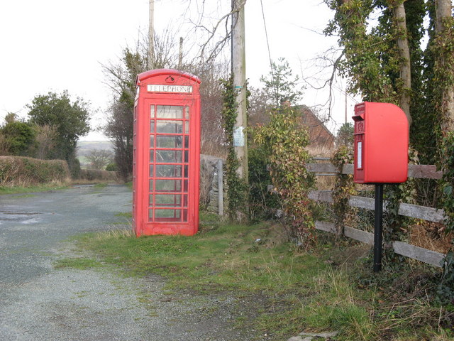
Michael Garlick — CC BY-SA 2.0 via Wikimedia Commons licence
_-_geograph.org.uk_-_6154463.jpg)
Plan your visit
- Typical visit
- 1 h–1.5 h
- Nearest railway station
- Welshpool · 9.3 km
- Wheelchair accessible
About
Ringwork and cultivation remains 260m west of St Michael's Church is a literary house museum located in wales mid. A British literary house preserving the home of a notable author, poet or playwright as a museum, often with original furniture and manuscripts. ringwork castle in Chirbury, Shropshire, England, UK
Photo gallery
See it from the streetimagery from 2023
Imagery © Mapillary contributors, CC BY-SA 4.0
Protected designations
- Area of Outstanding Natural Beauty: Shropshire Hills
Designations sourced from Natural England open data under OGL v3.
Place summary
Ringwork and cultivation remains located 260m west of St Michael's Church in Mid Wales. This site features earthworks that indicate a historical defensive structure, typical of medieval fortifications. The cultivation remains suggest agricultural activity in the area, providing insight into the landscape's use over time. The site is of archaeological interest, contributing to the understanding of local history and settlement patterns.
AI-generated from the structured facts on this page (operator, designation, listing, era). Not a substitute for visiting.
- Coordinates
- 52.5790, -3.0953
- District
- Shropshire
- Parish
- Chirbury with Brompton
- Postcode
- SY15 6BQ
- Parliamentary constituency
- South Shropshire
- Nearest railway station
- Welshpool — 9.3 km
Sources
- wikidata: Q17664492 (CC0)
Other places nearby

Chirbury Fort (Mercian)
Historic houses · 0.0 km

Chirbury Castle Mound
Castles · 0.1 km

Herbert Arms Hotel
Historic pubs · 0.2 km

Chirbury
Memorials & monuments · 0.2 km

Chirbury War Memorial
Memorials & monuments · 0.3 km
Chirbury Priory (dissolved 1535)
Abbeys & priories · 0.3 km

River Camlad
Memorials & monuments · 1.3 km

Motte castle at the south end of East Dudston hamlet
Literary houses · 1.8 km
Dudston Castle Mound
Castles · 1.8 km
Hockleton
Castles · 2.1 km

Hagley Castle
Literary houses · 2.1 km

Hagley
Castles · 2.1 km
Nearby
📷 3Historic houses · Mid Wales
Chirbury Fort (Mercian)
Chirbury Fort (Mercian) — a historic house in wales-mid, United Kingdom.
📷 5📷 7📷 4📷 3Memorials & monuments · Mid Wales
Chirbury War Memorial
Chirbury War Memorial — Grade II listed building-listed memorial in wales-mid, United Kingdom.
📷 3Abbeys & priories · Mid Wales
Chirbury Priory (dissolved 1535)
Chirbury Priory (dissolved 1535) — a abbey in wales-mid, United Kingdom.
Where to eat & stay near Ringwork and cultivation remains 260m west of St Michael's Church
Places to stay
 📷 5
📷 5 📷 5
📷 5 📷 5
📷 5 📷 5
📷 5Caravan parks · Mid Wales
Daisy Bank Touring Caravan Park
Daisy Bank Touring Caravan Park — a caravan park in wales mid.
 📷 5
📷 5Caravan parks · Mid Wales
Runnis Meadow Campsite
Runnis Meadow Campsite — a caravan park in wales mid.
 📷 5
📷 5Places to eat & drink
📷 7 📷 4
📷 4Historic pubs · Mid Wales
The Checkers
The Checkers in Wales Mid, United Kingdom.
 📷 7
📷 7 📷 5
📷 5Historic pubs · Mid Wales
The Black Lion And Forecourt Railings
The Black Lion And Forecourt Railings in Wales Mid, United Kingdom.
 📷 7
📷 7Historic pubs · Mid Wales
The Six Bells And Former Stables To Rear
The Six Bells And Former Stables To Rear in Wales Mid, United Kingdom.
 📷 5
📷 5More places in this region
 📷 5
📷 5Literary houses · Mid Wales
Little Shrawardine Castle
Little Shrawardine Castle — a literary house museum in wales north.
 📷 5
📷 5Literary houses · Mid Wales
Wollaston Castle
Wollaston Castle — a literary house museum in wales north.
 📷 5
📷 5Literary houses · Mid Wales
Barmouth Tower House
Barmouth Tower House — a literary house museum in wales north.
 📷 5
📷 5Literary houses · Mid Wales
Ringwork 540m north of Lane Farm
Ringwork 540m north of Lane Farm — a literary house museum in wales north.
Frequently asked questions
- Where is Ringwork and cultivation remains 260m west of St Michael's Church?
- Ringwork and cultivation remains 260m west of St Michael's Church is in Mid Wales, United Kingdom (postcode SY15 6BQ), in the parish of Chirbury with Brompton.
- What is Ringwork and cultivation remains 260m west of St Michael's Church?
- Ringwork and cultivation remains 260m west of St Michael's Church — a literary house museum in wales mid.
- How do I get to Ringwork and cultivation remains 260m west of St Michael's Church?
- The nearest railway station is Welshpool, about 9.3 km away. Drivers can use postcode SY15 6BQ.
- Is Ringwork and cultivation remains 260m west of St Michael's Church a protected site?
- Yes — Ringwork and cultivation remains 260m west of St Michael's Church is part of the Shropshire Hills National Landscape (AONB).
- How do I get to Ringwork and cultivation remains 260m west of St Michael's Church?
- Drivers can navigate to postcode SY15 6BQ. It sits within the South Shropshire parliamentary constituency.