Natural landmarks · Northern Ireland
Ring of Gullion
Also known as: Fáinne Cnoc Shliabh gCuillinn
In or near Mullaghbawn.
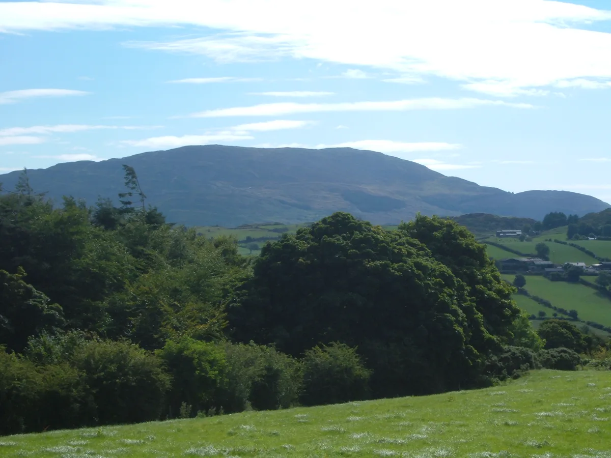
Ring of Gullion in Northern Ireland, United Kingdom.

Rossographer — CC BY-SA 2.0 via Wikimedia Commons licence
Plan your visit
- Typical visit
- 1 h–2 h
- Nearest railway station
- Newry · 8.1 km
- Free entry
- Dog-friendly
Getting there & planning your visit
To visit the Ring of Gullion, the nearest railway station is Newry, located 8.1 km away. The postcode for sat-nav is BT35 8LH, and entry to the site is free.
About
Ring of Gullion is a place of interest in Northern Ireland, United Kingdom — drawn from open-data sources for visitor reference. See the linked Wikipedia article for the full description.
Photo gallery
Official information
The Ring of Gullion is an Area of Outstanding Natural Beauty located in south Armagh, known for its unique geological features and rich cultural heritage. Visitors can explore various walking and cycling routes that showcase the area's geology, archaeology, and wildlife.
From the Wikipedia article
The Ring of Gullion (Irish: Fáinne Cnoc Shliabh gCuillinn, meaning 'the ring of Slieve Gullion') is a geological formation and area, officially designated as an Area of Outstanding Natural Beauty, (AONB) located in County Armagh, Northern Ireland. The area centres on Slieve Gullion, the highest peak in County Armagh, measures roughly 42 by 18 kilometres (26 by 11 mi) and comprises some 150 km2 defined topographically by the hills of an ancient ring dyke. Parts of the area have also been officially listed as Areas of Special Scientific Interest. The geological formation was the first ring dyke to be mapped, although its significance was not understood until similar structures had been described from Scotland. It was emplaced during the Paleogene opening of the Atlantic Ocean during the formation of the North Atlantic Igneous Province.
Excerpt from Wikipedia under CC BY-SA 4.0. See the source article linked in Sources below.
Background
Description
From the Irish Doirse, which means 'Doors' or 'gates', this Iron Age earthwork is located at Dorsey on the western edge of the Ring of Gullion. The structure consists of two roughly parallel massive earth bank and ditch ramparts over a mile long lie astride an old routeway to Eamhain Macha (Navan Fort, near Armagh – the ancient capital of Ulster). Recent evidence dates part of the monument to around 100BC, contemporary with a major phase of activity at Navan and lending support to the tradition that the Dorsey was once the 'gateway' to Ulster. The function of the Dorsey is a matter of debate. It has been suggested that it was a defensive enclosure related to the Black Pig's Dyke whilst…
Sourced from Wikipedia under CC BY-SA 4.0.
- Coordinates
- 54.1290, -6.4340
- District
- Newry, Mourne and Down
- Postcode
- BT35 8LH
- Parliamentary constituency
- Newry and Armagh
- Established
- 1966
- Nearest railway station
- Newry — 8.1 km
- Official site
- www.ringofgullion.org
Sources
- wikidata: Q2571519 (CC0)
- wikipedia: Ring of Gullion (CC BY-SA 4.0)
Other places nearby
Slieve Gullion North Cairn
Burial mounds & barrows · 0.3 km
Slieve Gullion
Natural landmarks · 0.5 km

Slieve Gullion
Mountains & hills · 0.8 km

Slieve Gullion South Cairn
Burial mounds & barrows · 0.8 km

Ballard
Natural landmarks · 1.6 km

Killeavy Castle
Castles · 1.6 km

Killeavy Castle
Castles · 1.6 km
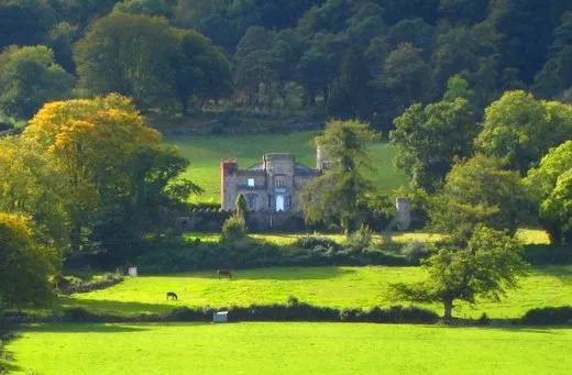
Killevy Castle
Castles · 1.6 km

Clonlum North Cairn
Burial mounds & barrows · 2.1 km

Clonlum South Cairn
Burial mounds & barrows · 2.2 km

Milltown
Villages · 2.6 km

Camlough Reservoir
Reservoirs & lochs · 2.6 km
Nearby
📷 3Burial mounds & barrows · Northern Ireland
Slieve Gullion North Cairn
Slieve Gullion North Cairn — a burial mound in northern-ireland, United Kingdom.
📷 3Natural landmarks · Northern Ireland
Slieve Gullion
Slieve Gullion is a natural landmark in the United Kingdom.
📷 5Mountains & hills · Northern Ireland
Slieve Gullion
Slieve Gullion — mountain in northern ireland. Elevation: 573 m.
📷 3Burial mounds & barrows · Northern Ireland
Slieve Gullion South Cairn
Slieve Gullion South Cairn — a burial mound in northern-ireland, United Kingdom.
📷 3📷 3Castles · Northern Ireland
Killeavy Castle
Killeavy Castle — a castle in northern-ireland, United Kingdom.
Where to eat & stay near Ring of Gullion
Places to stay
 📷 5
📷 5Caravan parks · Northern Ireland
Slieve Gullion Getaways
Slieve Gullion Getaways — a caravan park in northern ireland.
 📷 5
📷 5Hostels · Northern Ireland
Kilbroney Youth Centre C.O.I
Kilbroney Youth Centre C.O.I — a hostel in northern ireland.
 📷 5
📷 5Caravan parks · Northern Ireland
Kilbroney Caravan Park
Kilbroney Caravan Park — a caravan park in northern ireland.
 📷 5
📷 5Caravan parks · Northern Ireland
Touring in the Trees - Kilbroney
Touring in the Trees - Kilbroney — a caravan park in northern ireland.
 📷 5
📷 5 📷 5
📷 5More natural landmarks in this region
 Flagship📷 4
Natural landmarks · Northern Ireland
Lough Erne
Lough Erne — lake in County Fermanagh, Northern Ireland, UK.
 Flagship📷 4
Natural landmarks · Northern Ireland
Lough Neagh
Lough Neagh — large lake in Northern Ireland.
 📷 3
📷 3Natural landmarks · Northern Ireland
Ballysaggart Lough
Ballysaggart Lough — lake in the United Kingdom.
 📷 5
📷 5Natural landmarks · Northern Ireland
Belmore Mountain
Belmore Mountain — mountain in the United Kingdom.
Frequently asked questions
- Where is Ring of Gullion?
- Ring of Gullion is in Northern Ireland, United Kingdom (postcode BT35 8LH).
- What is Ring of Gullion?
- Ring of Gullion in Northern Ireland, United Kingdom.
- How do I get to Ring of Gullion?
- The nearest railway station is Newry, about 8.1 km away. Drivers can use postcode BT35 8LH.
- When was Ring of Gullion built?
- Built or established in 1966.
- Is Ring of Gullion free to visit?
- Yes, Ring of Gullion is free to enter.
- How do I get to Ring of Gullion?
- Drivers can navigate to postcode BT35 8LH. It sits within the Newry and Armagh parliamentary constituency.