Natural landmarks · North Wales
Rhobell Fawr
In or near Llanfachreth.
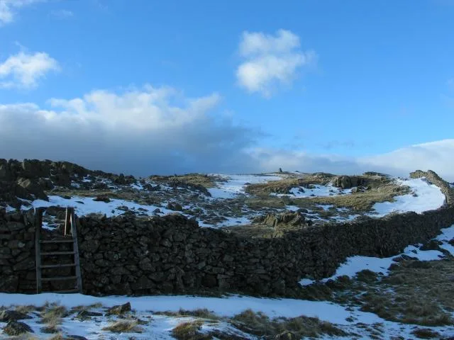
Rhobell Fawr — mountain (734m) in Gwynedd.

Wikimedia Commons contributors — see linked file page for photographer and licence licence
Plan your visit
- Typical visit
- 1 h–2 h
- Free entry
- Dog-friendly
About
Rhobell Fawr is a named natural landmark in the United Kingdom. Wikidata describes it as: "mountain (734m) in Gwynedd". Coordinates: 52.8140°, -3.8020°.
Photo gallery
From the Wikipedia article
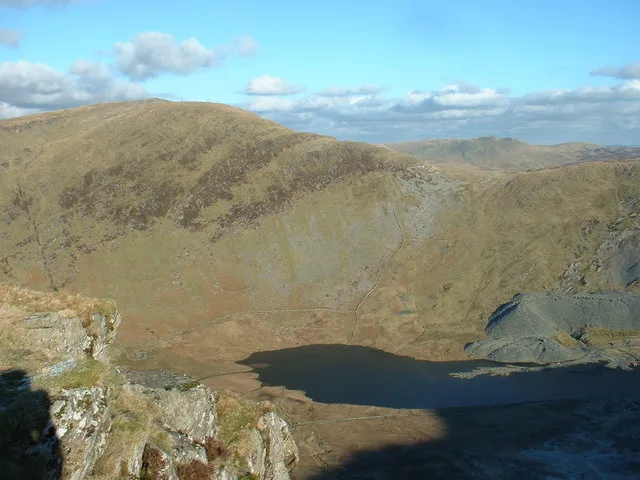
Rhobell Fawr is a mountain and the site of an ancient volcano that was active during the Early Ordovician period in the Arenig range within the Snowdonia National Park. Despite its modest height of 734 m (2,408 feet), it is a mountain with views of higher peaks all around, including the north face of Cadair Idris and distant Snowdon. The paths are not well trodden, but there is a distinct path up from Bwlch Goriwared, a couple of miles north-north-east of the small village of Llanfachreth.
Excerpt from Wikipedia under CC BY-SA 4.0. See the source article linked in Sources below.
- Coordinates
- 52.8140, -3.8020
- Address
- Gwynedd, Wales
Sources
- wikidata: Q7320822 (CC0)
- wikipedia: Rhobell Fawr (CC BY-SA 4.0)
- commons: Summit of Rhobell Fawr - geograph.org.uk - 910.jpg (CC BY-SA 4.0)
Other places nearby
Rhobell Fawr
Mountains & hills · 0.1 km

Cynefin Bryn Blew
Mountains & hills · 0.3 km

Graig Fach
Mountains & hills · 0.9 km

Bryn Melyn
Mountains & hills · 1.7 km

Moel Cae'r-defaid
Mountains & hills · 1.7 km
Moel Cae'r-defaid West Top
Mountains & hills · 1.7 km

Rhobell Ganol
Mountains & hills · 1.8 km

Moel Cors-y-garnedd
Mountains & hills · 2.1 km

Craig y Benglog
Mountains & hills · 2.2 km

Craig y Benglog
Mountains & hills · 2.2 km

Cerniau
Mountains & hills · 2.5 km

Bryniau Cogau
Mountains & hills · 2.6 km
Nearby
📷 3📷 3Mountains & hills · North Wales
Cynefin Bryn Blew
Cynefin Bryn Blew — a mountain in wales-north, United Kingdom, 719 m.
📷 5📷 5📷 3Mountains & hills · North Wales
Moel Cae'r-defaid
Moel Cae'r-defaid — a mountain in wales-north, United Kingdom, 531 m.
📷 5Mountains & hills · North Wales
Moel Cae'r-defaid West Top
Moel Cae'r-defaid West Top — a hill or mountain in wales north.
Where to eat & stay near Rhobell Fawr
Places to stay
 📷 5
📷 5Caravan parks · North Wales
Parc Gwliau Dolgamedd Holiday Park
Parc Gwliau Dolgamedd Holiday Park — a caravan park in wales north.
 📷 5
📷 5 📷 5
📷 5 📷 5
📷 5Caravan parks · North Wales
Hendre Mawr Caravan Park
Hendre Mawr Caravan Park — a caravan park in wales north.
 📷 5
📷 5 📷 5
📷 5Campsites · North Wales
Cae Gwyn Farm Holidays
Cae Gwyn Farm Holidays — a campsite in wales north.
Places to eat & drink
 📷 7
📷 7 📷 7
📷 7 📷 7
📷 7 📷 5
📷 5 📷 6
📷 6 📷 5
📷 5More natural landmarks in this region
 Flagship📷 5
Natural landmarks · North Wales
Llyn Llydaw
Llyn Llydaw is a natural landmark in the United Kingdom.
 📷 5
📷 5Natural landmarks · North Wales
Llyn Tegid
Llyn Tegid is a natural landmark in the United Kingdom.
 📷 3
📷 3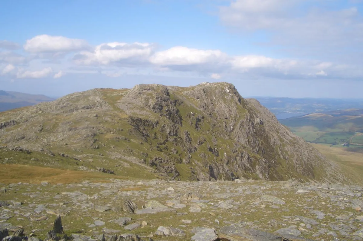 📷 3
📷 3Natural landmarks · North Wales
Aran Benllyn
Aran Benllyn — mountain (885m) in Gwynedd.
Frequently asked questions
- Where is Rhobell Fawr?
- Rhobell Fawr is in North Wales, United Kingdom.
- What is Rhobell Fawr?
- Rhobell Fawr — mountain (734m) in Gwynedd.
- How do I get to Rhobell Fawr?
- Its coordinates are 52.8140°, -3.8020°.
- Is Rhobell Fawr free to visit?
- Yes, Rhobell Fawr is free to enter.