
Memorials & monuments · South East England
Remains Of A Direction Finding (D/F) Tower, Ventnor Y-Station
In or near Wroxall.
Remains Of A Direction Finding (D/F) Tower, Ventnor Y-Station — Grade II listed building-listed memorial in england-south-east, United Kingdom.

Nigel Freeman — CC BY-SA 2.0 via Wikimedia Commons licence

Plan your visit
- Typical visit
- 15 min–45 min
- Nearest railway station
- Shanklin · 5.5 km
- Free entry
- Dog-friendly
Getting there & planning your visit
To visit the Remains Of A Direction Finding (D/F) Tower, Ventnor Y-Station, the nearest railway station is Shanklin, which is 5.5 km away. The postcode for the location is PO38 1LX, and entry is free.
About
Remains Of A Direction Finding (D/F) Tower, Ventnor Y-Station is a Grade II listed building-listed memorial in england-south-east, United Kingdom, registered on the National Heritage List for England (NHLE entry 1427450). Listed status protects buildings and structures of special architectural or historic interest. See the linked Wikipedia article for further details.
Photo gallery
Heritage listing
Details The remains of a D/F (Direction Finding) tower, Ventnor Y-station, c1942, comprising a protective brick wall, a concrete floor pad within it (the foundations for the wooden tower, now demolished), and concrete pads for the tower supports (also now gone). MATERIALS: red brick for the protective wall; the floor pad and tower foundations are of concrete as are the external tower support pads. PLAN: an octagonal structure. DESCRIPTION: the D/F tower’s octagonal red brick wall is in English bond capped with a soldier course with iron fixings. Set into the hill slope on Rew Down above Ventnor Bay, the wall is therefore of varying height but rises to a maximum of approximately 2m 25cm and is 36cm wide. The overall enclosure is circa 5m 40 in width. Seven sides contain loop holes for small arms, those on the upslope (north) side being higher up the wall. The eighth side, to the south-east, provides access to the interior. Here is a concrete floor pad with a gutter running around the internal face of the brick wall. In the centre of the pad is a recessed octagonal concrete platform, approximately 3m 90cm in diameter, with dwarf walls 15cm wide and some surviving iron fixings. This would have formed the foundation for the wooden tower (demolished). A cable-trench (63cm wide) runs through its centre on a west-east axis. Evenly distributed around the outside of the brick enclosure are seven concrete pads with one or two rectangular slots cut into them; these were the bases for wooden struts to support the tower.
From the Historic England List Entry under OGL v3.
Protected designations
- Site of Special Scientific Interest: Rew Down SSSI
- Site of Special Scientific Interest: Compton Chine to Steephill Cove SSSI
- Area of Outstanding Natural Beauty: Isle Of Wight
Designations sourced from Natural England open data under OGL v3.
Place summary
The Remains of a Direction Finding (D/F) Tower, located in Ventnor, South-East England, is a Grade II listed memorial. This structure is part of the Ventnor Y-Station, which played a role in wartime communications.
AI-generated from the structured facts on this page (operator, designation, listing, era). Not a substitute for visiting.
- Coordinates
- 50.5948, -1.2274
- District
- Isle of Wight
- Parish
- Ventnor
- Postcode
- PO38 1LX
- Parliamentary constituency
- Isle of Wight East
- Nearest railway station
- Shanklin — 5.5 km
Sources
- wikidata: Q26677344 (CC0)
Other places nearby

Steephill
Castles · 0.5 km
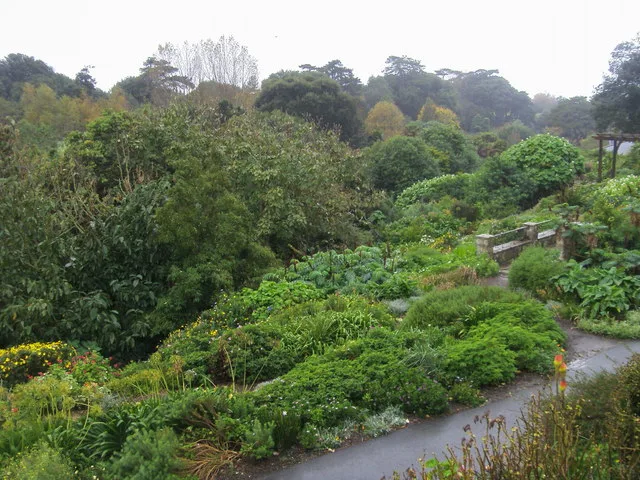
Ventnor Botanic Garden
Gardens · 0.6 km

Week Down
Mountains & hills · 0.7 km

Saint Lawrence
Villages · 0.7 km

Ventnor Cemetery
Cemeteries · 0.8 km

Ventnor War Memorial
Memorials & monuments · 0.8 km

Lisle Combe
B&Bs · 0.9 km
Ventnor Park Putting
Parks · 0.9 km
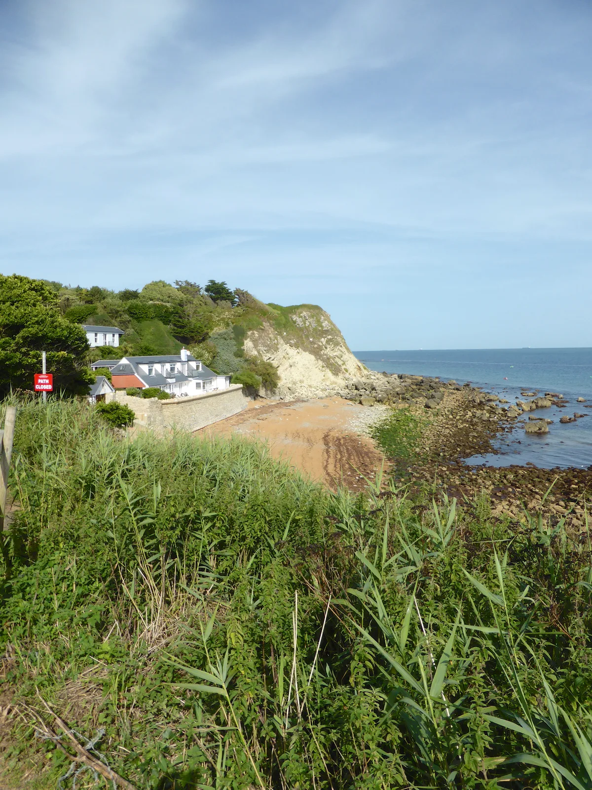
Orchard Bay
Mountains & hills · 1.0 km

Ventnor
Viewpoints · 1.0 km

Eversley Hotel
Hotels · 1.0 km

Royal Hotel
Hotels · 1.1 km
Nearby
📷 5Castles · South East England
Steephill
Steephill is a hamlet near Ventnor, Isle of Wight, England, previously the location of a Victorian country estate with a castle-style mansion, Steephill Castle, which was demolished to build bungalows
Flagship📷 7Gardens · South East England
Ventnor Botanic Garden
Ventnor Botanic Garden is a garden in the United Kingdom.
📷 5Mountains & hills · South East England
Week Down
Week Down — mountain in england south east. Elevation: 211 m.
📷 5📷 5Cemeteries · South East England
Ventnor Cemetery
Ventnor Cemetery is a cemetery in the United Kingdom.
📷 5Memorials & monuments · South East England
Ventnor War Memorial
Ventnor War Memorial — Grade II listed building-listed memorial in england-south-east, United Kingdom.
Where to eat & stay near Remains Of A Direction Finding (D/F) Tower, Ventnor Y-Station
Places to stay
📷 5B&Bs · South East England
Lisle Combe
Lisle Combe — a bed-and-breakfast in england south east.
📷 6📷 7 📷 7
📷 7Hotels · South East England
Hambrough Hotel
Hambrough Hotel — a hotel in england south east.
 📷 5
📷 5 📷 5
📷 5Campsites · South East England
3rd Ventnor Scouts Campsite
3rd Ventnor Scouts Campsite — a campsite in england south east.
Places to eat & drink
 📷 5
📷 5 📷 5
📷 5Cafés · South East England
No24 Ventnor
No24 Ventnor — a café in england south east.
 📷 7
📷 7Historic pubs · South East England
The Griffin Public House
The Griffin Public House in England South East, United Kingdom.
 📷 7
📷 7 📷 7
📷 7Historic pubs · South East England
The Buddle Inn
The Buddle Inn in England South East, United Kingdom.
 📷 7
📷 7Historic pubs · South East England
King Harry's Bar
King Harry's Bar in England South East, United Kingdom.
More memorials in this region
 📷 5
📷 5Memorials & monuments · South East England
Air Forces Memorial
Air Forces Memorial is a memorial in the United Kingdom.
 📷 5
📷 5Memorials & monuments · South East England
All Saints Church
All Saints Church is a memorial in the United Kingdom.
 📷 5
📷 5Memorials & monuments · South East England
Bevans War Memorial
Bevans War Memorial is a memorial in the United Kingdom.
.jpg?width=1200) 📷 5
📷 5Memorials & monuments · South East England
Cumberland Obelisk
Cumberland Obelisk is a memorial in the United Kingdom.
Frequently asked questions
- Where is Remains Of A Direction Finding (D/F) Tower, Ventnor Y-Station?
- Remains Of A Direction Finding (D/F) Tower, Ventnor Y-Station is in South-East England, United Kingdom (postcode PO38 1LX), in the parish of Ventnor.
- What is Remains Of A Direction Finding (D/F) Tower, Ventnor Y-Station?
- Remains Of A Direction Finding (D/F) Tower, Ventnor Y-Station — Grade II listed building-listed memorial in england-south-east, United Kingdom.
- How do I get to Remains Of A Direction Finding (D/F) Tower, Ventnor Y-Station?
- The nearest railway station is Shanklin, about 5.5 km away. Drivers can use postcode PO38 1LX.
- Is Remains Of A Direction Finding (D/F) Tower, Ventnor Y-Station a listed building?
- Remains Of A Direction Finding (D/F) Tower, Ventnor Y-Station is officially recognised as Grade II listed building listed.
- Is Remains Of A Direction Finding (D/F) Tower, Ventnor Y-Station a protected site?
- Yes — Remains Of A Direction Finding (D/F) Tower, Ventnor Y-Station is part of the Rew Down SSSI Site of Special Scientific Interest and the Compton Chine to Steephill Cove SSSI Site of Special Scientific Interest.
- Is Remains Of A Direction Finding (D/F) Tower, Ventnor Y-Station free to visit?
- Yes, Remains Of A Direction Finding (D/F) Tower, Ventnor Y-Station is free to enter.
- How do I get to Remains Of A Direction Finding (D/F) Tower, Ventnor Y-Station?
- The nearest railway station is Shanklin, about 5.5 km away. Drivers can navigate to postcode PO38 1LX.