
Historic bridges · South East England
Redbridge Bridge
In or near Ashurst.
Redbridge Bridge — Grade II* listed building-listed bridge in england-south-east, United Kingdom.

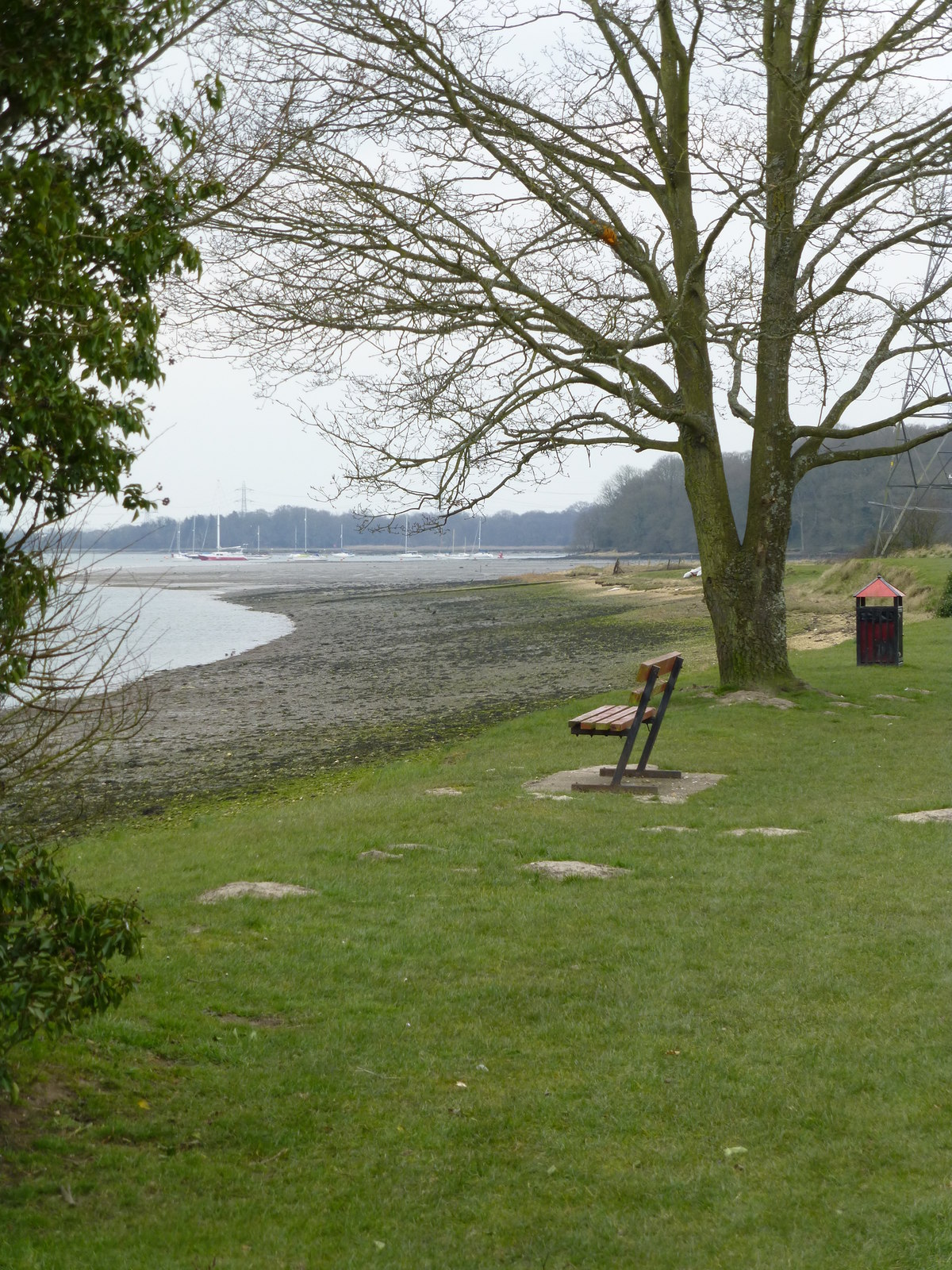
David Martin — CC BY-SA 2.0 via Wikimedia Commons licence

Plan your visit
- Typical visit
- 15 min–30 min
- Nearest railway station
- Redbridge · 0.5 km
- Free entry
- Dog-friendly
Getting there & planning your visit
To visit Redbridge Bridge, you can take a train to Redbridge station, which is 0.5 km away. The postcode for navigation is SO16 9JP, and entry to the bridge is free.
About
Redbridge Bridge is a Grade II* listed building-listed bridge in england-south-east, United Kingdom, registered on the National Heritage List for England (NHLE entry 1351230). Listed status protects buildings and structures of special architectural or historic interest. See the linked Wikipedia article for further details.
Photo gallery
See it from the streetimagery from 2021
Imagery © Mapillary contributors, CC BY-SA 4.0
Heritage listing
Redbridge is a ward with a population of 14,432, 3.1 miles (5.0 km) to the west of the city centre of Southampton, England. The settlement is positioned at the mouth of the River Test and is the southern terminus of the former Andover Canal and Sprat and Winkle railway line, and the modern M271 motorway. Because of its strategic position, the settlement became a substantial trading post and shipbuilding centre, with many merchant and Royal Navy vessels being constructed in Redbridge in the 18th and 19th centuries. Today, the area is mainly residential and industrial, with a large council estate and a tower block situated within the ward and Southampton Docks close by. The A35 road crosses the River Test at Redbridge, as does the South West Main Line railway.
From the Historic England List Entry under OGL v3.
Protected designations
- Site of Special Scientific Interest: The New Forest SSSI
- Site of Special Scientific Interest: Lower Test Valley SSSI
- Ramsar wetland: Solent & Southampton Water
Designations sourced from Natural England open data under OGL v3.
From the Wikipedia article
Redbridge is a ward with a population of 14,432, 3.1 miles (5.0 km) to the west of the city centre of Southampton, England. The settlement is positioned at the mouth of the River Test and is the southern terminus of the former Andover Canal and Sprat and Winkle railway line, and the modern M271 motorway. Because of its strategic position, the settlement became a substantial trading post and shipbuilding centre, with many merchant and Royal Navy vessels being constructed in Redbridge in the 18th and 19th centuries. Today, the area is mainly residential and industrial, with a large council estate and a tower block situated within the ward and Southampton Docks close by. The A35 road crosses the River Test at Redbridge, as does the South West Main Line railway. It has a small railway station.
Excerpt from Wikipedia under CC BY-SA 4.0. See the source article linked in Sources below.
- Coordinates
- 50.9217, -1.4750
- District
- Southampton
- Parish
- Southampton, unparished area
- Postcode
- SO16 9JP
- Parliamentary constituency
- Southampton Test
- Nearest railway station
- Redbridge — 0.5 km
Sources
- wikidata: Q17534568 (CC0)
- wikipedia: Redbridge Bridge (CC BY-SA 4.0)
Other places nearby

River Test
Museums · 0.5 km
Shipwrecks
Museums · 0.9 km

Lower Test Nature Reserve
Forests & woodlands · 1.0 km

The Cross Keys Public House
Historic pubs · 1.0 km

Totton and Eling
Museums · 1.1 km

Goatee Shore
Natural landmarks · 1.2 km

Eling Tide Mill Experience Visitor Centre
Museums · 1.3 km

Eling Tide Mill
Watermills · 1.3 km

Houdini's
Escape rooms · 1.6 km

Testwood Paddling Pool
Lidos & outdoor pools · 1.6 km

Colbury Manor
Manor houses · 1.7 km

Millbrook Community School
Natural landmarks · 2.1 km
Nearby
📷 5📷 5📷 5Forests & woodlands · South East England
Lower Test Nature Reserve
Lower Test Nature Reserve is a forest or woodland in the United Kingdom.
📷 7Historic pubs · South East England
The Cross Keys Public House
The Cross Keys Public House in England South East, United Kingdom.
📷 5Museums · South East England
Totton and Eling
Totton and Eling — a museum in england-south-east, United Kingdom.
📷 5Natural landmarks · South East England
Goatee Shore
Goatee Shore — a other in england-south-east, United Kingdom.
Where to eat & stay near Redbridge Bridge
Places to stay
 📷 5
📷 5B&Bs · South East England
The Regent Guest House
The Regent Guest House — a bed-and-breakfast in england south east.
 📷 5
📷 5Hostels · South East England
Ronald McDonald House
Ronald McDonald House — a hostel in england south east.
 📷 7
📷 7 📷 7
📷 7Hotels · South East England
Elizabeth House Hotel
Elizabeth House Hotel — a hotel in england south east.
 📷 5
📷 5Caravan parks · South East England
Green Pastures Caravan Site
Green Pastures Caravan Site — a caravan park in england south east.
 📷 5
📷 5Campsites · South East England
Ashurst Caravan & Camping Site
Ashurst Caravan & Camping Site — a campsite in england south east.
Places to eat & drink
📷 7Historic pubs · South East England
The Cross Keys Public House
The Cross Keys Public House in England South East, United Kingdom.
 📷 5
📷 5Historic pubs · South East England
White Horse
White Horse in England South East, United Kingdom.
 📷 7
📷 7Historic pubs · South East England
The Cowherds Inn
The Cowherds Inn in England South East, United Kingdom.
 📷 5
📷 5Historic pubs · South East England
Pensioners Arms Public House
Pensioners Arms Public House in England South East, United Kingdom.
 📷 7
📷 7Historic pubs · South East England
Star Hotel
Star Hotel in England South East, United Kingdom.
 📷 7
📷 7More bridges in this region
 📷 5
📷 5Historic bridges · South East England
Briary Hill Bridge east
Briary Hill Bridge east is a historic bridge in the United Kingdom.
 📷 5
📷 5Historic bridges · South East England
Briary Hill Bridge west
Briary Hill Bridge west is a historic bridge in the United Kingdom.
 📷 5
📷 5Historic bridges · South East England
Bridge 157 VIR (Bath Hard Road)
Bridge 157 VIR (Bath Hard Road) is a historic bridge in the United Kingdom.
 📷 5
📷 5Historic bridges · South East England
Dorking Arch Bridge
Dorking Arch Bridge is a historic bridge in the United Kingdom.
Frequently asked questions
- Where is Redbridge Bridge?
- Redbridge Bridge is in South-East England, United Kingdom (postcode SO16 9JP), in the parish of Southampton, unparished area.
- What is Redbridge Bridge?
- Redbridge Bridge — Grade II* listed building-listed bridge in england-south-east, United Kingdom.
- How do I get to Redbridge Bridge?
- The nearest railway station is Redbridge, about 0.5 km away. Drivers can use postcode SO16 9JP.
- Is Redbridge Bridge a listed building?
- Redbridge Bridge is officially recognised as Grade II* listed building listed.
- Is Redbridge Bridge a protected site?
- Yes — Redbridge Bridge is part of the The New Forest SSSI Site of Special Scientific Interest and the Lower Test Valley SSSI Site of Special Scientific Interest.
- Is Redbridge Bridge free to visit?
- Yes, Redbridge Bridge is free to enter.
- How do I get to Redbridge Bridge?
- The nearest railway station is Redbridge, about 0.5 km away. Drivers can navigate to postcode SO16 9JP.