Mountains & hills · North East England
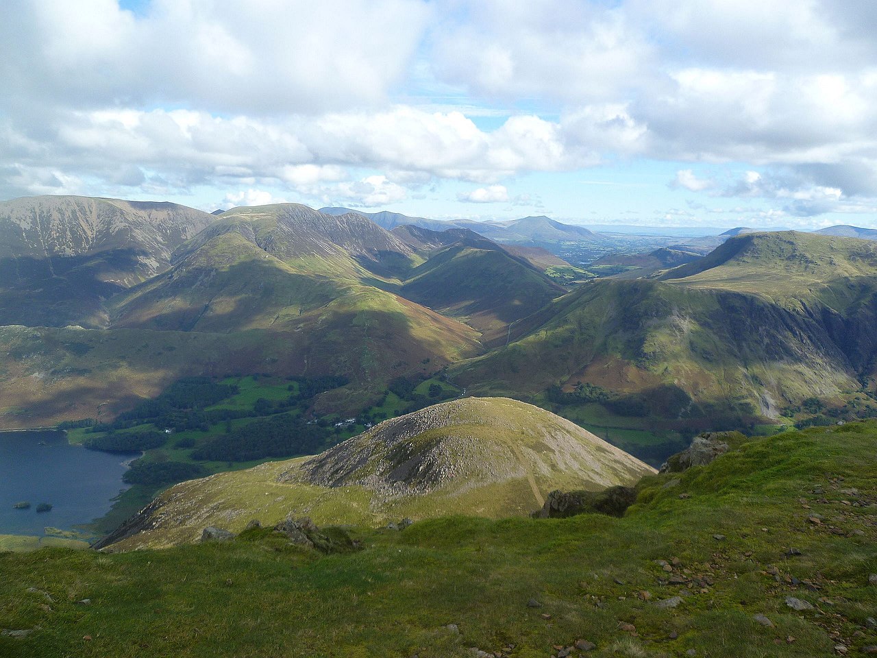
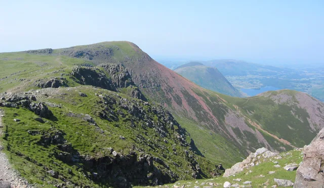
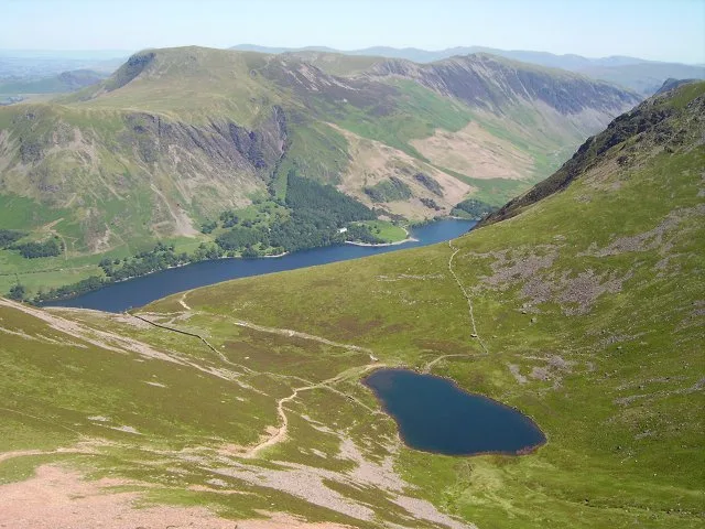
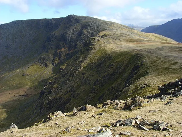
Red Pike (Buttermere)
Red Pike (Buttermere) — a hill or mountain in england north east.
Michael Graham — CC BY-SA 2.0 via Wikimedia Commons licence
Plan your visit
- Typical visit
- 3 h–8 h
- Best time of year
- Late spring – early autumn (May–Oct)
About
A British hill or mountain, named on Ordnance Survey maps and walked by hill-baggers. Red Pike (Buttermere) is a named hill or mountain in england north east, recorded in the GeoNames UK gazetteer. British landmarks of this type are typically marked on Ordnance Survey maps and recorded in the national gazetteer for cartographic and navigational reference. Coordinates and feature classification are sourced from the GeoNames open dataset.
Photo gallery
Place summary
Red Pike is a mountain located in North-East England, part of the Lake District National Park. It stands at 2,507 feet (764 metres) and offers striking views of the surrounding landscape, including Buttermere and Crummock Water. The area is popular for hiking and walking trails, attracting outdoor enthusiasts seeking varied terrain and scenic vistas.
AI-generated from the structured facts on this page (operator, designation, listing, era). Not a substitute for visiting.
- Coordinates
- 54.5276, -3.2990
Sources
- manual: geonames-6694110 (CC BY 4.0)
Other places nearby
Loading nearby places…
Nearby
 📷 3
📷 3Natural landmarks · North East England
Red Pike
Red Pike — fell near Buttermere in the Lake District, England.
 📷 3
📷 3Mountains & hills · North East England
Red Pike
Red Pike — Named summit at 755.3 m.
 📷 5
📷 5Mountains & hills · North East England
Dodd
Dodd — mountain in england north east. Elevation: 641.1 m.
 📷 3
📷 3Natural landmarks · North East England
Bleaberry Tarn
Bleaberry Tarn — lake in the United Kingdom.
 📷 3
📷 3Mountains & hills · North East England
High Stile (Wainwright)
High Stile (Wainwright) — Named summit at 806.2 m.
 📷 5
📷 5Mountains & hills · North East England
Little Dodd
Little Dodd — mountain in england north east. Elevation: 590 m.
Where to eat & stay near Red Pike (Buttermere)
Places to stay
 📷 5
📷 5Campsites · North East England
Syke Farm Campsite
Syke Farm Campsite — a campsite in england north east.
 📷 5
📷 5Hostels · North East England
Ennerdale
Ennerdale — a hostel in england north east.
 📷 5
📷 5Campsites · North East England
Dalegarth Guest House Camp Site
Dalegarth Guest House Camp Site — a campsite in england north east.
 📷 5
📷 5Hostels · North East England
YHA Black Sail
YHA Black Sail — a hostel in england north east.
 📷 5
📷 5Hostels · North East England
Honister Pass YHA
Honister Pass YHA — a hostel in england north east.
 📷 5
📷 5Hostels · North East England
Scouts - Ennerdale Campsite
Scouts - Ennerdale Campsite — a hostel in england north east.
Places to eat & drink
 📷 5
📷 5Cafés · North East England
Grange Bridge Cottage
Grange Bridge Cottage — a café in england north east.
 📷 5
📷 5Cafés · Scottish Lowlands
YHA Cafe
YHA Cafe — a café in scotland lowlands.
 📷 5
📷 5Historic pubs · Scottish Lowlands
The Pheasant Inn
The Pheasant Inn in Scotland Lowlands, United Kingdom.
 📷 5
📷 5Historic pubs · North West England
Fox and Grapes
Fox and Grapes in England North West, United Kingdom.
 📷 5
📷 5Historic pubs · North West England
The Travellers Rest
The Travellers Rest in England North West, United Kingdom.
 📷 5
📷 5Historic pubs · North West England
Golden Rule Hotel
Golden Rule Hotel in England North West, United Kingdom.
More mountains in this region
 📷 3
📷 3Mountains & hills · North East England
Angletarn Pikes
Angletarn Pikes — Named summit at 566 m.
 📷 3
📷 3Mountains & hills · North East England
Angletarn Pikes South Top
Angletarn Pikes South Top — Named summit at 563.6 m.
 📷 3
📷 3Mountains & hills · North East England
Ard Crags
Ard Crags — Named summit at 581 m.
 📷 3
📷 3Mountains & hills · North East England
Arnison Crag
Arnison Crag — Named summit at 433 m.
Frequently asked questions
- Where is Red Pike (Buttermere)?
- Red Pike (Buttermere) is in North-East England, United Kingdom.
- What is Red Pike (Buttermere)?
- Red Pike (Buttermere) — a hill or mountain in england north east.
- How do I get to Red Pike (Buttermere)?
- Its coordinates are 54.5276°, -3.2990°.