Mountains & hills · North West England
Randygill Top
In or near Tebay.
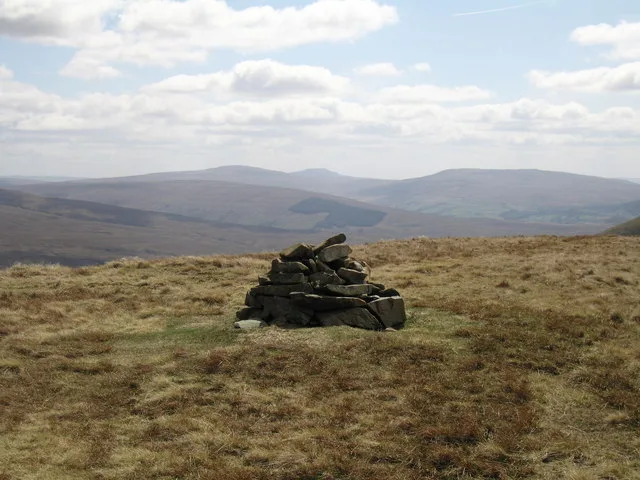
Randygill Top — a mountain in england-north-west, United Kingdom, 624 m.

David Brown — CC BY-SA 2.0 via Wikimedia Commons licence
Plan your visit
- Typical visit
- 3 h–8 h
- Best time of year
- Late spring – early autumn (May–Oct)
- Nearest railway station
- Kirkby Stephen · 10.0 km
- Free entry
- Dog-friendly
About
Randygill Top is a named summit in england-north-west, United Kingdom, with an elevation of approximately 624 metres. Listed in the Wikidata register of UK peaks; see the Wikipedia article for further details on the mountain's location, geology and walking routes.
Photo gallery
Protected designations
- Site of Special Scientific Interest: Langdale, Bowderdale and Carlin Gill SSSI
- Site of Special Scientific Interest: River Eden and Tributaries SSSI
Designations sourced from Natural England open data under OGL v3.
From the Wikipedia article
Randygill Top is a mountain located in the Howgill Fells, Cumbria (historically Westmorland), England.
Excerpt from Wikipedia under CC BY-SA 4.0. See the source article linked in Sources below.
- Coordinates
- 54.3949, -2.4834
- Address
- Westmorland and Furness, Cumbria, England
- Nearest railway station
- Kirkby Stephen — 10 km
Sources
- wikidata: Q104783377 (CC0)
- wikipedia: Randygill Top (CC BY-SA 4.0)
Other places nearby

Hooksey
Mountains & hills · 0.7 km

Kensgriff
Mountains & hills · 0.8 km

Kensgriff
Mountains & hills · 0.8 km

Hooksey
Mountains & hills · 0.8 km

Stockless
Mountains & hills · 0.9 km

Howgill Fells
Burial mounds & barrows · 1.2 km

Hazelgill Knott
Mountains & hills · 1.5 km
Hazelgill Knott
Mountains & hills · 1.5 km
Yarlside
Mountains & hills · 1.5 km
Green Bell
Natural landmarks · 1.6 km

Grere Fell
Mountains & hills · 1.7 km

Wandale Hill
Mountains & hills · 2.1 km
Nearby
📷 5Mountains & hills · North East England
Hooksey
Hooksey — mountain in england north west. Elevation: 586 m.
📷 5Mountains & hills · North West England
Kensgriff
Kensgriff — a hill or mountain in england north west.
📷 5Mountains & hills · North West England
Kensgriff
Kensgriff — mountain in england north west. Elevation: 574 m.
📷 5📷 5Mountains & hills · North West England
Stockless
Stockless — mountain in england north west. Elevation: 568 m.
📷 3Burial mounds & barrows · North East England
Howgill Fells
Howgill Fells in England North East, United Kingdom.
Where to eat & stay near Randygill Top
Places to stay
 📷 5
📷 5Campsites · North West England
Low Greenside Farm Campsite
Low Greenside Farm Campsite — a campsite in england north west.
 📷 7
📷 7Hotels · North West England
The Black Swan Hotel
The Black Swan Hotel — a hotel in england north west.
 📷 7
📷 7Hotels · North West England
The Kings Head
The Kings Head — a hotel in england north west.
 📷 5
📷 5Caravan parks · North West England
Cross Hall Caravan Park
Cross Hall Caravan Park — a caravan park in england north west.
📷 5Caravan parks · North West England
Cross Hall Camp Site
Cross Hall Camp Site — a caravan park in england north west.
 📷 5
📷 5Places to eat & drink
 📷 5
📷 5Cafés · North West England
The Cross Keys Temperance Inn
The Cross Keys Temperance Inn — a café in england north west.
 📷 5
📷 5Cafés · North West England
Gun Dog Coffee Shop
Gun Dog Coffee Shop — a café in england north west.
 📷 7
📷 7Cafés · North West England
The White Hare Cafe
The White Hare Cafe — a café in england north west.
 📷 5
📷 5Historic pubs · North East England
1, Scattergate
1, Scattergate in England North East, United Kingdom.
 📷 5
📷 5More mountains in this region
 📷 5
📷 5Mountains & hills · North West England
Appleton Park
Appleton Park — a hill or mountain in england west midlands.
 📷 5
📷 5Mountains & hills · North West England
High Warren
High Warren — mountain in england west midlands. Elevation: 105 m.
 📷 5
📷 5Mountains & hills · North West England
Alderley Edge
Alderley Edge — mountain in england west midlands. Elevation: 194 m.
 📷 3
📷 3Frequently asked questions
- Where is Randygill Top?
- Randygill Top is in North-West England, United Kingdom.
- What is Randygill Top?
- Randygill Top — a mountain in england-north-west, United Kingdom, 624 m.
- How do I get to Randygill Top?
- The nearest railway station is Kirkby Stephen, about 10.0 km away. Its coordinates are 54.3949°, -2.4834°.
- Is Randygill Top a protected site?
- Yes — Randygill Top is part of the Langdale, Bowderdale and Carlin Gill SSSI Site of Special Scientific Interest and the River Eden and Tributaries SSSI Site of Special Scientific Interest.
- Is Randygill Top free to visit?
- Yes, Randygill Top is free to enter.