
Historic bridges · North West England
Railway Bridge With Cutting Walls To North And South
In or near Aughton.
Railway Bridge With Cutting Walls To North And South — Grade II listed building-listed bridge in england-north-west, United Kingdom.

Galatas — CC BY-SA 2.0 via Wikimedia Commons licence

Plan your visit
- Typical visit
- 15 min–30 min
- Nearest railway station
- Ormskirk · 0.3 km
- Free entry
- Family-friendly
- Dog-friendly
Getting there & planning your visit
To visit the Railway Bridge With Cutting Walls To North And South, the nearest railway station is Ormskirk, located 0.3 km away. Entry is free.
About
Railway Bridge With Cutting Walls To North And South is a Grade II listed building-listed bridge in england-north-west, United Kingdom, registered on the National Heritage List for England (NHLE entry 1290562). Listed status protects buildings and structures of special architectural or historic interest. See the linked Wikipedia article for further details.
Photo gallery
See it from the streetimagery from 2025
Imagery © Mapillary contributors, CC BY-SA 4.0
Heritage listing
Details ORMSKIRK SD4108SE MOOR STREET 663-1/8/169 Railway Bridge with cutting walls to north and south GV II Public road bridge over cutting of Preston to Liverpool railway. c.1846-8. For the Liverpool, Ormskirk and Preston Railway Company; Rock faced sandstone. The cutting walls are approx.130m long, with a slightly concave batter, and have a moulded band and parapets of larger blocks with rounded coping ramped up to meet the bridge. The bridge has a stilted segmental arch springing from the cutting walls, with the bands and parapets carried round from these. Forms group with Derby Street Railway Bridge to the north (q.v.). Listing NGR: SD4157008175 Legacy The contents of this record have been generated from a legacy data system. Legacy System number: 386407 Legacy System: LBS
From the Historic England List Entry under OGL v3.
Protected designations
- Ramsar wetland: Ribble & Alt Estuaries
Designations sourced from Natural England open data under OGL v3.
Place summary
The Railway Bridge with Cutting Walls to North and South is a Grade II listed bridge located in West Lancashire, North-West England. It features distinctive cutting walls that flank the structure, characteristic of the region's railway architecture.
AI-generated from the structured facts on this page (operator, designation, listing, era). Not a substitute for visiting.
- Coordinates
- 53.5669, -2.8837
- County
- Lancashire
- District
- West Lancashire
- Parish
- West Lancashire, unparished area
- Postcode
- L39 2AL
- Parliamentary constituency
- West Lancashire
- Nearest railway station
- Ormskirk — 0.3 km
Sources
- wikidata: Q26578757 (CC0)
Other places nearby

Chapel Gallery
Galleries · 0.1 km

Buck I' Th' Vine Inn
Historic pubs · 0.2 km

Ormskirk
Museums · 0.2 km

Boer War Memorial In Victoria Park
Memorials & monuments · 0.2 km

The Windmill Public House
Historic pubs · 0.3 km

Ormskirk Comrades War Memorial
Memorials & monuments · 0.3 km
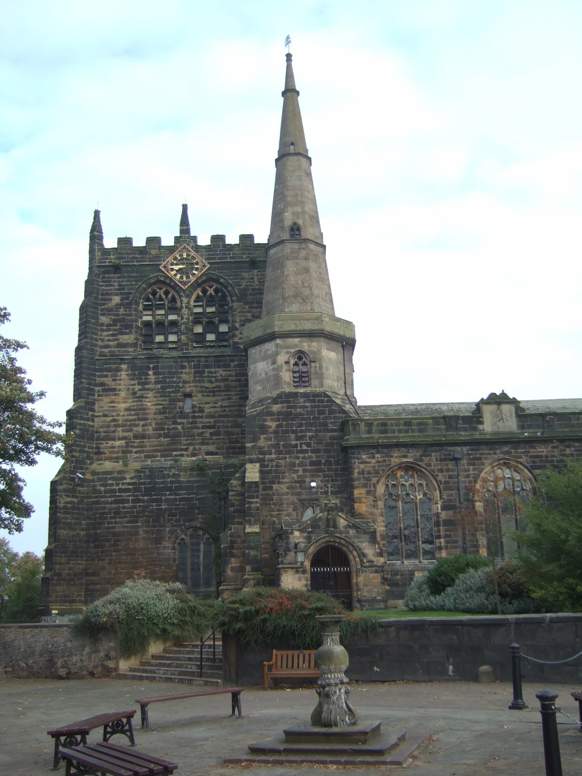
Church of St Peter and St Paul, Ormskirk
Historic churches · 0.4 km

Ormskirk War Memorial
Memorials & monuments · 0.8 km

Tower Hill Water Tower
Memorials & monuments · 0.8 km

The Arts Centre
Theatres · 0.9 km

The Ruff Wood
Memorials & monuments · 1.3 km
Welcome sign
Public art & sculpture · 1.3 km
Nearby
📷 3Galleries · North West England
Chapel Gallery
Chapel Gallery — a gallery in england-north-west, United Kingdom.
📷 7Historic pubs · North West England
Buck I' Th' Vine Inn
Buck I' Th' Vine Inn in England North West, United Kingdom.
📷 5Museums · North West England
Ormskirk
Ormskirk — a museum in england-north-west, United Kingdom.
📷 3Memorials & monuments · North West England
Boer War Memorial In Victoria Park
Boer War Memorial In Victoria Park — Grade II listed building-listed memorial in england-north-west, United Kingdom.
📷 7Historic pubs · North West England
The Windmill Public House
The Windmill Public House in England North West, United Kingdom.
📷 3Memorials & monuments · North West England
Ormskirk Comrades War Memorial
Ormskirk Comrades War Memorial — Grade II listed building-listed memorial in england-north-west, United Kingdom.
Where to eat & stay near Railway Bridge With Cutting Walls To North And South
Places to stay
 📷 5
📷 5Caravan parks · North West England
Abbey Farm Holiday Park
Abbey Farm Holiday Park — a caravan park in england north west.
 📷 5
📷 5Caravan parks · North West England
Tristram's Farmhouse
Tristram's Farmhouse — a caravan park in england north west.
 📷 5
📷 5 📷 5
📷 5Campsites · North West England
Tawd Vale Scout Camp
Tawd Vale Scout Camp — a campsite in england north west.
 📷 5
📷 5Campsites · North West England
Hidden Corner Camp Site
Hidden Corner Camp Site — a campsite in england north west.
 📷 5
📷 5Campsites · North West England
Merseyside Scouts County HQ
Merseyside Scouts County HQ — a campsite in england north west.
Places to eat & drink
📷 7Historic pubs · North West England
Buck I' Th' Vine Inn
Buck I' Th' Vine Inn in England North West, United Kingdom.
📷 7Historic pubs · North West England
The Windmill Public House
The Windmill Public House in England North West, United Kingdom.
 📷 5
📷 5Historic pubs · North West England
The Old Toby Public House
The Old Toby Public House in England North West, United Kingdom.
 📷 7📷 5
 📷 7
📷 7Cafés · North West England
Claude's of Churchtown
Claude's of Churchtown — a café in england north west.
More bridges in this region
 📷 3
📷 3Historic bridges · North West England
Albert Bridge
Albert Bridge is a historic bridge in the United Kingdom.
 📷 3
📷 3Historic bridges · North West England
Arpley New Bridge
Arpley New Bridge is a historic bridge in the United Kingdom.
 📷 3
📷 3Historic bridges · North West England
Arpley Railway Bridge
Arpley Railway Bridge is a historic bridge in the United Kingdom.
 📷 5
📷 5Historic bridges · North West England
Barton Road Bridge
Barton Road Bridge is a historic bridge in the United Kingdom.
Frequently asked questions
- Where is Railway Bridge With Cutting Walls To North And South?
- Railway Bridge With Cutting Walls To North And South is in Lancashire, North-West England, United Kingdom (postcode L39 2AL), in the parish of West Lancashire, unparished area.
- What is Railway Bridge With Cutting Walls To North And South?
- Railway Bridge With Cutting Walls To North And South — Grade II listed building-listed bridge in england-north-west, United Kingdom.
- How do I get to Railway Bridge With Cutting Walls To North And South?
- The nearest railway station is Ormskirk, about 0.3 km away. The nearest town is Aughton. Drivers can use postcode L39 2AL.
- Is Railway Bridge With Cutting Walls To North And South a listed building?
- Railway Bridge With Cutting Walls To North And South is officially recognised as Grade II listed building listed.
- Is Railway Bridge With Cutting Walls To North And South a protected site?
- Yes — Railway Bridge With Cutting Walls To North And South is part of the Ribble & Alt Estuaries Ramsar wetland.
- Is Railway Bridge With Cutting Walls To North And South free to visit?
- Yes, Railway Bridge With Cutting Walls To North And South is free to enter.
- How do I get to Railway Bridge With Cutting Walls To North And South?
- The nearest railway station is Ormskirk, about 0.3 km away. Drivers can navigate to postcode L39 2AL.