
Other places · Mid Wales
Q156150
Also known as: Powys
In or near Rhayader Town F.C..
Q156150 in Wales Mid, United Kingdom.

Stuart Wilding — CC BY-SA 2.0 via Wikimedia Commons licence

Plan your visit
- Typical visit
- 1 h–2 h
- Nearest railway station
- Llandrindod · 6.9 km
Getting there & planning your visit
To visit, the nearest railway station is Llandrindod, located 6.9 km away. The postcode for your sat-nav is LD6 5PE. Entry details are not specified.
About
Q156150 is a place of interest in Wales Mid, United Kingdom — drawn from open-data sources for visitor reference. See the linked Wikipedia article for the full description.
Photo gallery
From the Wikipedia article
Powys ( POH-iss, POW-iss, Welsh: [ˈpou̯ɪs]) is a county and preserved county in Wales. It borders Gwynedd, Denbighshire and Wrexham to the north; the English ceremonial counties of Shropshire and Herefordshire to the east; Monmouthshire, Blaenau Gwent, Merthyr Tydfil, Caerphilly, Rhondda Cynon Taf and Neath Port Talbot to the south; and Carmarthenshire and Ceredigion to the west. The largest settlement is Newtown, and the administrative centre is Llandrindod Wells. Powys is the largest and most sparsely populated county in Wales, having an area of 5,181 km2 (2,000 sq mi) and a population of 135,059 in 2024. While largely rural, its towns include Welshpool in the north-east, Newtown in the north-centre, Llandrindod Wells in the south-centre, Brecon in the south, Ystradgynlais in the far south-west, and Machynlleth in the far west. The Welsh language can be spoken by 16.4% of the population. The boundaries of Powys largely follow those of the historic counties of Montgomeryshire, Radnorshire, and Brecknockshire. The county is predominantly hilly and mountainous. To the west lie the Cambrian Mountains, where the River Severn and River Wye both have their source on the Powys side of the Plynlimon massif; together with their tributaries they drain most of the county. The southern quarter of Powys contains, from east to west, part of the Black Mountains, the Brecon Beacons, Fforest Fawr, and part of the Black Mountains, all of which are part of Brecon Beacons National Park. Further north are two more upland areas, Mynydd Epynt and Radnor Forest. The only extensive area of flat land in Powys is the region northeast of Welshpool. The county is named after the Kingdom of Powys, which was a Welsh successor state, petty kingdom and principality that emerged during the Middle Ages following the end of Roman rule in Britain.
Excerpt from Wikipedia under CC BY-SA 4.0. See the source article linked in Sources below.
Background
History
The county is named after the ancient Welsh Kingdom of Powys, which in the sixth century AD included the northern two-thirds of the area as well as most of Shropshire, Herefordshire and adjacent areas now in England, and came to an end when it was occupied by Llywelyn ap Gruffudd of Gwynedd during the 1260s. The uplands retain evidence of occupation from long before the Kingdom of Powys, and before the Romans, who built roads and forts across the area. There are 1130 identified burial mounds within the county, of varying styles and ages, dating from 4000 BC to 1000 BC, most of them belonging to the Bronze Age. Of these, 339 are scheduled monuments. Standing stones, most again dating to the…
Sourced from Wikipedia under CC BY-SA 4.0.
- Coordinates
- 52.3000, -3.4167
- District
- Powys
- Parish
- Nantmel
- Postcode
- LD6 5PE
- Parliamentary constituency
- Brecon, Radnor and Cwm Tawe
- Nearest railway station
- Llandrindod — 6.9 km
Sources
Other places nearby

Cefn Nantmel
Mountains & hills · 0.6 km

Garth Enclosure
Literary houses · 0.6 km
Pen yr Onnen
Mountains & hills · 0.7 km

Church of St Cynllo
Historic churches · 1.4 km
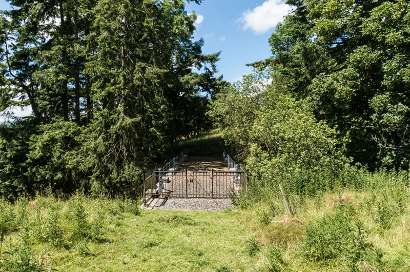
Aqueduct SW of Church of St Cynllo
Aqueducts · 1.5 km
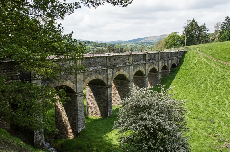
Aqueduct SE of Church of St Cynllo
Aqueducts · 1.6 km

Nantmel Castle
Literary houses · 1.6 km

Nantmel
Museums · 1.7 km

Camlo Hill
Mountains & hills · 1.9 km

Dolau
Villages · 2.2 km
.jpg?width=1200)
Carmel United Reformed Church
Chapels · 2.3 km

Baxters Bank
Mountains & hills · 2.4 km
Nearby
📷 3Mountains & hills · Mid Wales
Cefn Nantmel
Cefn Nantmel — a mountain in wales-mid, United Kingdom, 402 m.
📷 5📷 3Mountains & hills · Mid Wales
Pen yr Onnen
Pen yr Onnen — a mountain in wales-mid, United Kingdom, 465 m.
📷 5Historic churches · Mid Wales
Church of St Cynllo
Church of St Cynllo — Grade II listed building-listed church in wales-mid, United Kingdom.
📷 3Aqueducts · Mid Wales
Aqueduct SW of Church of St Cynllo
Aqueduct SW of Church of St Cynllo — Grade II listed building in Powys. In a field SW of the church and above Ashbrook, spanning a steep-sided dingle.
📷 3Aqueducts · Mid Wales
Aqueduct SE of Church of St Cynllo
Aqueduct SE of Church of St Cynllo — Grade II listed building in Powys. In a field SE of the churchyard, spanning a steep-sided dingle.
Where to eat & stay near Q156150
Places to stay
 📷 5
📷 5Campsites · Mid Wales
Church House Farm Caravan & Campsite
Church House Farm Caravan & Campsite — a campsite in wales mid.
 📷 7
📷 7 📷 7
📷 7 📷 5
📷 5Campsites · Mid Wales
Wyeside Caravan & Camping Park
Wyeside Caravan & Camping Park — a campsite in wales mid.
 📷 5
📷 5 📷 5
📷 5Places to eat & drink
 📷 5
📷 5 📷 7
📷 7 📷 4
📷 4 📷 4
📷 4More places in this region
 📷 5
📷 5 📷 3
📷 3Other places · Mid Wales
Sheep Music
Sheep Music is a three-day world music festival which takes place during July each year in Presteigne. It has 22 years of history, starting as a party on The Warden in 1991. Since moving to its curren
 📷 2
📷 2 📷 4
📷 4Frequently asked questions
- Where is Q156150?
- Q156150 is in Mid Wales, United Kingdom (postcode LD6 5PE), in the parish of Nantmel.
- What is Q156150?
- Q156150 in Wales Mid, United Kingdom.
- How do I get to Q156150?
- The nearest railway station is Llandrindod, about 6.9 km away. Drivers can use postcode LD6 5PE.
- Who owns Q156150?
- Q156150 is owned by Powys County Council.
- How do I get to Q156150?
- The nearest railway station is Llandrindod, about 6.9 km away. Drivers can navigate to postcode LD6 5PE.