
Memorials & monuments · West Midlands
Priory Tower
In or near Ironbridge.
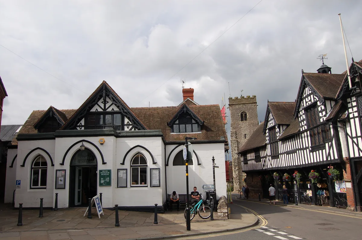
Priory Tower — Grade II listed building-listed memorial in england-west-midlands, United Kingdom.

Jo and Steve Turner — CC BY-SA 2.0 via Wikimedia Commons licence

Plan your visit
- Typical visit
- 15 min–45 min
- Nearest railway station
- Spring Village · 8.9 km
- Free entry
- Dog-friendly
- Wheelchair accessible
Getting there & planning your visit
To visit Priory Tower, the nearest railway station is Spring Village, which is 8.9 km away. The postcode for sat-nav is TF13 6HR. Entry is free, and the site is wheelchair accessible.
About
Priory Tower is a Grade II listed building-listed memorial in england-west-midlands, United Kingdom, registered on the National Heritage List for England (NHLE entry 1367552). Listed status protects buildings and structures of special architectural or historic interest. See the linked Wikipedia article for further details.
Photo gallery
Heritage listing
Priory Road is a street in Kilburn. Located in the London Borough of Camden it runs northwards from Belsize Road through South Hampstead crossing several streets including Abbey Road before finishing at a junction with Broadhurst Gardens, not far from West Hampstead tube station. It takes its name from the old Kilburn Priory located in the area until the dissolution of the monasteries under Henry VIII. The street marked the boundary between two separate estates that were redeveloped from the mid-Victorian era and was jointly constructed between them. It followed a very old track linking the priory with Hampstead. Originally known as Canfield Road, the name was changed in 1880 to reflect the area's connection with the former priory.
From the Historic England List Entry under OGL v3.
Official information
Much Wenlock Museum offers insights into local geology and the history of the modern Olympic Games. Visitors can explore the collection and learn about the area's rich history, with regular events for children.
Protected designations
- Area of Outstanding Natural Beauty: Shropshire Hills
Designations sourced from Natural England open data under OGL v3.
From the Wikipedia article
Priory Road is a street in Kilburn. Located in the London Borough of Camden it runs northwards from Belsize Road through South Hampstead crossing several streets including Abbey Road before finishing at a junction with Broadhurst Gardens, not far from West Hampstead tube station. It takes its name from the old Kilburn Priory located in the area until the dissolution of the monasteries under Henry VIII. The street marked the boundary between two separate estates that were redeveloped from the mid-Victorian era and was jointly constructed between them. It followed a very old track linking the priory with Hampstead. Originally known as Canfield Road, the name was changed in 1880 to reflect the area's connection with the former priory. The Anglican St Mary's Church was built between 1857 and 1862 at the junction with Abbey Road and is now Grade II listed. Part of the street was built over the ground of Hampstead Cricket Club who were forced to relocate in 1876. From 1895 to 1901 Kilburn Library, the Borough of Hampstead's first public library, was based in the street. The southern stretch of the street features a large number of white stucco houses and is part of a Conservation area along with nearby Priory Terrace. During the nineteenth century, the road continuing south beyond Belsize Road was considered an extension of Priory Road, but is now named Kilburn Priory.
Excerpt from Wikipedia under CC BY-SA 4.0. See the source article linked in Sources below.
- Coordinates
- 52.5969, -2.5567
- District
- Shropshire
- Parish
- Much Wenlock
- Postcode
- TF13 6HR
- Parliamentary constituency
- South Shropshire
- Nearest railway station
- Spring Village — 8.9 km
- Opening
- Summer: Tue, Thu, Fri, Sat 10am–1pm, 1:30pm–4:30pm; Winter: Thu, Fri, Sat 10am–1pm, 1:30pm–4:30pm; closed 1pm–1:30pm for lunch
- Official site
- www.shropshiremuseums.org.uk
Sources
- wikidata: Q26649047 (CC0)
- wikipedia: Priory Terrace (CC BY-SA 4.0)
Other places nearby

Dr William Penny Brookes
Memorials & monuments · 0.1 km
Much Wenlock Museum
Museums · 0.1 km

Much Wenlock
Caves · 0.1 km

Elizabeth II
Memorials & monuments · 0.1 km

Wenlock Priory
Abbeys & priories · 0.1 km

Wenlock Priory
Archaeological sites · 0.1 km
.jpg?width=1200)
Priory House
Historic houses · 0.1 km

55 and 56, High Street
Gardens · 0.2 km

Wenlock Cinema
Theatres · 0.2 km

34, Barrow Street
Gardens · 0.2 km
.jpg?width=1200)
Ashfield Hall
Historic houses · 0.3 km

William Penny Brookes
Public art & sculpture · 0.3 km
Nearby
📷 3Memorials & monuments · West Midlands
Dr William Penny Brookes
Dr William Penny Brookes — a memorial in england-west-midlands, United Kingdom.
📷 3Museums · West Midlands
Much Wenlock Museum
Much Wenlock Museum — museum in Much Wenlock, England, United Kingdom.
📷 5Caves · West Midlands
Much Wenlock
Much Wenlock is a market town and parish in Shropshire, England; it is situated on the A458 road between Shrewsbury and Bridgnorth. Nearby, to the north-east, is the Ironbridge Gorge and Telford. The
📷 4Memorials & monuments · West Midlands
Elizabeth II
Elizabeth II — a memorial in england-west-midlands, United Kingdom.
📷 3Abbeys & priories · West Midlands
Wenlock Priory
Wenlock Priory — a abbey in england-west-midlands, United Kingdom.
📷 5Archaeological sites · West Midlands
Wenlock Priory
Wenlock Priory — archaeological in england west midlands. Operated by English Heritage.
Where to eat & stay near Priory Tower
Places to stay
 📷 5
📷 5Campsites · West Midlands
Sytche Camping and Caravan Park
Sytche Camping and Caravan Park — a campsite in england west midlands.
 📷 5
📷 5Caravan parks · West Midlands
Pool View Caravan Park
Pool View Caravan Park — a caravan park in england west midlands.
 📷 5
📷 5 📷 5
📷 5 📷 5
📷 5Campsites · West Midlands
Iron Gorge Camping
Iron Gorge Camping — a campsite in england west midlands.
 📷 5
📷 5Places to eat & drink
 📷 7
📷 7Historic pubs · West Midlands
Kynnersley Arms Public House Incorporating Remains Of Mill And Furnace
Kynnersley Arms Public House Incorporating Remains Of Mill And Furnace in England West Midlands, United Kingdom.
 📷 5
📷 5Historic pubs · West Midlands
Crown Inn Including Outbuildings Adjoining South West
Crown Inn Including Outbuildings Adjoining South West in England West Midlands, United Kingdom.
 📷 7
📷 7Historic pubs · West Midlands
The Coalbrookdale Inn
The Coalbrookdale Inn in England West Midlands, United Kingdom.
 📷 5
📷 5Historic pubs · West Midlands
The Golden Ball Public House
The Golden Ball Public House in England West Midlands, United Kingdom.
 📷 5
📷 5Historic pubs · West Midlands
The Beacon Public House
The Beacon Public House in England West Midlands, United Kingdom.
 📷 5
📷 5Historic pubs · West Midlands
The Brewery Inn
The Brewery Inn in England West Midlands, United Kingdom.
More memorials in this region
 📷 3
📷 3Memorials & monuments · West Midlands
Abbots Bromley War Memorial
Abbots Bromley War Memorial — Grade II listed building-listed memorial in england-east-midlands, United Kingdom.
 📷 3
📷 3Memorials & monuments · West Midlands
Kings Bromley War Memorial
Kings Bromley War Memorial — Grade II listed building-listed memorial in england-east-midlands, United Kingdom.
 📷 3
📷 3Memorials & monuments · West Midlands
Hednesford War Memorial And Gates
Hednesford War Memorial And Gates — Grade II listed building-listed memorial in england-east-midlands, United Kingdom.
 📷 3
📷 3Memorials & monuments · West Midlands
Uttoxeter War Memorial
Uttoxeter War Memorial — Grade II listed building-listed memorial in england-east-midlands, United Kingdom.
Frequently asked questions
- Where is Priory Tower?
- Priory Tower is in the West Midlands, United Kingdom (postcode TF13 6HR), in the parish of Much Wenlock.
- What is Priory Tower?
- Priory Tower — Grade II listed building-listed memorial in england-west-midlands, United Kingdom.
- How do I get to Priory Tower?
- The nearest railway station is Spring Village, about 8.9 km away. Drivers can use postcode TF13 6HR.
- Is Priory Tower a listed building?
- Priory Tower is officially recognised as Grade II listed building listed.
- Is Priory Tower a protected site?
- Yes — Priory Tower is part of the Shropshire Hills National Landscape (AONB).
- Is Priory Tower free to visit?
- Yes, Priory Tower is free to enter.
- How do I get to Priory Tower?
- Drivers can navigate to postcode TF13 6HR. It sits within the South Shropshire parliamentary constituency.