Piers · Scottish Highlands
Portnaguran
Also known as: Port nan Giúran
Portnaguran in Scotland Islands, United Kingdom.

Angus Peck — CC BY-SA 2.0 via Wikimedia Commons licence
Plan your visit
- Typical visit
- 30 min–1 h
- Best time of year
- Summer
- Free entry
- Family-friendly
- Dog-friendly
- Limited wheelchair access
About
Portnaguran is a place of interest in Scotland Islands, United Kingdom — drawn from open-data sources for visitor reference. See the linked Wikipedia article for the full description.
Photo gallery
From the Wikipedia article
Portnaguran (Scottish Gaelic: Port nan Giùran) is a settlement situated within Point, on the Isle of Lewis, in the Outer Hebrides, Scotland. Portnaguran is the township at the north-easternmost point of the peninsula. It lies 1 mile (1.6 km) southwest of Tiumpan Head and just south of the headland called Geòdha 'ic Sheòrais or sometimes Small Head amongst locals. Portnaguran is situated at the north-eastern end of the A866, within the parish of Stornoway. There is a small pier in the harbour, and the surrounding villages are Portvoller, Broker, Aird and Flesherin. The village itself is about 12 miles (20 km) from the town of Stornoway.
Excerpt from Wikipedia under CC BY-SA 4.0. See the source article linked in Sources below.
- Coordinates
- 58.2580, -6.1696
- District
- Na h-Eileanan Siar
- Postcode
- HS2 0HD
- Parliamentary constituency
- Na h-Eileanan an Iar
Sources
- wikidata: Q7232133 (CC0)
- wikipedia: Portnaguran (CC BY-SA 4.0)
Other places nearby

Broker
Islands · 0.9 km

Flesherin
Islands · 1.0 km

Portvoller
Islands · 1.1 km

Ceann an t-Siumpain
Mountains & hills · 1.7 km

Aird
Islands · 1.7 km
Tiumpan Head Lighthouse
Lighthouses · 1.8 km

Tiumpan Head
Lighthouses · 1.9 km

Cnoc Chùsbaig
Mountains & hills · 3.0 km

Shulishader
Beaches · 3.0 km

Lewis, Rubha na Greine
Vineyards · 4.2 km
St Mac Dara's Community College
Historic churches · 4.7 km

Broad Bay
Reservoirs & lochs · 4.8 km
Nearby
📷 4📷 5📷 5📷 5Mountains & hills · Scottish Highlands
Ceann an t-Siumpain
Ceann an t-Siumpain — a hill or mountain in scotland highlands.
📷 4📷 3Lighthouses · Scottish Highlands
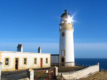
Tiumpan Head Lighthouse
Tiumpan Head Lighthouse — lighthouse in Outer Hebrides, Scotland, UK.
Where to eat & stay near Portnaguran
Places to stay
 📷 5
📷 5Campsites · Scottish Islands
Laxdale Holiday Park (overflow) Camping Field
Laxdale Holiday Park (overflow) Camping Field — a campsite in scotland highlands.
📷 5Caravan parks · Scottish Islands
Laxdale Holiday Park
Laxdale Holiday Park — a caravan park in scotland highlands.
 📷 7
📷 7Hotels · Scottish Islands
The Caberfeidh
The Caberfeidh — a hotel in scotland highlands.
 📷 5
📷 5Hostels · Scottish Islands
Dunroamin Bed and Breakfast
Dunroamin Bed and Breakfast — a hostel in scotland highlands.
 📷 5
📷 5 📷 5
📷 5Hotels · Scottish Islands
Borve Country House Hotel
Borve Country House Hotel — a hotel in scotland highlands.
Places to eat & drink
 📷 6
📷 6Historic pubs · Scottish Islands
Neptune's Bar, 11 Cromwell Street, Stornoway, Lewis
Neptune's Bar, 11 Cromwell Street, Stornoway, Lewis in Scotland Highlands, United Kingdom.
More piers in this region
 📷 3
📷 3Piers · Scottish Highlands
Ardnamurchan Charters
Ardnamurchan Charters is a pier in the United Kingdom.
 📷 4
📷 4 📷 3
📷 3 📷 3
📷 3Piers · Scottish Highlands
North Kessock Community Pier
North Kessock Community Pier is a pier in the United Kingdom.
Frequently asked questions
- Where is Portnaguran?
- Portnaguran is in the Scottish Islands, United Kingdom (postcode HS2 0HD).
- What is Portnaguran?
- Portnaguran in Scotland Islands, United Kingdom.
- How do I get to Portnaguran?
- Drivers can use postcode HS2 0HD.
- Is Portnaguran free to visit?
- Yes, Portnaguran is free to enter.
- How do I get to Portnaguran?
- Drivers can navigate to postcode HS2 0HD. It sits within the Na h-Eileanan an Iar parliamentary constituency.