
Museums · South Wales
Portishead, Somerset
In or near Weston in Gordano.
Portishead ( PORT-iss-hed) is a town and civil parish in the North Somerset unitary authority area, in the county of Somerset, England. With a population of 26,366 at the 2021 Census, the town is loca

Neil Owen — CC BY-SA 2.0 via Wikimedia Commons licence

Plan your visit
- Typical visit
- 1.5 h–3 h
- Best time of year
- Year-round
- Nearest railway station
- Avonmouth · 4.7 km
- Family-friendly
- Limited wheelchair access
Getting there & planning your visit
To visit the museum in Portishead, Somerset, the nearest railway station is Avonmouth, located 4.7 km away. The postcode for navigation is BS20 7GD. Accessibility is limited for wheelchair users.
About
Portishead ( PORT-iss-hed) is a town and civil parish in the North Somerset unitary authority area, in the county of Somerset, England. With a population of 26,366 at the 2021 Census, the town is located on the Severn Estuary opposite Cardiff and Newport in Wales. The town is 8 miles (13 km) to the west of Bristol and 18 miles northeast of Weston-super-Mare and approximately 110 miles (180 km) west of London. Portishead has a long history as a fishing port. As a royal manor it expanded rapidly during the early 19th century around the docks, with supporting transport infrastructure. A power station and chemical works were added in the 20th century, but the dock and industrial facilities have since closed and have been redeveloped into a marina and residential areas. Portishead was also the telephone control centre used by British Telecom (BT) for non-direct dialled calls to maritime vessels, a service known as Portishead Radio. The headquarters of both Avon and Somerset Constabulary and Avon Fire and Rescue Service are in Portishead. Portishead Lifeboat Station is situated close to the marina. Run solely by local Royal National Lifeboat Institution (RNLI) volunteers, it serves the waters of the Severn estuary and inland waterways into the city of Bristol.
Photo gallery
Protected designations
- Site of Special Scientific Interest: Portishead Pier to Black Nore SSSI
- Site of Special Scientific Interest: Severn Estuary SSSI
- Ramsar wetland: Severn Estuary
Designations sourced from Natural England open data under OGL v3.
From the Wikipedia article
Portishead ( PORT-iss-hed) is a town and civil parish in the North Somerset unitary authority area, in the county of Somerset, England. With a population of 26,366 at the 2021 Census, the town is located on the Severn Estuary opposite Cardiff and Newport in Wales. The town is 8 miles (13 km) to the west of Bristol and 18 miles northeast of Weston-super-Mare and approximately 110 miles (180 km) west of London. Portishead has a long history as a fishing port. As a royal manor it expanded rapidly during the early 19th century around the docks, with supporting transport infrastructure. A power station and chemical works were added in the 20th century, but the dock and industrial facilities have since closed and have been redeveloped into a marina and residential areas. Portishead was also the telephone control centre used by British Telecom (BT) for non-direct dialled calls to maritime vessels, a service known as Portishead Radio. The headquarters of both Avon and Somerset Constabulary and Avon Fire and Rescue Service are in Portishead. Portishead Lifeboat Station is situated close to the marina. Run solely by local Royal National Lifeboat Institution (RNLI) volunteers, it serves the waters of the Severn estuary and inland waterways into the city of Bristol.
Excerpt from Wikipedia under CC BY-SA 4.0. See the source article linked in Sources below.
Background
History
The name Portishead derives from the "port at the head of the river". It has been called 'Portshead' and 'Portschute' at times in its history and Portesheve in the Domesday Book, and was locally known as Posset. The town's recorded history dates back to Roman times, Other sites that have been identified include a 1200 by site that was successively occupied by the Romans, Britons and Danes. There is some evidence that it may have been the western end of the Wansdyke, an early medieval or possibly Roman boundary with a series of defensive linear earthworks extending to the Savernake Forest near Marlborough in Wiltshire. After the Norman conquest the manor was held by the Bishop of Coutances…
Sourced from Wikipedia under CC BY-SA 4.0.
- Coordinates
- 51.4840, -2.7626
- District
- North Somerset
- Parish
- Portishead
- Postcode
- BS20 7GD
- Parliamentary constituency
- North Somerset
- Nearest railway station
- Avonmouth — 4.7 km
Sources
- wikipedia: Portishead, Somerset (CC BY-SA 4.0)
Other places nearby

Den Dungen Bridge
Memorials & monuments · 0.2 km

ibis budget Portishead Marina
Hotels · 0.2 km
Flying
Public art & sculpture · 0.3 km

Timelines
Public art & sculpture · 0.3 km

Battery Point Bell
Memorials & monuments · 0.4 km

The White Lion Public House And Section Of Former Sea Wall To North End Of West Front
Historic pubs · 0.4 km
Portishead Millstone
Memorials & monuments · 0.4 km

Precious
Public art & sculpture · 0.5 km

Portishead Power Station Gate
Memorials & monuments · 0.5 km
Man and Animal
Public art & sculpture · 0.6 km

Crouch
Public art & sculpture · 0.6 km
Towards The Sky
Public art & sculpture · 0.6 km
Nearby
📷 3Memorials & monuments · South Wales
Den Dungen Bridge
Den Dungen Bridge — a memorial in wales-south, United Kingdom.
📷 7Hotels · South Wales
ibis budget Portishead Marina
ibis budget Portishead Marina — a hotel in wales south. 2-star. Brand: Ibis Budget.
📷 3Public art & sculpture · South Wales
Flying
Flying — a public art in wales-south, United Kingdom.
📷 3Public art & sculpture · South Wales
Timelines
Timelines — a public art in wales-south, United Kingdom.
📷 3Memorials & monuments · South Wales
Battery Point Bell
Battery Point Bell is a memorial in the United Kingdom.
📷 5Historic pubs · South Wales
The White Lion Public House And Section Of Former Sea Wall To North End Of West Front
The White Lion Public House And Section Of Former Sea Wall To North End Of West Front in Wales South, United Kingdom.
Where to eat & stay near Portishead, Somerset
Places to stay
📷 7Hotels · South Wales
ibis budget Portishead Marina
ibis budget Portishead Marina — a hotel in wales south. 2-star. Brand: Ibis Budget.
 📷 5
📷 5Campsites · South Wales
Glenny Wood Scout Camp Site
Glenny Wood Scout Camp Site — a campsite in wales south.
 📷 5
📷 5 📷 5
📷 5Caravan parks · South Wales
Colehouse Farm Caravan Park
Colehouse Farm Caravan Park — a caravan park in wales south.
 📷 5
📷 5 📷 7
📷 7Places to eat & drink
📷 5Historic pubs · South Wales
The White Lion Public House And Section Of Former Sea Wall To North End Of West Front
The White Lion Public House And Section Of Former Sea Wall To North End Of West Front in Wales South, United Kingdom.
 📷 7
📷 7 📷 5
📷 5Historic pubs · South Wales
The Lamplighters Public House
The Lamplighters Public House in Wales South, United Kingdom.

 📷 5
📷 5 📷 5
📷 5More museums in this region
 📷 3
📷 3Museums · South Wales
Baked Bean Museum of Excellence
Baked Bean Museum of Excellence — food museum in Wales.
 📷 5
📷 5Museums · South Wales
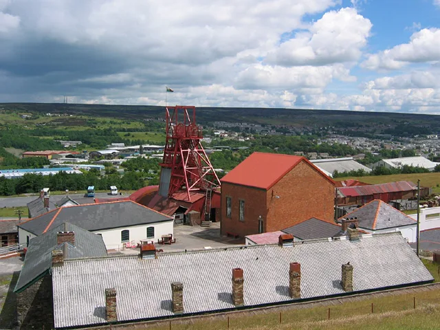
Big Pit National Coal Museum
Big Pit National Coal Museum — former coal mine and industrial heritage museum in Blaenavon in south-east Wales, United Kingdom.
 📷 5
📷 5Museums · South Wales
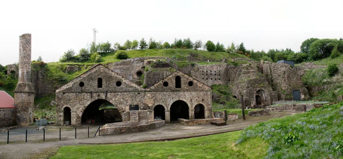
Blaenavon Ironworks
Blaenavon Ironworks — former ironworks transformed into a museum.
 📷 4
📷 4Museums · South Wales
Caerleon Roman Fortress and Baths
Caerleon Roman Fortress and Baths — archaeological museum in Newport, Wales.
Frequently asked questions
- Where is Portishead, Somerset?
- Portishead, Somerset is in South Wales, United Kingdom (postcode BS20 7GD), in the parish of Portishead.
- What is Portishead, Somerset?
- Portishead ( PORT-iss-hed) is a town and civil parish in the North Somerset unitary authority area, in the county of Somerset, England. With a population of 26,366 at the 2021 Census, the town is loca
- How do I get to Portishead, Somerset?
- The nearest railway station is Avonmouth, about 4.7 km away. Drivers can use postcode BS20 7GD.
- Is Portishead, Somerset a protected site?
- Yes — Portishead, Somerset is part of the Portishead Pier to Black Nore SSSI Site of Special Scientific Interest and the Severn Estuary SSSI Site of Special Scientific Interest.
- How do I get to Portishead, Somerset?
- The nearest railway station is Avonmouth, about 4.7 km away. Drivers can navigate to postcode BS20 7GD.