
Beaches · North Wales
Porthor
Porthor is a beach in the United Kingdom.

Brian Whittle — CC BY-SA 2.0 via Wikimedia Commons licence

Plan your visit
- Typical visit
- 1 h–3 h
- Best time of year
- Summer (Jun–Aug)
- Free entry
- Family-friendly
- Dog-friendly
About
Porthor is a named beach on the United Kingdom coastline. Coordinates: 52.8360°, -4.7236°. This entry is part of The Great Britain Guide, a free, ad-free, open-data tourist directory.
Photo gallery
From the Wikipedia article
Aberdaron (Welsh pronunciation: [abɛrˈdarɔn]) is a community, electoral ward and former fishing village at the western tip of the Llŷn Peninsula in the Welsh county of Gwynedd. It lies 14.8 miles (23.8 km) west of Pwllheli and 33.5 miles (53.9 km) south-west of Caernarfon; as of 2021, it has a population of 896. The community includes Bardsey Island (Welsh: Ynys Enlli), the coastal area around Porthor, and the villages of Anelog, Llanfaelrhys, Penycaerau, Rhoshirwaun, Rhydlios, Uwchmynydd and Y Rhiw. It covers an area of just under 50 square kilometres. Y Rhiw and Llanfaelrhys have long been linked by sharing rectors and by their close proximity, but were originally ecclesiastical parishes in themselves. The parish of Bodferin/Bodverin was assimilated in the 19th century. The village was the last rest stop for pilgrims heading to Bardsey Island (Ynys Enlli), the legendary "island of 20,000 saints". In the 18th and 19th centuries, it developed as a shipbuilding centre and port. The mining and quarrying industries became major employers, and limestone, lead, jasper and manganese (Mango) were exported. There are the ruins of an old pier running out to sea at Porth Simdde, which is the local name for the west end of Aberdaron Beach. After the Second World War, the mining industry collapsed and Aberdaron gradually developed into a holiday resort. The beach was awarded a Seaside Award in 2008. The coastal waters are part of Pen Llŷn a'r Sarnau Special Area of Conservation, one of the largest marine designated sites in the United Kingdom. The coast itself forms part of the Aberdaron Coast and Bardsey Island Special Protection Area and was designated a Heritage Coast in 1974. In 1956, the area was included in Llŷn Area of Outstanding Natural Beauty. Conservation Areas have been created in Aberdaron, Bardsey Island and Y Rhiw; the area has been designated a Landscape of Historic Interest.
Excerpt from Wikipedia under CC BY-SA 4.0. See the source article linked in Sources below.
- Coordinates
- 52.8360, -4.7236
- District
- Gwynedd
- Parish
- Aberdaron
- Postcode
- LL53 8LG
- Parliamentary constituency
- Dwyfor Meirionnydd
Sources
Other places nearby
Porthor
Beaches · 0.0 km

Porth Oer
Vineyards · 0.2 km

Porth Oer
Natural landmarks · 0.7 km

Mynydd Carreg
Mountains & hills · 0.8 km

Mynydd Carreg
Mountains & hills · 0.8 km

Dinas Fawr
Mountains & hills · 1.0 km

Dinas Bach
Mountains & hills · 1.4 km

Mur Melyn
Campsites · 1.4 km

Bodferin
Historic churches · 1.5 km

Carmel Baptist Chapel
Chapels · 1.6 km
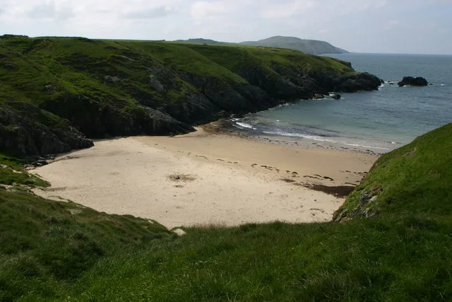
Porth Iago
Beaches · 1.6 km
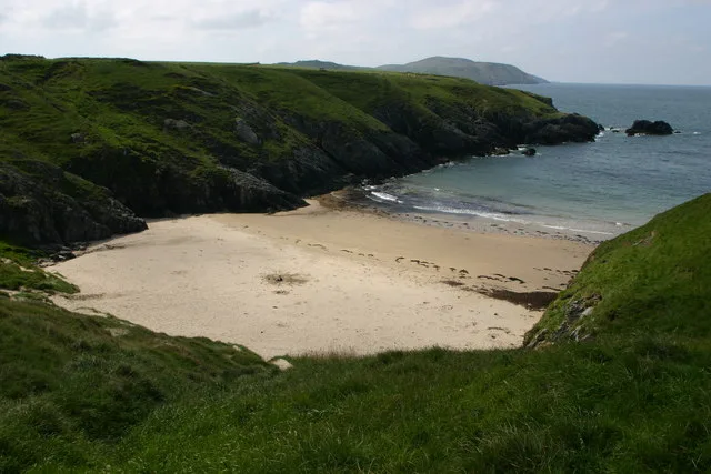
Porth Iago
Beaches · 1.7 km
Nearby
📷 3📷 5Vineyards · North Wales
Porth Oer
Porth Oer — a UK vineyard in wales north, producing English or Welsh wine from cool-climate grape varieties.
📷 5📷 5Mountains & hills · North Wales
Mynydd Carreg
Mynydd Carreg — mountain in wales north. Elevation: 90 m.
📷 3Mountains & hills · North Wales
Mynydd Carreg
Mynydd Carreg — a mountain in wales-north, United Kingdom, 99 m.
📷 5Where to eat & stay near Porthor
Places to stay
📷 3 📷 5
📷 5Caravan parks · North Wales
Brynfynnon Caravan Park
Brynfynnon Caravan Park — a caravan park in wales north.
 📷 5
📷 5 📷 5
📷 5Campsites · North Wales
Morawel Caravan & Camp Site
Morawel Caravan & Camp Site — a campsite in wales north.
 📷 5
📷 5Campsites · North Wales
Caerau Farm Caravan & Campsite
Caerau Farm Caravan & Campsite — a campsite in wales north.
 📷 5
📷 5Places to eat & drink
 📷 5
📷 5More beaches in this region
 📷 3
📷 3Beaches · North Wales
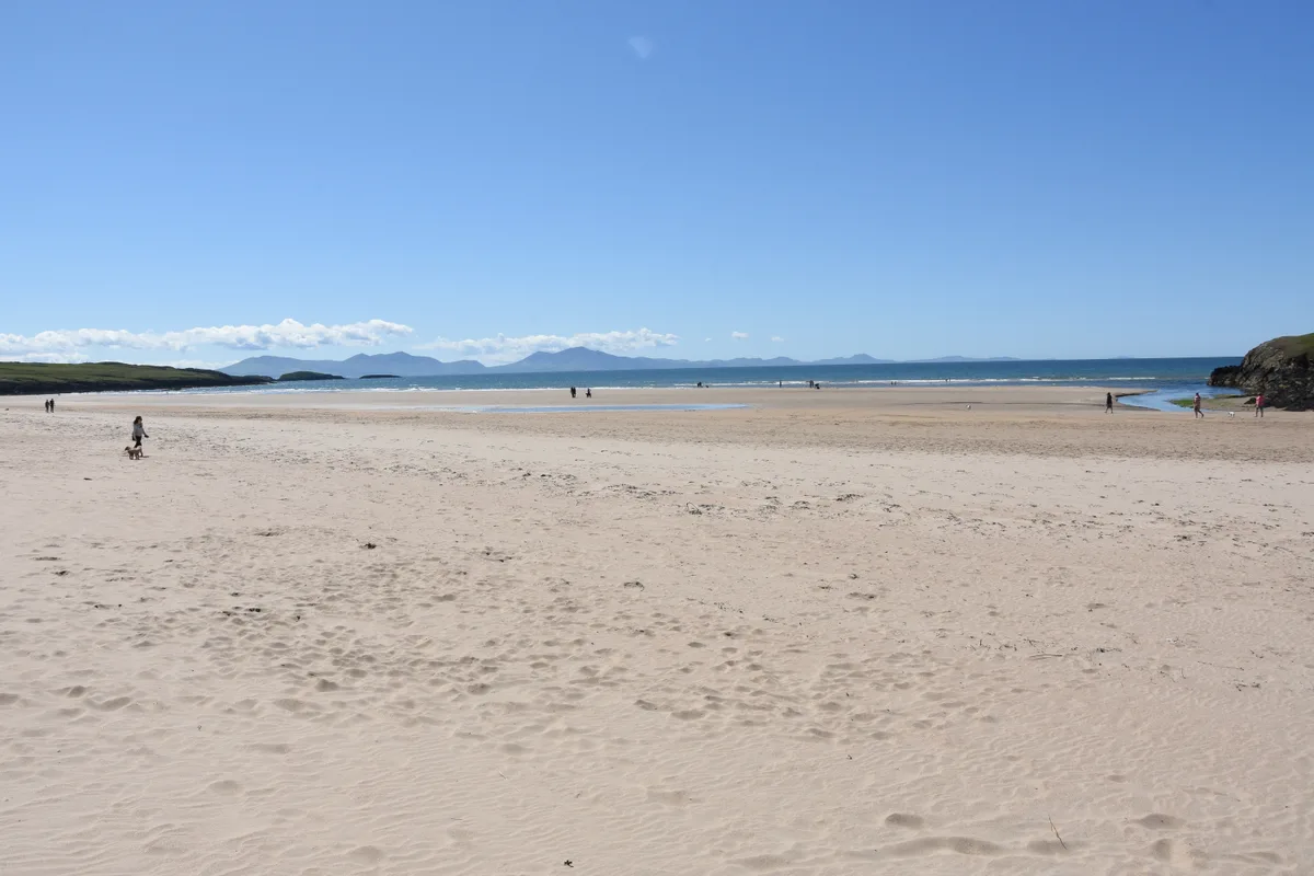
Aberffraw Sands
Aberffraw Sands — sandy beach on west coast of Anglesey, in Wales, UK.
 📷 3
📷 3 📷 3
📷 3 📷 3
📷 3Frequently asked questions
- Where is Porthor?
- Porthor is in North Wales, United Kingdom (postcode LL53 8LG), in the parish of Aberdaron.
- What is Porthor?
- Porthor is a beach in the United Kingdom.
- How do I get to Porthor?
- Drivers can use postcode LL53 8LG.
- Is Porthor free to visit?
- Yes, Porthor is free to enter.
- How do I get to Porthor?
- Drivers can navigate to postcode LL53 8LG. It sits within the Dwyfor Meirionnydd parliamentary constituency.