Harbours & ports · South Wales
Porthclais
Also known as: Porth Clais
Porthclais — harbour in Pembrokeshire, Wales.

Wikimedia Commons contributors — see linked file page for photographer and licence licence
Plan your visit
- Typical visit
- 45 min–1.5 h
- Family-friendly
- Dog-friendly
About
Porthclais is a harbour in the United Kingdom. Wikidata describes it as: "harbour in Pembrokeshire, Wales". Coordinates: 51.8680°, -5.2800°.
Photo gallery
From the Wikipedia article
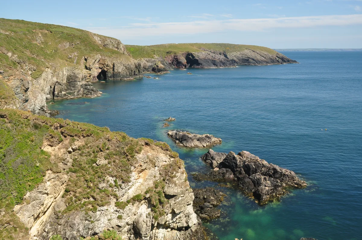
Porthclais (also known as Porth Clais) is a small sheltered inlet harbour near St Davids, Pembrokeshire, Wales, in the community of St Davids and the Cathedral Close.
Excerpt from Wikipedia under CC BY-SA 4.0. See the source article linked in Sources below.
Background
History
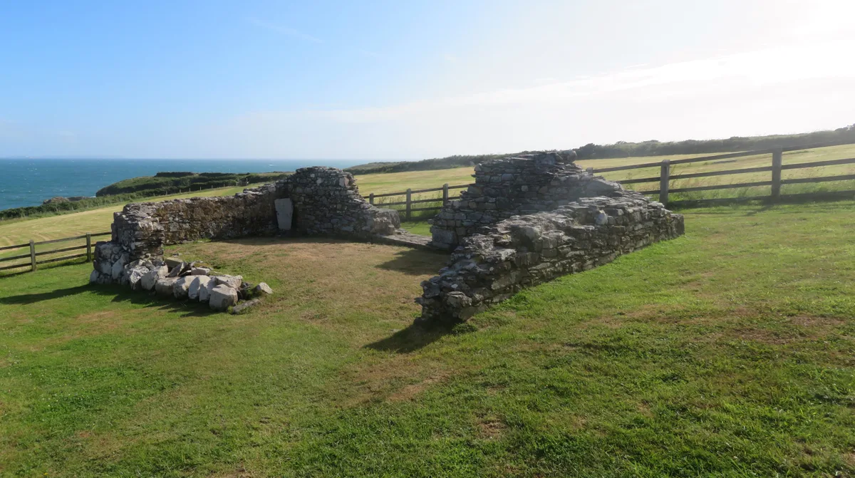
Porthclais harbour was built in the 12th century, importing coal and timber. The entire harbour is within the St David's Peninsula Site of Special Scientific Interest. Porthclais is still used as a small port by local fishermen and recreational sailors. The largely intact old harbour wall may have been built by the Romans, and the harbour was mentioned in the mediaeval Mabinogion. The earliest recorded date of trade through the port is 1385. The harbour dries out at low tide and is a good launching spot for small boats, dive craft and kayaks who are setting out to explore St Bride's Bay. Porthclais harbour has some of the best preserved remains of stone Lime kilns in Pembrokeshire.
Sourced from Wikipedia under CC BY-SA 4.0.
- Coordinates
- 51.8680, -5.2800
- District
- Pembrokeshire
- Parish
- St. David's and the Cathedral Close
- Postcode
- SA62 6RR
- Parliamentary constituency
- Mid and South Pembrokeshire
Sources
- wikidata: Q7231758 (CC0)
- wikipedia: Porthclais (CC BY-SA 4.0)
- commons: Harbour entrance at Porthclais - geograph.org.uk - 1525244.jpg (CC BY-SA 4.0)
Other places nearby
Loading nearby places…
Nearby
Campsites · South Wales
Porthclais Farm Campsite
Porthclais Farm Campsite — a campsite in wales south.
 📷 3
📷 3Historic houses · South Wales
Lime Kiln Ruins
Lime Kiln Ruins — a historic house in wales-south, United Kingdom.
 📷 3
📷 3Historic houses · South Wales
St Non's Chapel (ruins)
St Non's Chapel (ruins) — a historic house in wales-south, United Kingdom.
 📷 5
📷 5Historic churches · South Wales
Chapel of St Non
Chapel of St Non — church in Pembrokeshire, UK.
 📷 3
📷 3Mountains & hills · South Wales
St Non's Bay
St Non's Bay — bay immediately south of St Davids, Pembrokeshire, Wales, UK.
 📷 3
📷 3Archaeological sites · South Wales
Ring and Bailey
Ring and Bailey — a archaeological in wales-south, United Kingdom.
More places in this region
 Flagship📷 5
Harbours & ports · South Wales
Barry Docks
Barry Docks is a harbour in the United Kingdom.
 📷 5
📷 5Harbours & ports · South Wales
Avonmouth
Avonmouth — port, suburb and former electoral ward in Bristol, England.
 📷 3
📷 3Harbours & ports · South Wales
Barry Harbour
Barry Harbour — former harbour in Barry, Vale of Glamorgan.
 📷 5
📷 5Harbours & ports · South Wales
Bristol Harbour
Bristol Harbour — harbour in the city of Bristol, England.
Frequently asked questions
- Where is Porthclais?
- Porthclais is in South Wales, in the United Kingdom — coordinates 51.8680°, -5.2800°.