Wildlife reserves · South West England
Poor's Allotment
In or near St Briavels.
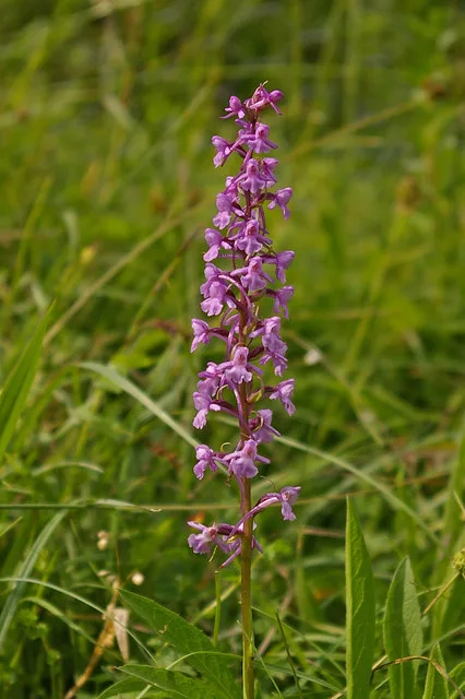
Poor's Allotment — biological Site of Special Scientific Interest in Gloucestershire, UK.

Wikimedia Commons contributors — see linked file page for photographer and licence licence
Plan your visit
- Typical visit
- 2 h–4 h
- Best time of year
- Autumn & winter (migration & wildfowl)
- Nearest railway station
- Chepstow · 5.9 km
- Free entry
- Dog-friendly
Getting there & planning your visit
To visit Poor's Allotment in the Forest of Dean, Gloucestershire, the nearest railway station is Chepstow, located 5.9 km away. The postcode for sat-nav is NP16 7LY, and entry to the reserve is free.
About
Poor's Allotment is a wildlife reserve in the United Kingdom. Heritage designation: Site of Special Scientific Interest. Part of The Park & Poor's Allotment Nature Reserve. Wikidata describes it as: "biological Site of Special Scientific Interest in Gloucestershire, UK". Coordinates: 51.6885°, -2.6372°.
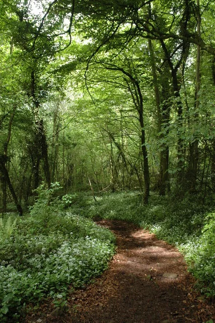
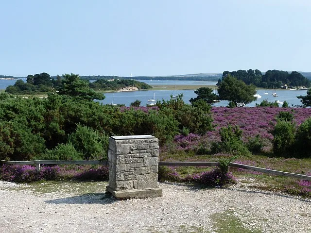
Photo gallery
Protected designations
- Site of Special Scientific Interest: River Wye SSSI
- Site of Special Scientific Interest: Severn Estuary SSSI
- Site of Special Scientific Interest: Poor's Allotment SSSI
- Area of Outstanding Natural Beauty: Wye Valley
Designations sourced from Natural England open data under OGL v3.
From the Wikipedia article
Poor's Allotment (grid reference ST560990) is a 28.57-hectare (70.6-acre) biological Site of Special Scientific Interest in Gloucestershire, notified in 1954. The site is listed in the 'Forest of Dean Local Plan Review' as a Key Wildlife Site (KWS). The site is now part of a larger nature reserve of 60 hectares (The Park & Poor's Allotment (grid reference ST558992)) managed by the Gloucestershire Wildlife Trust. The Park's conservation interest is now managed in partnership with the Forestry Commission who are the land owners. Poor’s Allotment is owned by trustees from the parish of Tidenham.
Excerpt from Wikipedia under CC BY-SA 4.0. See the source article linked in Sources below.
- Coordinates
- 51.6885, -2.6372
- County
- Gloucestershire
- District
- Forest of Dean
- Parish
- Tidenham
- Postcode
- NP16 7LY
- Parliamentary constituency
- Forest of Dean
- Nearest railway station
- Chepstow — 5.9 km
Sources
- wikidata: Q7228751 (CC0)
- wikipedia: Poor's Allotment (CC BY-SA 4.0)
- commons: Poor's Allotment. Tidenham - geograph.org.uk - 221700.jpg (CC BY-SA 4.0)
Other places nearby

The Park & Poor's Allotment Nature Reserve
Wildlife reserves · 0.3 km
Ridley Bottom
Wildlife reserves · 0.6 km

Miss Grace's Lane Cave
Caves · 0.9 km

Queen Victoria Jubilee Stone
Memorials & monuments · 0.9 km

Clayton Wood
Mountains & hills · 1.1 km

High Woolaston
Literary houses · 1.6 km

Devil's Pulpit
Viewpoints · 1.8 km

Shorn Cliff Cave
Caves · 1.9 km

Caswell Wood
Battlefields & battle sites · 1.9 km

Beeches Farm Campsite
Campsites · 2.0 km
Lippets Grove
Parks · 2.2 km

Cowshill Cave
Caves · 2.5 km
Nearby
Wildlife reserves · South West England
The Park & Poor's Allotment Nature Reserve
The Park & Poor's Allotment Nature Reserve — Gloucestershire Wildlife Trust Nature Reserve.
📷 3Wildlife reserves · South West England
Ridley Bottom
Ridley Bottom — nature reserve in Tidenham, Gloucestershire, England, UK.
📷 3Caves · South West England
Miss Grace's Lane Cave
Miss Grace's Lane Cave is a cave in the United Kingdom.
📷 3Memorials & monuments · South West England
Queen Victoria Jubilee Stone
Queen Victoria Jubilee Stone — a memorial in wales-south, United Kingdom.
📷 5Mountains & hills · South West England
Clayton Wood
Clayton Wood — a hill or mountain in wales south.
📷 5Literary houses · South West England
High Woolaston
High Woolaston — a literary house museum in wales south.
Where to eat & stay near Poor's Allotment
Places to stay
📷 5Campsites · South Wales
Beeches Farm Campsite
Beeches Farm Campsite — a campsite in wales south.
 📷 7
📷 7 📷 7
📷 7 📷 7
📷 7B&Bs · South Wales
Tintern Old Rectory B&B
Tintern Old Rectory B&B — a bed-and-breakfast in wales south.
 📷 5
📷 5Campsites · South Wales
Botany Bay Scout campsite
Botany Bay Scout campsite — a campsite in wales south.
 📷 5
📷 5Places to eat & drink
 📷 5
📷 5Cafés · South West England
Swan House
Swan House — a café in england west midlands.
 📷 5
📷 5Restaurants · South Wales
Mint & Mustard
Mint & Mustard — a restaurant in wales south.
 📷 7
📷 7 📷 6
📷 6 📷 7
📷 7
Restaurants · South Wales
The Whitebrook
The Whitebrook — a restaurant in wales south.
More places in this region
 Flagship📷 10
Wildlife reserves · South West England
Arne RSPB reserve
Arne RSPB reserve — RSPB nature reserve in the United Kingdom.
 📷 5
📷 5Wildlife reserves · South West England
Bath and Bradford-on-Avon Bats SAC
Bath and Bradford-on-Avon Bats SAC — Special Area of Conservation in England, UK.
 📷 5
📷 5Wildlife reserves · South West England
Baverstock Juniper Bank
Baverstock Juniper Bank — Conservation site in Wiltshire, England.
 📷 5
📷 5Wildlife reserves · South West England
Girdlers Coppice
Girdlers Coppice — nature reserve in Dorset, UK.
Frequently asked questions
- Where is Poor's Allotment?
- Poor's Allotment is in Gloucestershire, South Wales, United Kingdom (postcode NP16 7LY), in the parish of Tidenham.
- What is Poor's Allotment?
- Poor's Allotment — biological Site of Special Scientific Interest in Gloucestershire, UK.
- How do I get to Poor's Allotment?
- The nearest railway station is Chepstow, about 5.9 km away. Drivers can use postcode NP16 7LY.
- Is Poor's Allotment a listed building?
- Poor's Allotment is officially recognised as Site of Special Scientific Interest listed.
- Is Poor's Allotment a protected site?
- Yes — Poor's Allotment is part of the River Wye SSSI Site of Special Scientific Interest and the Severn Estuary SSSI Site of Special Scientific Interest.
- Is Poor's Allotment free to visit?
- Yes, Poor's Allotment is free to enter.
- How do I get to Poor's Allotment?
- The nearest railway station is Chepstow, about 5.9 km away. Drivers can navigate to postcode NP16 7LY.
- Are dogs allowed at Poor's Allotment?
- Most wildlife reserves allow dogs on lead only, with restrictions during ground-nesting bird season (March-July). Check signage at the reserve.