Abbeys & priories · Mid Wales
Pontrhydfendigaid
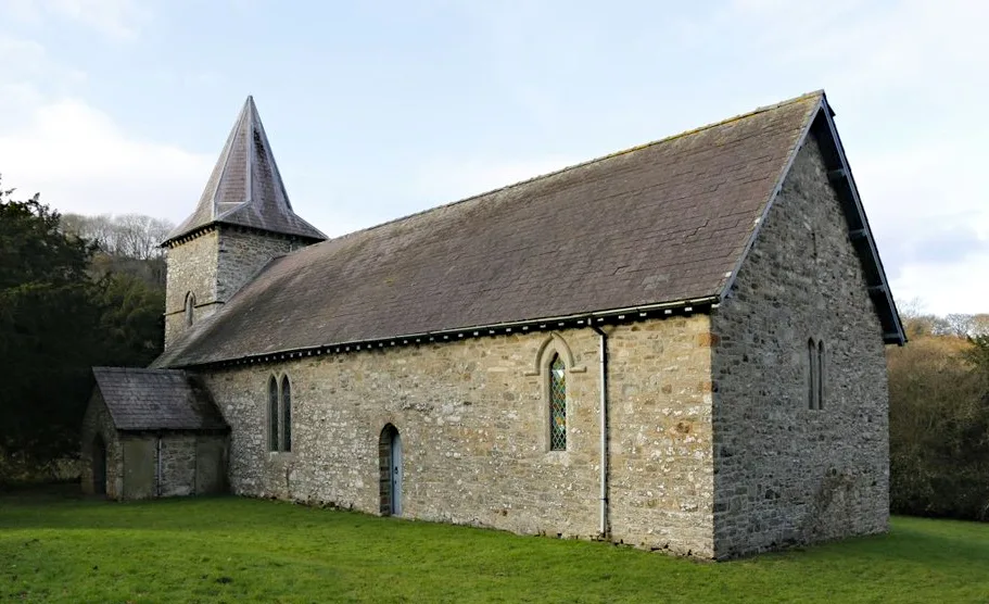
In or near Tregaron.
Pontrhydfendigaid in Wales Mid, United Kingdom.

Philip Halling — CC BY-SA 2.0 via Wikimedia Commons licence
Plan your visit
- Typical visit
- 45 min–1.5 h
- Family-friendly
- Limited wheelchair access
About
Pontrhydfendigaid is a place of interest in Wales Mid, United Kingdom — drawn from open-data sources for visitor reference. See the linked Wikipedia article for the full description.
Photo gallery
See it from the streetimagery from 2020
Imagery © Mapillary contributors, CC BY-SA 4.0
From the Wikipedia article
Pontrhydfendigaid (Welsh pronunciation: [pɔntˌr̥idvɛnˈdiɡai̯d]) is a village in Ceredigion, Wales. It lies on the western flank of the Cambrian Mountains, between Devil's Bridge and Tregaron. The village lies on the River Teifi, whose source is just 3 miles (5 km) to the east at Llyn Teifi. The community of Ystrad Fflur, which Pontrhydfendigaid makes most of the population of, had a population of 712 as of 2011 census. The ruins of the Cistercian Strata Florida Abbey are 1 mile south-east of the village. The abbey was founded 1164; the poet Dafydd ap Gwilym is traditionally said to be buried there and Llywelyn the Great held a council there. The station at Strata Florida was positioned to serve the village. The hillfort of Pen y Bannau is 1 km east of the village. The village is home to an annual eisteddfod, the Eisteddfod Pantyfedwen, or colloquially the "Steddfod Bont". Concerts and other events are also held in the modern multi-purpose Pavilion here. A Celtic Music Society is based at the village's Black Lion Hotel. The village was the birthplace and home of Caradog Jones, the first Welshman to reach the summit of Mount Everest. It is in the Community of Ystrad Fflur. The village takes its name from an old ford (rhyd) across the Teifi and a bridge (pont) that was later built there. It is on the B4343 road between Tregaron to the south and Pontarfynach to the north, around 13 miles (21 km) to the south-east of Aberystwyth. The abbey was an important centre of learning, and it is believed that one of the earliest versions of the Brut y Tywysogion was made there. It is believed that the TV programme C'mon Midffild! is based on the village football club.
Excerpt from Wikipedia under CC BY-SA 4.0. See the source article linked in Sources below.
Background
Description
The Beast of Bont is the name given to a big cat said to roam the area centred on Pontrhydfendigaid. (Y Bont is the local abbreviation and colloquial name for Pontrhydfendigaid.) It was blamed for the death of 12 sheep in June 1981. After a number of livestock attacks in the mid-1990s, Ministry of Agriculture veterinarians inspected a sheep carcass "and declared that the killer was a great deal more powerful than a fox or dog". The Dyfed-Powys police then searched the area, but failed to find the animal. In the spring of 2012, Mark Davey and his partner Annette came across a "sickening" scene: two large groups of slaughtered sheep, about two miles apart, in the hills near Devil's Bridge. In…
Sourced from Wikipedia under CC BY-SA 4.0.
- Coordinates
- 52.2823, -3.8628
- District
- Ceredigion
- Parish
- Ystrad Fflur
- Postcode
- SY25 6ED
- Parliamentary constituency
- Ceredigion Preseli
Sources
- wikidata: Q3401544 (CC0)
- wikipedia: Pontrhydfendigaid (CC BY-SA 4.0)
Other places nearby
Pont Rhydfendigaid
Historic bridges · 0.0 km
Murlun y Bont
Public art & sculpture · 0.1 km

Cofiwch
Public art & sculpture · 0.1 km
Y Felin
Watermills · 0.1 km
Pontrhydfendigaid War Memorial
Memorials & monuments · 0.2 km
Goffa Haelioni Teulu Pantyfedwen
Memorials & monuments · 0.2 km

Teifi Vale woolen factory
Watermills · 0.3 km
Wern Factory
Watermills · 0.3 km

Bryn-y-gors Holiday Park
Caravan parks · 0.7 km

Y Gaer, Caron-uwch-clawdd
Vineyards · 0.9 km

Coed y Bont
Battlefields & battle sites · 1.0 km

Pen y Bannau
Mountains & hills · 1.1 km
Nearby
📷 5Historic bridges · Mid Wales
Pont Rhydfendigaid
Pont Rhydfendigaid — Grade II listed building-listed bridge in wales-mid, United Kingdom.
📷 4📷 3📷 5Memorials & monuments · Mid Wales
Pontrhydfendigaid War Memorial
Pontrhydfendigaid War Memorial — Grade II listed building-listed memorial in wales-mid, United Kingdom.
📷 3Memorials & monuments · Mid Wales
Goffa Haelioni Teulu Pantyfedwen
Goffa Haelioni Teulu Pantyfedwen — a memorial in wales-mid, United Kingdom.
Where to eat & stay near Pontrhydfendigaid
Places to stay
📷 5Caravan parks · Mid Wales
Bryn-y-gors Holiday Park
Bryn-y-gors Holiday Park — a caravan park in wales mid.
 📷 5
📷 5 📷 5
📷 5 📷 5
📷 5 📷 5
📷 5 📷 5
📷 5Caravan parks · Mid Wales
Aeron View Camping
Aeron View Camping — a caravan park in wales mid.
Places to eat & drink
 📷 4
📷 4 📷 5
📷 5Cafés · Mid Wales
Llywernog Silver Lead Mine
Llywernog Silver Lead Mine — a café in wales mid.
 📷 5
📷 5 📷 3
📷 3Historic pubs · Mid Wales
The Commercial Inn
The Commercial Inn — Historic pub — listed building or notable heritage status.
 📷 5
📷 5More abbeys in this region
 📷 3
📷 3 📷 3
📷 3Abbeys & priories · Mid Wales
Cwmhir Abbey
Cwmhir Abbey — Grade II* listed building in Abbeycwmhir. Abbey.
 📷 3
📷 3 📷 3
📷 3Frequently asked questions
- Where is Pontrhydfendigaid?
- Pontrhydfendigaid is in Mid Wales, United Kingdom (postcode SY25 6ED), in the parish of Ystrad Fflur.
- What is Pontrhydfendigaid?
- Pontrhydfendigaid in Wales Mid, United Kingdom.
- How do I get to Pontrhydfendigaid?
- Drivers can use postcode SY25 6ED.
- How do I get to Pontrhydfendigaid?
- Drivers can navigate to postcode SY25 6ED. It sits within the Ceredigion Preseli parliamentary constituency.