
Natural landmarks · South East England
Pipers Corner School
In or near Holmer Green.
Pipers Corner School — a school heritage in england-west-midlands, United Kingdom.

Rod Allday — CC BY-SA 2.0 via Wikimedia Commons licence

Plan your visit
- Typical visit
- 1 h–2 h
- Nearest railway station
- High Wycombe · 4.5 km
- Free entry
- Dog-friendly
About
Pipers Corner School is a school heritage located in england-west-midlands, United Kingdom. Catalogued from Wikidata's UK heritage register; see the Wikipedia article for further historical and visitor details.
Photo gallery
Official information
Pipers Corner School is an independent day school for girls that focuses on the holistic development of students. It offers a supportive environment that encourages academic achievement, personal growth, and participation in various extracurricular activities.
Protected designations
- Area of Outstanding Natural Beauty: Chilterns
Designations sourced from Natural England open data under OGL v3.
Place summary
Pipers Corner School is an educational institution located in the West Midlands. It is known for its commitment to providing quality education and has a reputation for academic excellence.
AI-generated from the structured facts on this page (operator, designation, listing, era). Not a substitute for visiting.
Background
History
The school was first established in 1930 by Miss Jessie Cross as the Old Vicarage School, Richmond. It moved to Prestwood Lodge, Buckinghamshire during The Blitz on London in the Second World War and officially opened at the present site on 23 March 1946, after the purchase of the Pipers Corner property in July 1945. The school started with 11 girls in Grove Park in Chiswick in 1930, moving to Richmond Hill in 1931 and splitting between two sites in 1935, the second being Prestwood in Buckinghamshire. The school finally settled in its current site in the winter of 1945. By 1955 the number of pupils had doubled and there were 162 girls attending the school. Additions to the school took place…
Sourced from Wikipedia under CC BY-SA 4.0.
- Coordinates
- 51.6698, -0.7465
- District
- Buckinghamshire
- Parish
- Hughenden
- Postcode
- HP15 6LP
- Parliamentary constituency
- Mid Buckinghamshire
- Established
- 1930
- Nearest railway station
- High Wycombe — 4.5 km
- Official site
- www.piperscorner.co.uk
Sources
- wikidata: Q7197367 (CC0)
- wikipedia: Pipers Corner School (CC BY-SA 4.0)
Other places nearby

Prestwood Local Nature Reserve
Wildlife reserves · 1.6 km
Prestwood Nature Reserve
Forests & woodlands · 1.6 km

Hughenden
Villages · 2.0 km

Benjamin Disraeli's grave
Natural landmarks · 2.0 km
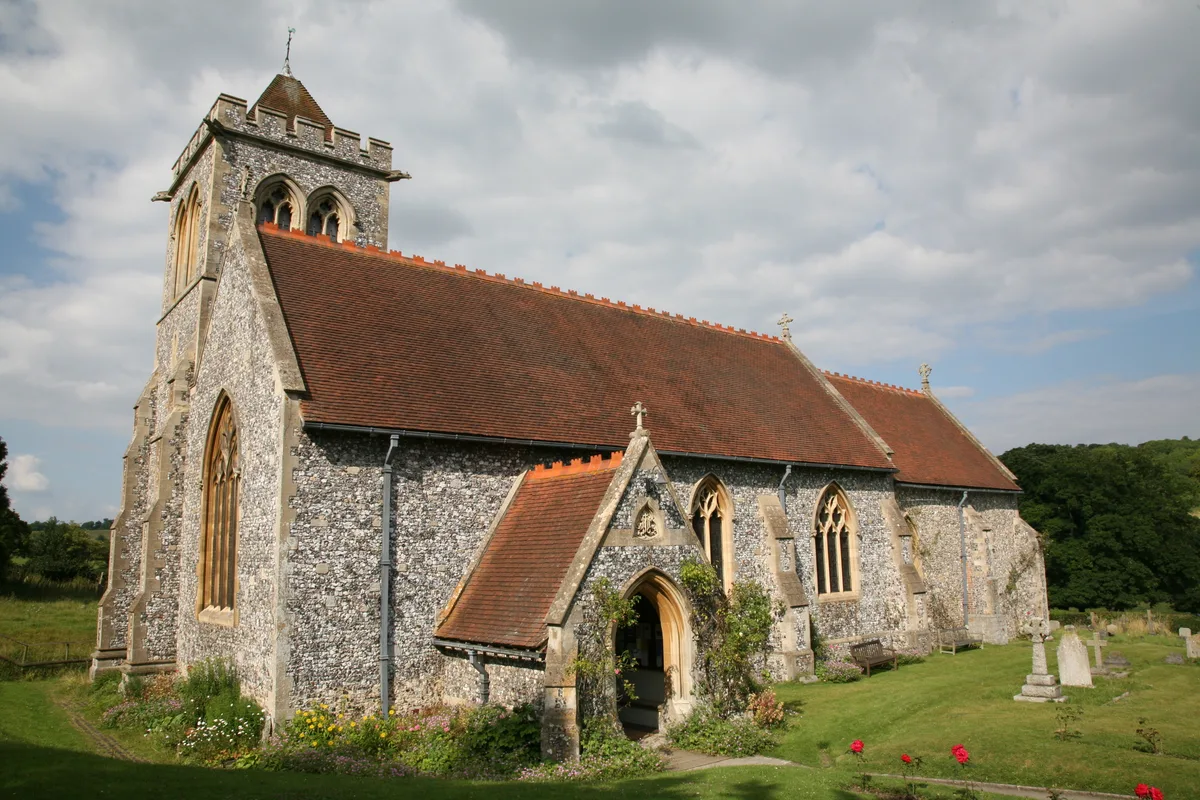
St Michael and All Angels Church, Hughenden
Historic churches · 2.0 km

Millfield Wood
Forests & woodlands · 2.1 km

Picnic Orchard
Natural landmarks · 2.1 km

Naphill War Memorial
Memorials & monuments · 2.2 km

The Stables
Cafés · 2.2 km

Hughenden Manor
Manor houses · 2.3 km

Little Kingshill War Memorial
Memorials & monuments · 2.9 km

Disraeli Monument
Memorials & monuments · 3.1 km
Nearby
📷 5Wildlife reserves · South East England
Prestwood Local Nature Reserve
Prestwood Local Nature Reserve — local nature reserve in Buckinghamshire, England.
📷 5Forests & woodlands · South East England
Prestwood Nature Reserve
Prestwood Nature Reserve is a forest or woodland in the United Kingdom.
📷 5📷 3Natural landmarks · South East England
Benjamin Disraeli's grave
Benjamin Disraeli's grave — a other in england-west-midlands, United Kingdom.
📷 5Historic churches · South East England
St Michael and All Angels Church, Hughenden
St Michael and All Angels Church, Hughenden — church in Buckinghamshire, England, UK.
📷 3Forests & woodlands · South East England
Millfield Wood
Millfield Wood is a forest or woodland in the United Kingdom.
Where to eat & stay near Pipers Corner School
Places to stay
 📷 5
📷 5Hotels · South East England
Hampton by Hilton High Wycombe
Hampton by Hilton High Wycombe — a hotel in england west midlands. 3-star. Brand: Hampton.
 📷 5
📷 5 📷 5
📷 5 📷 7
📷 7Hotels · South East England
Kings Arms Hotel
Kings Arms Hotel — a hotel in england west midlands.
 📷 7
📷 7 📷 5
📷 5Campsites · South East England
Braid Wood Scout & Guide Activity Centre
Braid Wood Scout & Guide Activity Centre — a campsite in england west midlands.
Places to eat & drink
📷 5 📷 7
📷 7Historic pubs · South East England
The Nag's Head Public House
The Nag's Head Public House in England East, United Kingdom.
 📷 5
📷 5Restaurants · South East England
Treatz
Treatz — a restaurant in england west midlands.
 📷 7
📷 7Historic pubs · South East England
The Flint Cottage Inn
The Flint Cottage Inn in England South East, United Kingdom.
 📷 7
📷 7Historic pubs · South East England
The George Public House
The George Public House in England South East, United Kingdom.
 📷 5
📷 5Historic pubs · South East England
The Crooked Billet
The Crooked Billet in England South East, United Kingdom.
More natural landmarks in this region
 📷 5
📷 5Natural landmarks · South East England
Queen Victoria Statue
Queen Victoria Statue — Public artwork (statue) by Victor Ferdinand Franz Eugen Gustaf Adolf Constantin Friedrich of Hohenlohe-Langenburg.
 📷 5
📷 5Natural landmarks · South East England
Silent Pool
Silent Pool — lake in the United Kingdom.
 📷 5
📷 5Natural landmarks · South East England
Thomas & Jane Holloway Statue
Thomas & Jane Holloway Statue — Public artwork (statue) by Victor Ferdinand Franz Eugen Gustaf Adolf Constantin Friedrich of Hohenlohe-Langenburg.
 📷 5
📷 5Natural landmarks · South East England
Polesden Lacey
Polesden Lacey — a other in england-london, United Kingdom.
Frequently asked questions
- Where is Pipers Corner School?
- Pipers Corner School is in the West Midlands, United Kingdom (postcode HP15 6LP), in the parish of Hughenden.
- What is Pipers Corner School?
- Pipers Corner School — a school heritage in england-west-midlands, United Kingdom.
- How do I get to Pipers Corner School?
- The nearest railway station is High Wycombe, about 4.5 km away. Drivers can use postcode HP15 6LP.
- When was Pipers Corner School built?
- Built or established in 1930.
- Is Pipers Corner School a protected site?
- Yes — Pipers Corner School is part of the Chilterns National Landscape (AONB).
- Is Pipers Corner School free to visit?
- Yes, Pipers Corner School is free to enter.
- How do I get to Pipers Corner School?
- The nearest railway station is High Wycombe, about 4.5 km away. Drivers can navigate to postcode HP15 6LP.