
Chapels · London
Petts Wood
In or near Farnborough.
Petts Wood — a methodist chapel in england-london, United Kingdom.

N Chadwick — CC BY-SA 2.0 via Wikimedia Commons licence

Plan your visit
- Typical visit
- 20 min–45 min
- Nearest railway station
- Petts Wood · 0.1 km
- Free entry
About
Petts Wood is a methodist chapel located in england-london, United Kingdom. Catalogued from Wikidata's UK heritage register; see the linked Wikipedia article for further details on its history, architecture and visiting information.
Photo gallery
Official information
Petts Wood station is a railway station located in Greater London, providing access to various transport links including bus and rail services. The station features step-free access to all platforms, lifts, and facilities such as toilets and baby changing areas.
Protected designations
- Area of Outstanding Natural Beauty: Kent Downs
Designations sourced from Natural England open data under OGL v3.
Place summary
Petts Wood is a chapel located in London. It is known for its distinctive architectural features, though specific details regarding its era or design are not provided. The chapel serves as a local place of worship within the Petts Wood area.
AI-generated from the structured facts on this page (operator, designation, listing, era). Not a substitute for visiting.
Background
History
The name appeared first in 1577 as "the wood of the Pett family", who were shipbuilders and leased the wood as a source of timber. (A pub, The Sovereign of the Seas, is named after a ship built at Woolwich to a design by Phineas Pett.) The area remained rural right up until the late 19th century; in 1872 just one house ('Ladywood') stood here. Most of the modern suburb of Petts Wood was built in the late 1920s by the Harlow-based developer Basil Scruby together with architect Leonard Culliford who designed the layout of the roads.]] The generally higher quality of large homes built to the east of the railway line, as compared to smaller and more densely packed development to the west, was…
Description
The eponymous wood itself survives and is managed by the National Trust. Originally just 88 acres (36 hectares) were bought by public subscription and donated to the Trust in 1927, after it became clear that the area would be developed for housing. This asset expanded when the neighbouring Hawkwood Estate and Edlmann Wood, comprising a further 250 acres (100 hectares), were donated to the Trust by landowners Robert and Francesca Hall in 1957. The woodland features oak, birch, rowan, alder, ash, hornbeam and sweet chestnut.
Visiting
Birchwood Road, Kingsway, and other surrounding roads, were used as a location for the 1978 feature film, Give Us Tomorrow, with Sylvia Syms.
Sourced from Wikipedia under CC BY-SA 4.0.
- Coordinates
- 51.3885, 0.0760
- District
- Bromley
- Parish
- Bromley, unparished area
- Postcode
- BR5 1EQ
- Parliamentary constituency
- Orpington
- Nearest railway station
- Petts Wood — 0.1 km
- Official site
- www.nationalrail.co.uk
Sources
- wikidata: Q123296 (CC0)
- wikipedia: Petts Wood (CC BY-SA 4.0)
Other places nearby

Daylight Inn
Historic houses · 0.1 km

Daylight Inn
Historic pubs · 0.1 km

Jubilee Country Park
Parks · 1.0 km

Edlmann Memorial
Memorials & monuments · 1.1 km

Crofton
Chapels · 1.5 km

Poverest
Chapels · 1.7 km

Willett Memorial
Memorials & monuments · 1.7 km

St. Luke's Cemetery
Cemeteries · 1.9 km
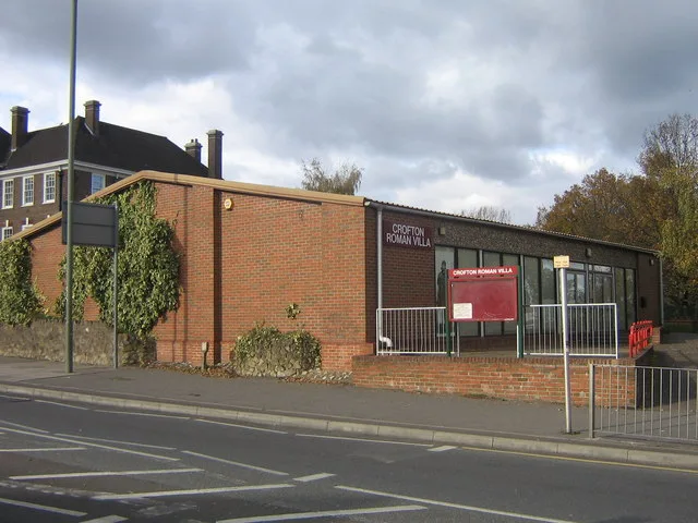
Crofton Roman Villa
Museums · 1.9 km

Southborough
Chapels · 2.2 km

Odeon Orpington
Theatres · 2.2 km

Locksbottom
Chapels · 2.2 km
Nearby
📷 5Historic houses · London
Daylight Inn
Daylight Inn — a Grade II*-listed historic house in england-london, United Kingdom.
📷 7📷 5📷 5Memorials & monuments · London
Edlmann Memorial
Edlmann Memorial — a memorial in england-london, United Kingdom.
📷 5📷 5Where to eat & stay near Petts Wood
Places to stay
 📷 5
📷 5Campsites · London
The Naturist Foundation
The Naturist Foundation — a campsite in england london.
 📷 5
📷 5Campsites · London
Cudham Shaws Outdoor Centre
Cudham Shaws Outdoor Centre — a campsite in england london.
 📷 5
📷 5Campsites · London
Woollett Hall Farm
Woollett Hall Farm — a campsite in england london.
 📷 5
📷 5 📷 5
📷 5 📷 6
📷 6Places to eat & drink
📷 7 📷 7
📷 7Historic pubs · London
The Bulls Head Public House
The Bulls Head Public House in England London, United Kingdom.
 📷 7
📷 7Historic pubs · London
The Blue Anchor Public House
The Blue Anchor Public House in England London, United Kingdom.
 📷 5
📷 5 📷 5
📷 5Historic pubs · London
The Rock And Fountain Public House
The Rock And Fountain Public House in England London, United Kingdom.
 📷 5
📷 5More places in this region
.jpg?width=1200) 📷 5
📷 5Chapels · London
Baptist Chapel
Baptist Chapel — chapel in Southwark, London, England, UK.
 📷 5
📷 5Chapels · London
Boone's Chapel
Boone's Chapel — Grade I listed chapel in London Borough of Lewisham, United Kingdom.
 📷 5
📷 5Chapels · London
Chantry Chapel Of St Mary Magdalene
Chantry Chapel Of St Mary Magdalene — chapel in Royal Borough of Kingston upon Thames, London, England, UK.
 📷 5
📷 5Chapels · London
Chapel at College of St Mark and St John
Chapel at College of St Mark and St John — grade II listed chapel in the United Kingdom.
Frequently asked questions
- Where is Petts Wood?
- Petts Wood is in London, United Kingdom (postcode BR5 1EQ), in the parish of Bromley, unparished area.
- What is Petts Wood?
- Petts Wood — a methodist chapel in england-london, United Kingdom.
- How do I get to Petts Wood?
- The nearest railway station is Petts Wood, about 0.1 km away. Drivers can use postcode BR5 1EQ.
- Is Petts Wood a protected site?
- Yes — Petts Wood is part of the Kent Downs National Landscape (AONB).
- Is Petts Wood free to visit?
- Yes, Petts Wood is free to enter.
- How do I get to Petts Wood?
- The nearest railway station is Petts Wood, about 0.1 km away. Drivers can navigate to postcode BR5 1EQ.