
Archaeological sites · Mid Wales
Pentreheyling
In or near Montgomery Town F.C..
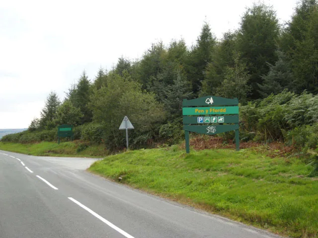
Pentreheyling in Wales Mid, United Kingdom.

John Firth — CC BY-SA 2.0 via Wikimedia Commons licence

Plan your visit
- Typical visit
- 45 min–1.5 h
- Free entry
- Dog-friendly
About
Pentreheyling is a place of interest in Wales Mid, United Kingdom — drawn from open-data sources for visitor reference. See the linked Wikipedia article for the full description.
Photo gallery
See it from the streetimagery from 2026
Imagery © Mapillary contributors, CC BY-SA 4.0
Protected designations
- Area of Outstanding Natural Beauty: Shropshire Hills
Designations sourced from Natural England open data under OGL v3.
From the Wikipedia article
Pentreheyling is a hamlet in Shropshire, England. It lies just west of Brompton on the A489 between Church Stoke and Newtown. The hamlet is notable for the fact that it is impossible to reach any other settlement in England (except Brompton) by road without first passing through Wales. Public footpaths are the only access which links it with the rest of England. It is however not geographically an exclave. Pentreheyling is in the civil parish of Chirbury with Brompton; formerly in the parish of Brompton and Rhiston. The remains of a Roman fort have been discovered in the hamlet.
Excerpt from Wikipedia under CC BY-SA 4.0. See the source article linked in Sources below.
- Coordinates
- 52.5290, -3.1174
- District
- Shropshire
- Parish
- Chirbury with Brompton
- Postcode
- SY15 6HU
- Parliamentary constituency
- South Shropshire
Sources
- wikidata: Q3878305 (CC0)
- wikipedia: Pentreheyling (CC BY-SA 4.0)
Other places nearby

Millers Rest Campsite
Campsites · 0.1 km
Bacheldre Mill
Watermills · 0.1 km

Brompton Roman fort
Archaeological sites · 0.5 km

Brompton
Historic churches · 0.8 km

Brompton Mill Castle Mound
Castles · 0.8 km
Motte and bailey castle and line of Offa's Dyke adjacent to Brompton Mill
Literary houses · 0.8 km

Bacheldre
Other places · 1.0 km

Brompton and Rhiston
Other places · 1.7 km

Mellington Hall Hotel
Hotels · 1.8 km

Chirbury Rural District
Other places · 2.3 km

Church Stoke
Villages · 2.4 km

The Lack
Other places · 2.4 km
Nearby
📷 5📷 5Watermills · Mid Wales
Bacheldre Mill
Bacheldre Mill — Grade II listed building-listed watermill in wales-mid, United Kingdom.
📷 3Archaeological sites · Mid Wales
Brompton Roman fort
Brompton Roman fort — a archaeological in wales-mid, United Kingdom.
📷 4📷 5📷 5Literary houses · Mid Wales
Motte and bailey castle and line of Offa's Dyke adjacent to Brompton Mill
Motte and bailey castle and line of Offa's Dyke adjacent to Brompton Mill — a literary house museum in wales mid.
Where to eat & stay near Pentreheyling
Places to stay
📷 5📷 5 📷 5
📷 5 📷 5
📷 5Caravan parks · Mid Wales
Daisy Bank Touring Caravan Park
Daisy Bank Touring Caravan Park — a caravan park in wales mid.
Caravan parks · Mid Wales
Argae Hall Caravan Park
Argae Hall Caravan Park — a caravan park in wales mid.
 📷 5
📷 5Campsites · Mid Wales
Foxholes Camp Site
Foxholes Camp Site — a campsite in wales mid.
Places to eat & drink
 📷 4
📷 4Historic pubs · Mid Wales
The Checkers
The Checkers in Wales Mid, United Kingdom.
 📷 7
📷 7 📷 5
📷 5Historic pubs · Mid Wales
The Black Lion And Forecourt Railings
The Black Lion And Forecourt Railings in Wales Mid, United Kingdom.
 📷 7
📷 7Historic pubs · Mid Wales
The Six Bells And Former Stables To Rear
The Six Bells And Former Stables To Rear in Wales Mid, United Kingdom.
 📷 7
📷 7 📷 4
📷 4More archaeological sites in this region
 📷 5
📷 5 📷 3
📷 3Archaeological sites · Mid Wales
Quaker settlement Dolgellau
Quaker settlement Dolgellau — a archaeological in wales-north, United Kingdom.
 📷 3
📷 3Archaeological sites · Mid Wales
Centenary Viewpoint
Centenary Viewpoint — a archaeological in wales-north, United Kingdom.
 📷 3
📷 3Archaeological sites · Mid Wales
Gwanas-Fawr Roman Marching Camp
Gwanas-Fawr Roman Marching Camp — a archaeological in wales-north, United Kingdom.
Frequently asked questions
- Where is Pentreheyling?
- Pentreheyling is in Mid Wales, United Kingdom (postcode SY15 6HU), in the parish of Chirbury with Brompton.
- What is Pentreheyling?
- Pentreheyling in Wales Mid, United Kingdom.
- How do I get to Pentreheyling?
- The nearest town is Montgomery Town F.C.. Drivers can use postcode SY15 6HU.
- Is Pentreheyling a protected site?
- Yes — Pentreheyling is part of the Shropshire Hills National Landscape (AONB).
- Is Pentreheyling free to visit?
- Yes, Pentreheyling is free to enter.
- How do I get to Pentreheyling?
- Drivers can navigate to postcode SY15 6HU. It sits within the South Shropshire parliamentary constituency.